RIGHT OF WAY DEDICATION
TELFORD AVENUE
BEING A PARTIAL REPLAT OF PART OF LOT 2780 OF THE REVISED AND CONSECUTIVE NUMBERS OF LOTS ON THE PLAT OF THE CITY OF OAKWOOD
SECTION 31, TOWN 2, RANGE 7 MRS
MONTGOMERY COUNTY, OHIO
0.2815 ACRES
JUNE, 2021

Survey drawing
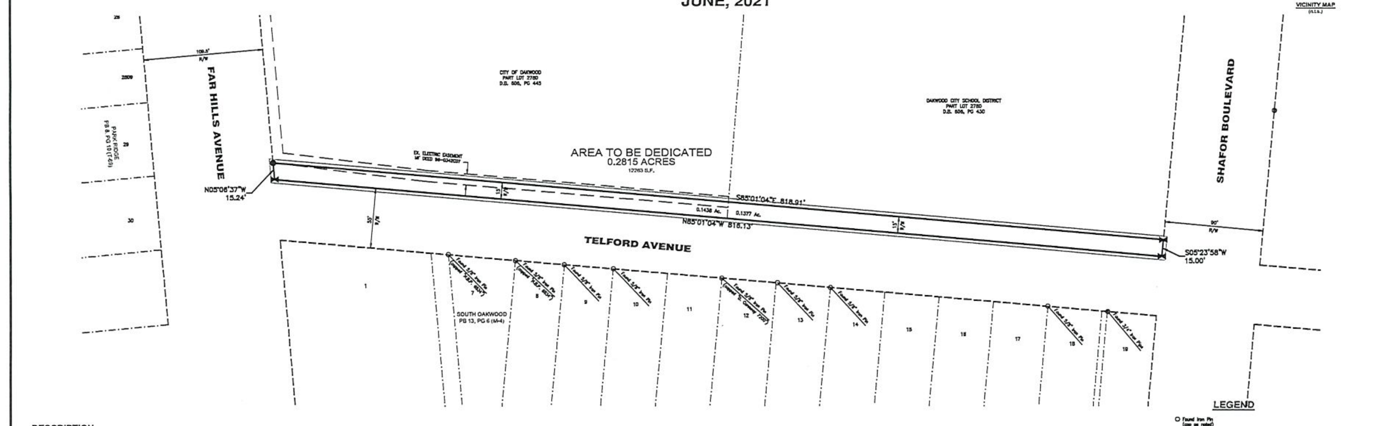
Area and street labels
Area to be dedicated: 0.2815 acres.
Streets shown: Telford Avenue, Far Hills Avenue, and Shafor Boulevard. The drawing also identifies the City of Oakwood and Oakwood City School District parcels and the numbered lots.
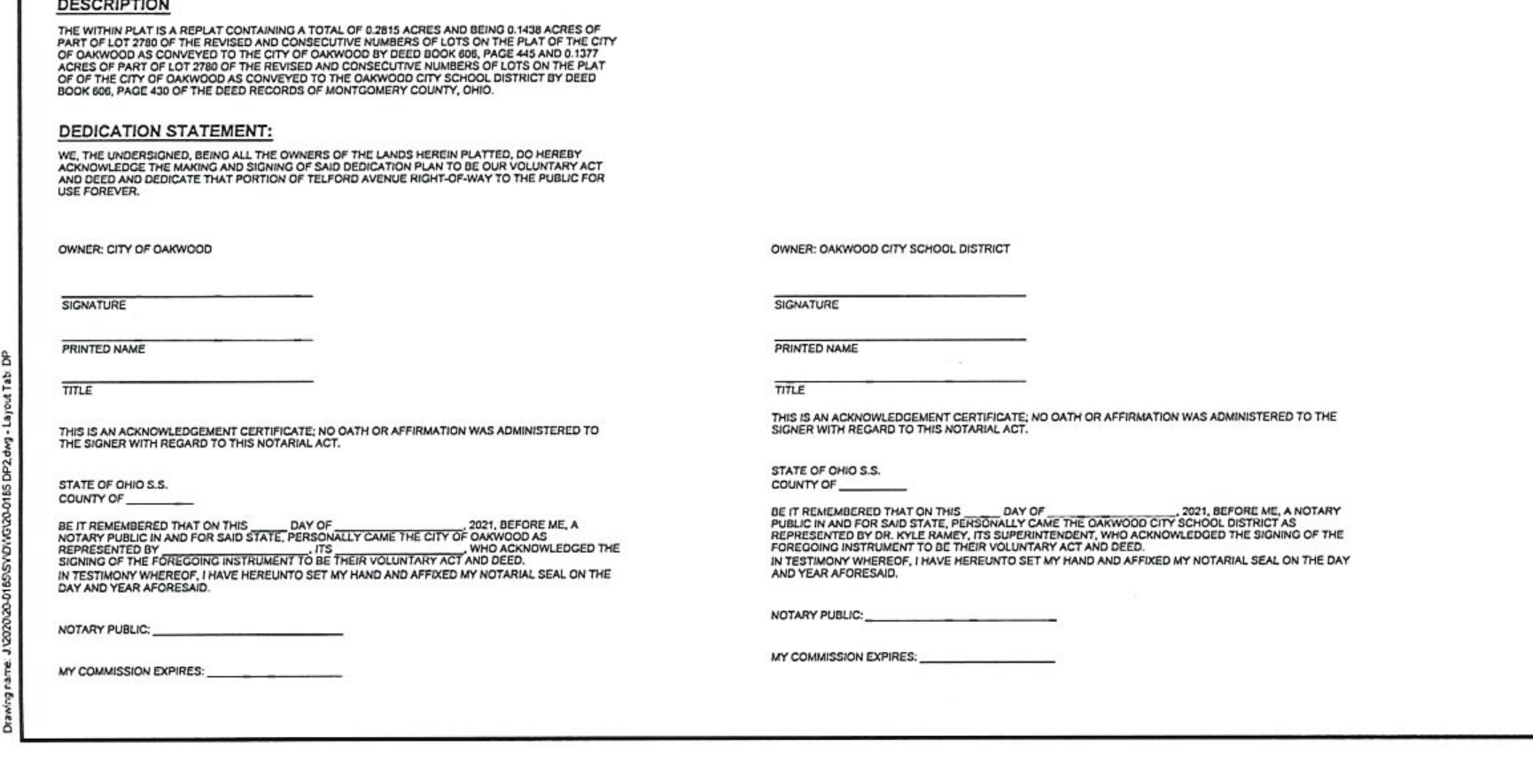
Description
The within is a replat containing a total of 0.2815 acres and being 0.1438 acres of part of Lot 2780 of the revised and consecutive numbers of lots on the plat of the City of Oakwood as conveyed to the City of Oakwood by Deed Book 606, page 445 and 0.1337 acres of part of Lot 2780 of the revised and consecutive numbers of lots on the plat of the City of Oakwood as conveyed to the Oakwood City School District by Deed Book 606, page 430 of the deed records of Montgomery County, Ohio.
Dedication statement
We, the undersigned, being all the owners of the lands herein platted, do hereby acknowledge the making and signing of said dedication plan to be our voluntary act and deed and dedicate that portion of Telford Avenue right-of-way to the public for use forever.
Owner: City of Oakwood
This is an acknowledgement certificate; no oath or affirmation was administered to the signer with regard to this notarial act.
State of Ohio S.S.
County of __________
Be it remembered that on this ______ day of __________, 2021, before me, a notary public in and for said state, personally came the City of Oakwood, who acknowledged the signing of the foregoing instrument to be their voluntary act and deed. In testimony whereof, I have hereunto set my hand and affixed my notarial seal on the day and year aforesaid.
Owner: Oakwood City School District
This is an acknowledgement certificate; no oath or affirmation was administered to the signer with regard to this notarial act.
State of Ohio S.S.
County of __________
Be it remembered that on this ______ day of __________, 2021, before me, a notary public in and for said state, personally came the Oakwood City School District as represented by Dr. Kyle Ramey, its superintendent, who acknowledged the signing of the foregoing instrument to be their voluntary act and deed. In testimony whereof, I have hereunto set my hand and affixed my notarial seal on the day and year aforesaid.
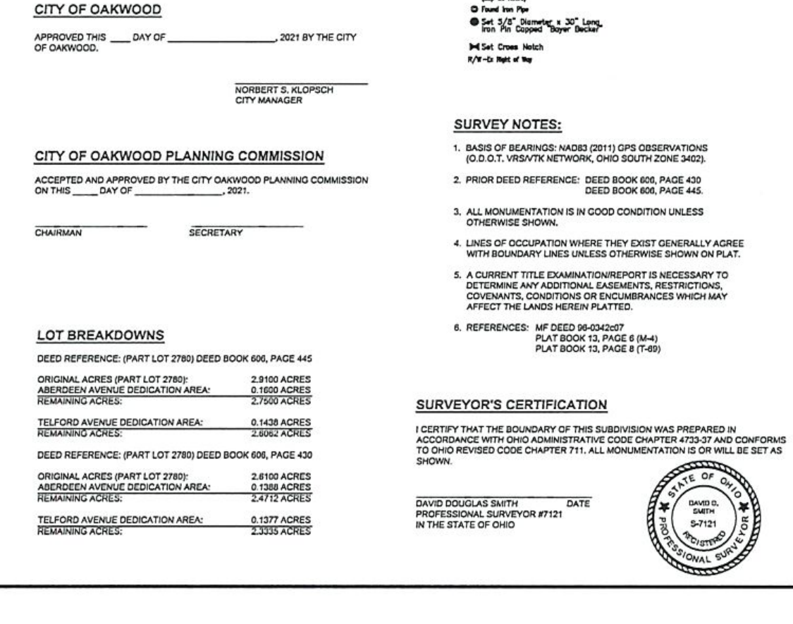
City approvals
City of Oakwood
Approved this ______ day of __________________, 2021 by the City of Oakwood.
Norbert S. Klopsch
City Manager
City of Oakwood Planning Commission
Accepted and approved by the City of Oakwood Planning Commission on this ______ day of __________________, 2021.
Lot breakdowns
Deed reference: (Part Lot 2780), Deed Book 606, page 445
- Original acres (Part Lot 2780)
- 2.9100 acres
- Aberdeen Avenue dedication area
- 0.1600 acres
- Remaining acres
- 2.7500 acres
- Telford Avenue dedication area
- 0.1438 acres
- Remaining acres
- 2.6062 acres
Deed reference: (Part Lot 2780), Deed Book 606, page 430
- Original acres (Part Lot 2780)
- 2.6100 acres
- Aberdeen Avenue dedication area
- 0.1338 acres
- Remaining acres
- 2.4762 acres
- Telford Avenue dedication area
- 0.1337 acres
- Remaining acres
- 2.3335 acres
Legend and survey notes
Legend: Found iron pin; set 5/8" diameter × 30" long iron pin capped “Bayer Becker”; set cross. R/W means right of way.
- Basis of bearings: NAD83 (2011) GPS observations (O.D.O.T. VRS/VRTK network, Ohio south zone 3402).
- Prior deed reference: Deed Book 606, page 445; Deed Book 606, page 430.
- All monumentation is in good condition unless otherwise shown.
- Lines of occupation where they exist generally agree with boundary lines unless otherwise shown on plat.
- A current title examination/report is necessary to determine any additional easements, restrictions, covenants, conditions or encumbrances which may affect the lands herein platted.
- References shown on the original survey scan are retained above.
Surveyor’s certification
I certify that the boundary of this subdivision was prepared in accordance with the Ohio Administrative Code Chapter 4733-37 and conforms to Ohio Revised Code Chapter 711. All monumentation is or will be set as shown.
David Douglas Smith Date
Professional Surveyor #7121
In the State of Ohio