Zoning & Parcel Plat Map
Area bounded by Burlington Drive, Inlow Springs Road, and West Fork White River
Accessible view
Map Overview & Key Features
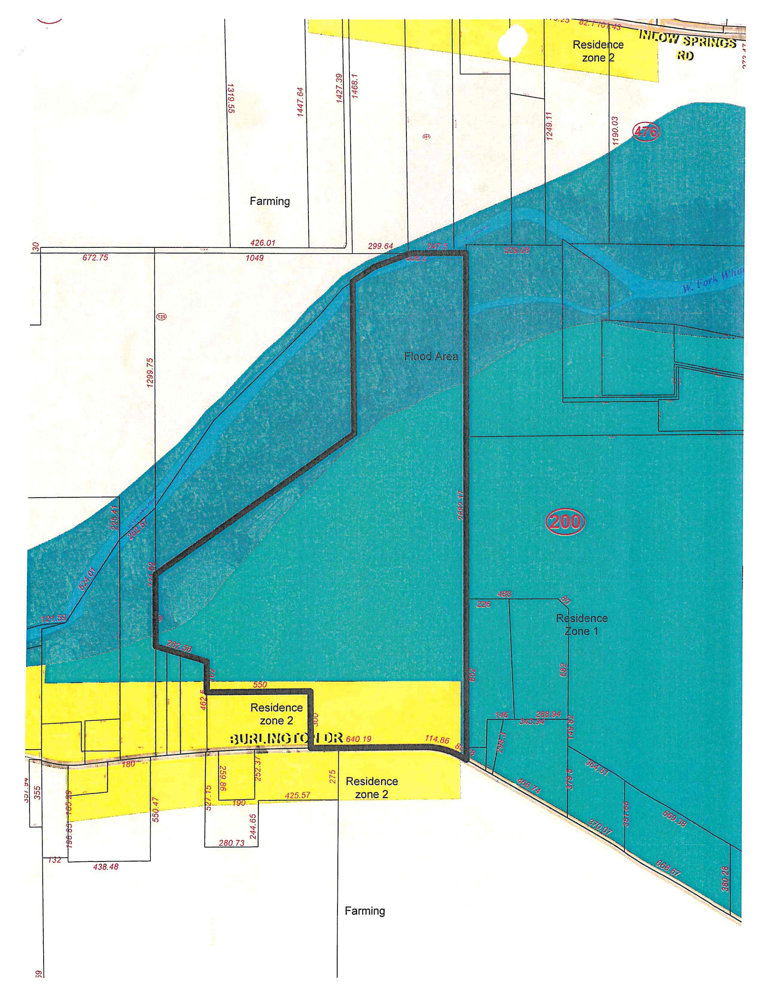
This plat and zoning diagram depicts land parcels, boundary dimensions, zoning classifications, and geographical features for an area bordered by Burlington Drive to the south, Inlow Springs Road to the northeast, and the West Fork White River corridor.
Zoning Designations
- Farming: Large acreage parcels spanning the north and central-west areas, as well as the southern border.
- Residence zone 2: Highlighted in yellow, situated primarily along Burlington Drive (south) and near Inlow Springs Road (northeast).
- Residence Zone 1: Located in the eastern section (marked with parcel reference 200).
- Flood Area: Shaded blue-green zone representing the river basin and floodplain along the West Fork White River traversing diagonally through the parcel.
Key Roadways & Waterways
- Burlington Dr: Southern roadway boundary with frontage segments (e.g., 640.19, 114.86, 425.57, 280.73, 438.48).
- Inlow Springs Rd: Northeastern thoroughfare.
- W. Fork White River: Waterway traversing northeast-to-southwest across the upper and middle parcels.
Parcel references and boundary labels
The map prints parcel references (126), (451), (200), and (476) within the mapped tracts. It also prints dimensions directly on individual boundary and frontage segments, including along Burlington Drive and the northern tracts near Inlow Springs Road. Because the image does not provide a reliable key that unambiguously pairs every transcribed dimension with a parcel or named boundary segment, those measurements are left in their original visual locations rather than presented as an inferred parcel-data table or CSV.
- North and northwest: Farming parcels meet the upper boundary and the river corridor.
- Central and eastern tracts: The Flood Area follows the W. Fork White River; parcel reference (200) is shown within the eastern Residence Zone 1 tract, with (476) near the northeastern boundary.
- South: Residence zone 2 fronts Burlington Drive, with Farming parcels below the roadway.
- Northeast: Residence zone 2 is shown along Inlow Springs Road.