Delaware County Indiana
Precincts
Accessible view
Overview
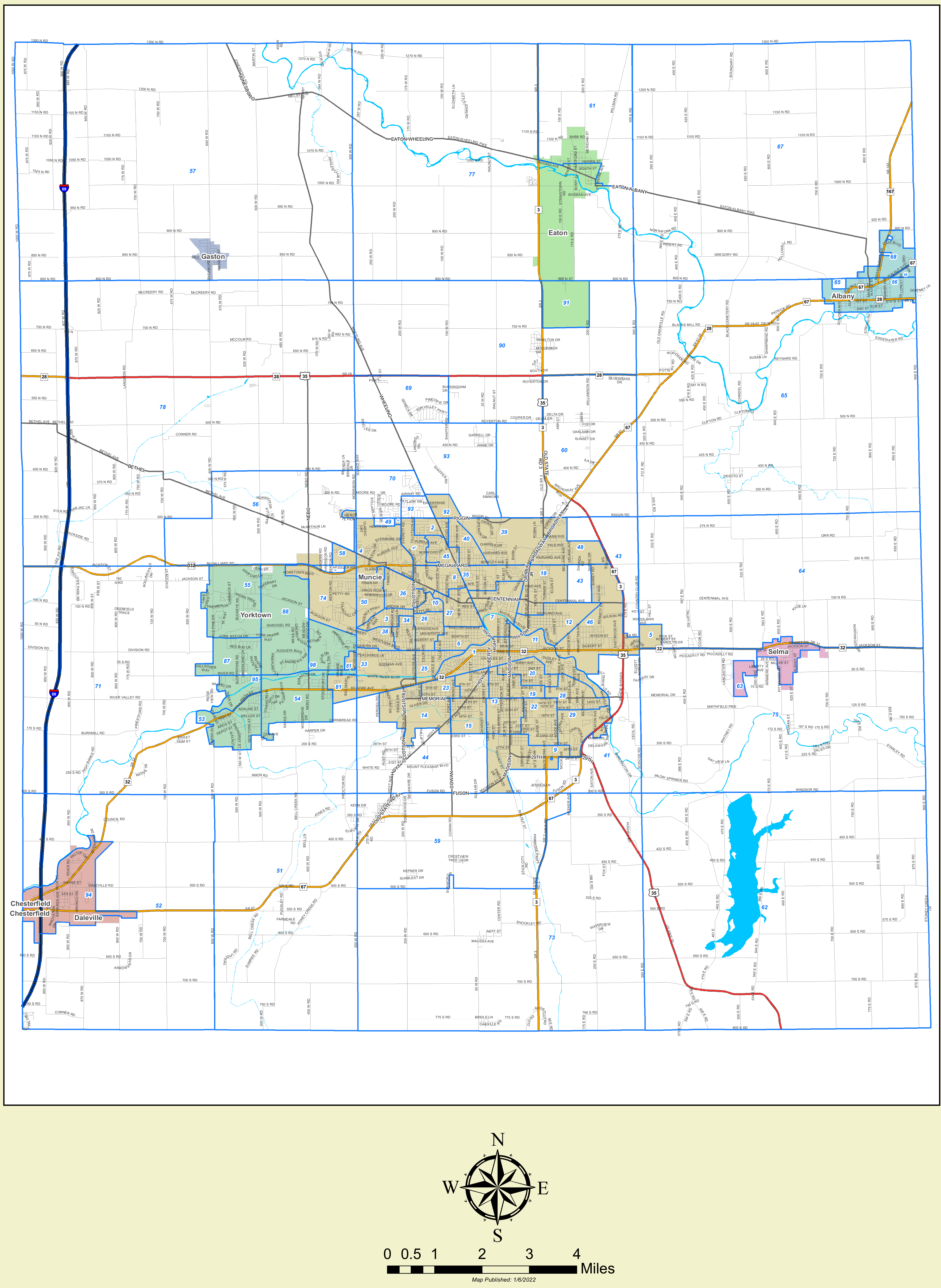
This map illustrates the voting precincts across Delaware County, Indiana, as published on January 6, 2022.
Municipalities & Urban Centers Shown
- Muncie (County seat; central area containing precincts 1–50, 54, 58, 67, 74, 81, 88, etc.)
- Yorktown (West-central, including precincts 55, 87, 88, 95, 98)
- Daleville & Chesterfield (Southwest corner, precincts 51, 52, 94)
- Gaston (Northwest, precinct 68)
- Eaton (North, precincts 3, 77, 91)
- Albany (Northeast, precincts 65, 66, 67)
- Selma (East-central, precinct 63)
Major Transportation Routes
- Interstate 69 (traversing north-south along the western corridor)
- State Roads: SR 3, SR 28, SR 32, SR 67, SR 332, US 35
Natural Landmarks
- White River, Mississinewa River, Prairie Creek Reservoir (southeast)
Map Legend & Metadata
- Scale: 0 to 4 Miles
- Orientation: North arrow indicator
- Publication Date: 1/6/2022