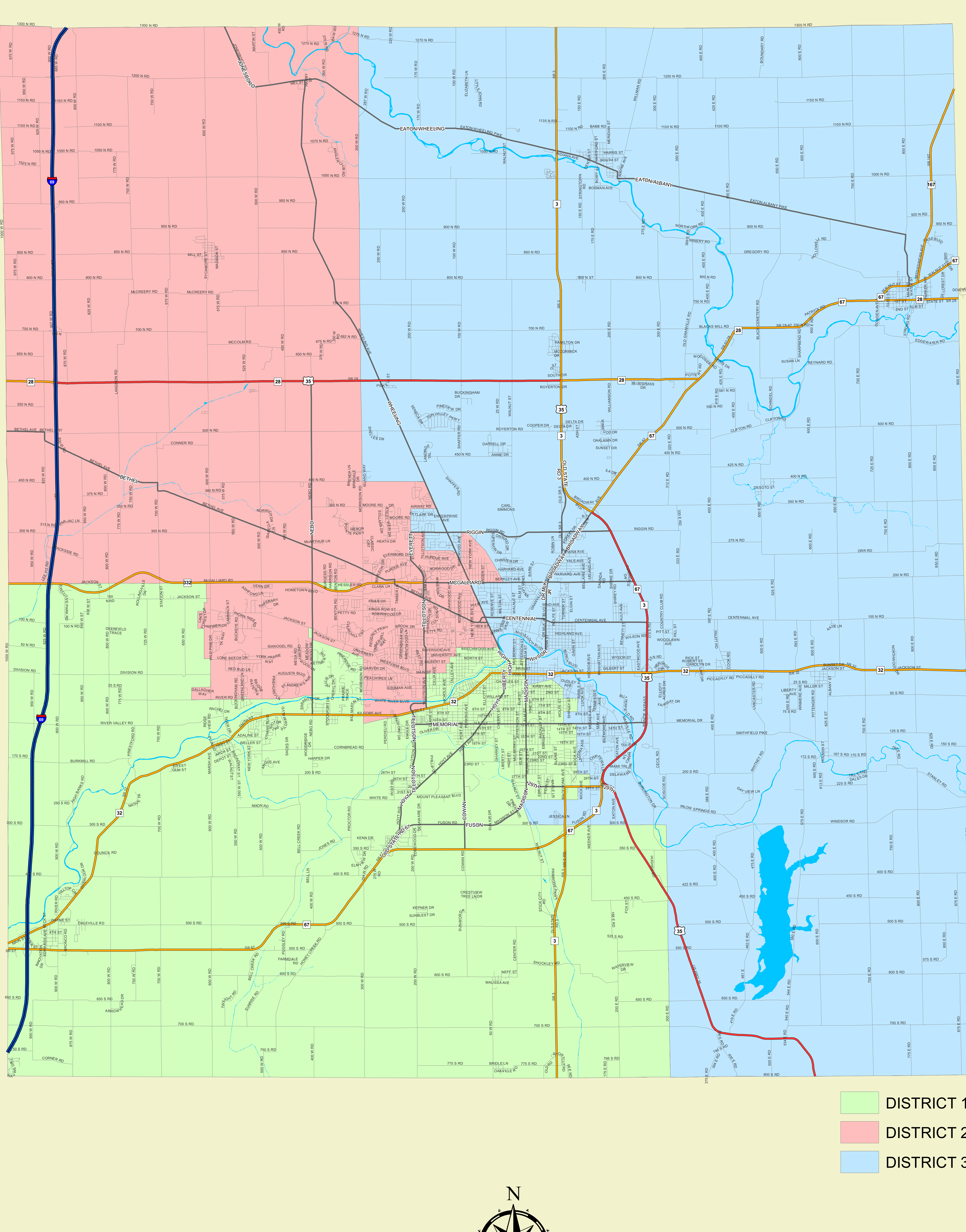
This official map illustrates the three County Commissioner Districts within Delaware County, Indiana (published January 6, 2022).
Swipe or scroll horizontally to view all columns.
Delaware County Commissioner Districts
| District |
Color Identifier |
Geographic Coverage & Highlights |
| District 1 |
Light Green |
Covers northern and northeastern portions of Delaware County including Eaton, Albany, and surrounding rural townships, as well as northern regional corridors. |
| District 2 |
Pink / Light Red |
Encompasses the central Muncie urban area, Ball State University area, McGalliard Road corridor, Bethel Ave, Centennial Ave, and central thoroughfares. |
| District 3 |
Light Yellow |
Covers western and southern areas of Delaware County including Yorktown, Daleville, Oakville, Prairie Creek Reservoir region, and southern rural corridors. |
Map Metadata:
• Scale: 0 to 4 Miles
• Direction: North oriented
• Publication Date: January 6, 2022