Harman School
Suggested School Route Map
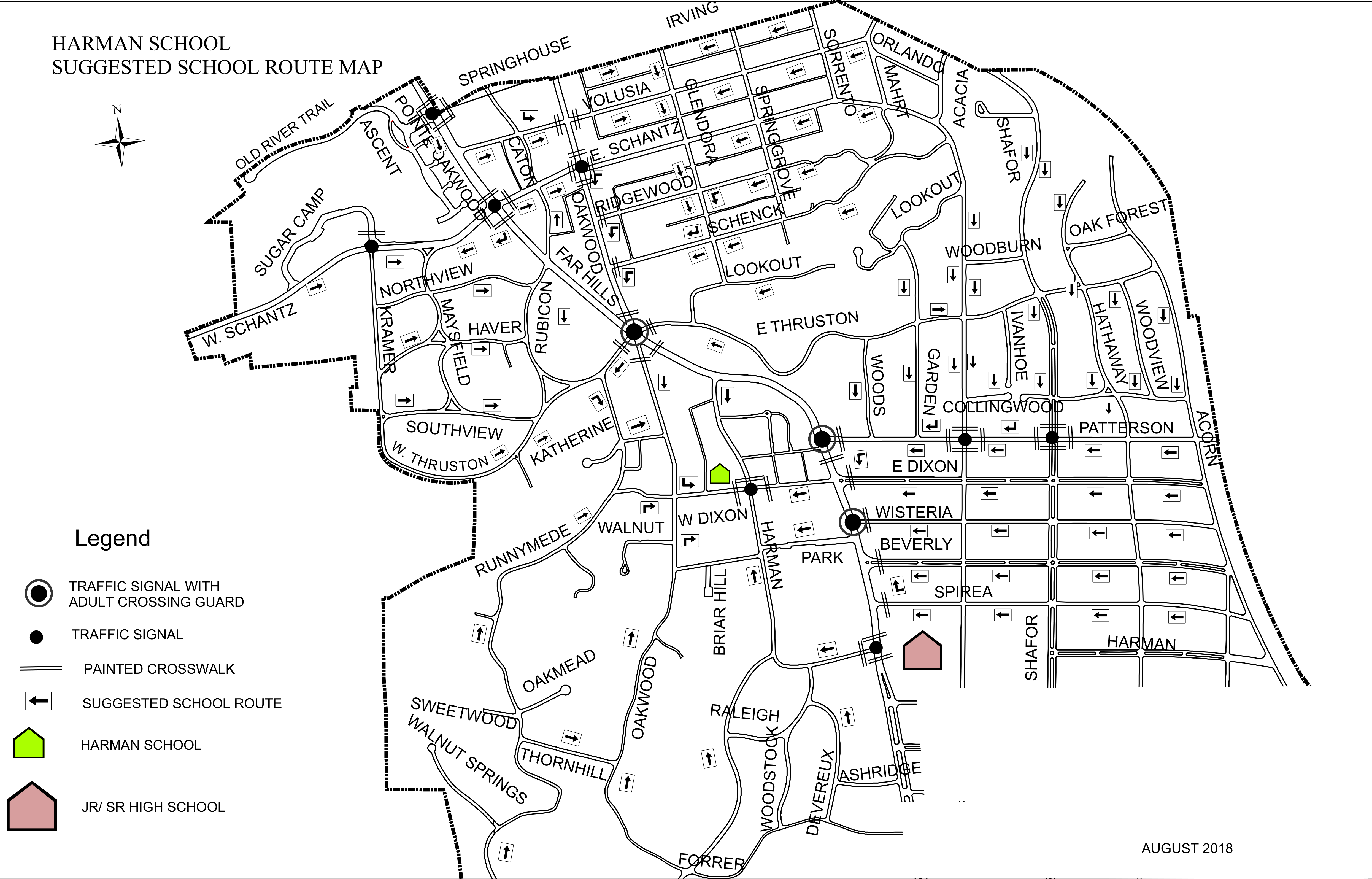
Accessible view
Map Legend
- Traffic Signal with Adult Crossing Guard: Indicated by double concentric target circles (e.g., Far Hills at E. Thruston, Dixon at Harman, Shafor at Patterson, Shafor at Spirea).
- Traffic Signal: Indicated by solid black circles at major roadway intersections.
- Painted Crosswalk: Indicated by double-striped crosswalk lines across intersections.
- Suggested School Route: Directional arrows marking recommended pedestrian walking corridors towards Harman School.
- Harman School: Marked with a green school icon near West Dixon and Harman.
- Jr/Sr High School: Marked with a pink school icon along Shafor near Spirea/Harman.
Key Streets & Neighborhood Areas
- Northern / Northwestern Area: Irving, Springhouse, Volusia, Pointe Oakwood, Ascent, Old River Trail, Sugar Camp, W. Schantz, E. Schantz, Caton, Glendora, Springgrove, Ridgewood, Schenck.
- Central / Far Hills Corridor: Far Hills Avenue, Northview, Maysfield, Haver, Rubicon, Lookout, E. Thruston, Katherine, Southview, Walnut, W. Dixon, E. Dixon.
- Eastern / Shafor Corridor: Sorrento, Orlando, Mahrt, Acacia, Shafor, Woodburn, Oak Forest, Hathaway, Woodview, Ivanhoe, Garden, Woods, Collingwood, Patterson, Acorn, Wisteria, Beverly, Spirea, Harman.
- Southern Area: Runnymede, Briar Hill, Oakmead, Sweetwood, Walnut Springs, Raleigh, Thornhill, Woodstock, Devereux, Ashridge, Forrer.