Delaware County Indiana
Council Districts
N
E
S
W
Miles
District 1
Light Blue / Cyan
District 2
Peach / Coral
District 3
Light Green
District 4
Light Purple / Lavender
Accessible view
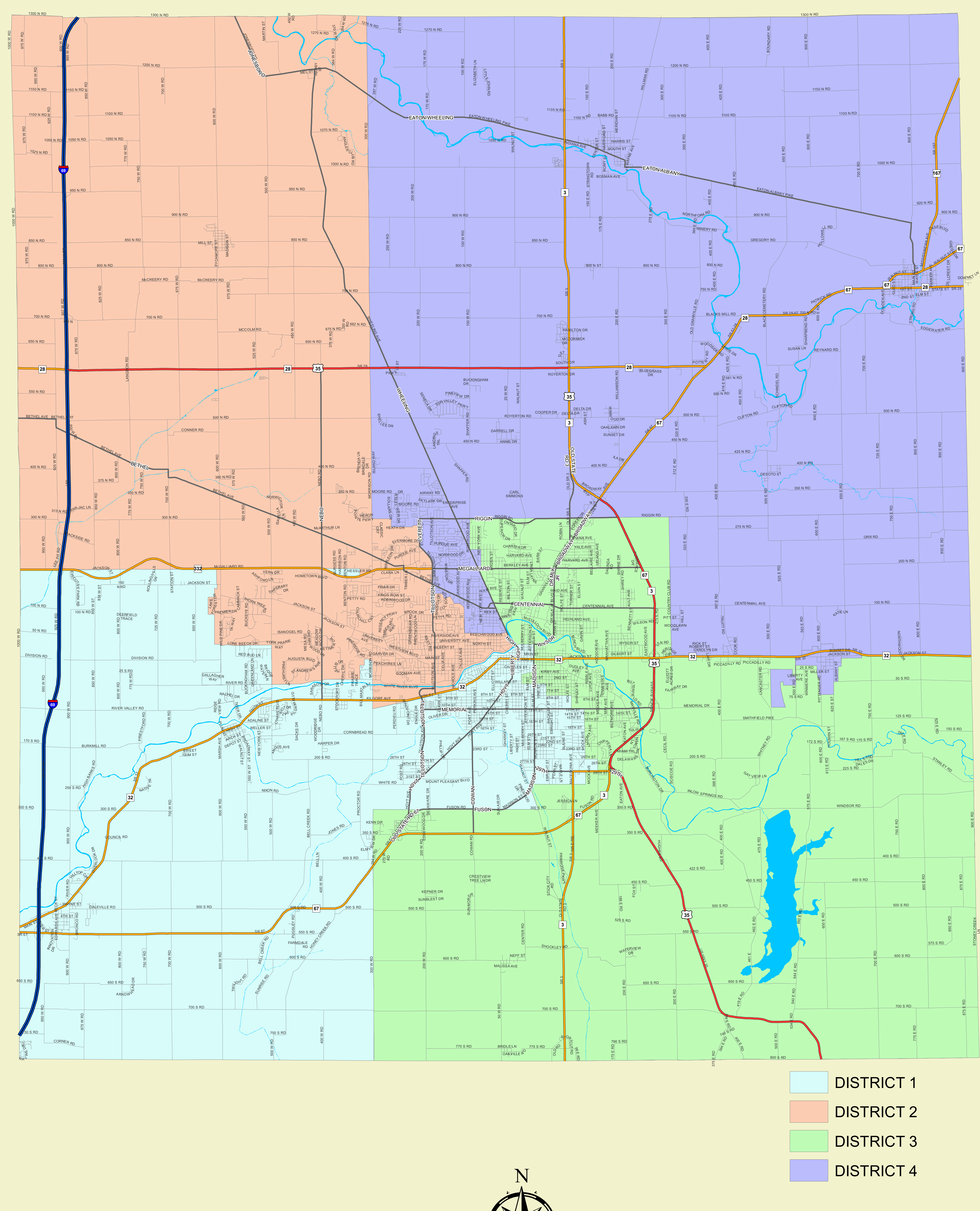
Map Overview: Delaware County, Indiana Council Districts map showing four color-coded districts, local roads, highways, and waterways.
Approximate district positions
With north at the top, the four districts are arranged around the central Muncie area. The map shows their broad geographic relationships; these descriptions do not assert street-level boundary details.
- District 1
- Southwest and south-central area, extending toward the central Muncie area.
- District 2
- Northwest and west-central area, extending into the central Muncie area.
- District 3
- Southeast and central area, adjoining the central Muncie area.
- District 4
- Northeast and east/north-central area, adjoining the central Muncie area.
Swipe or scroll horizontally to view all columns.
| District | Map Color |
|---|---|
| District 1 | Light Blue / Cyan |
| District 2 | Peach / Coral |
| District 3 | Light Green |
| District 4 | Light Purple / Lavender |
Map Metadata:
- Scale: Graphic bar 0 to 4 Miles (with intervals at 0, 0.5, 1, 2, 3, 4 miles)
- Orientation: North oriented upwards with compass rose