Accessible view
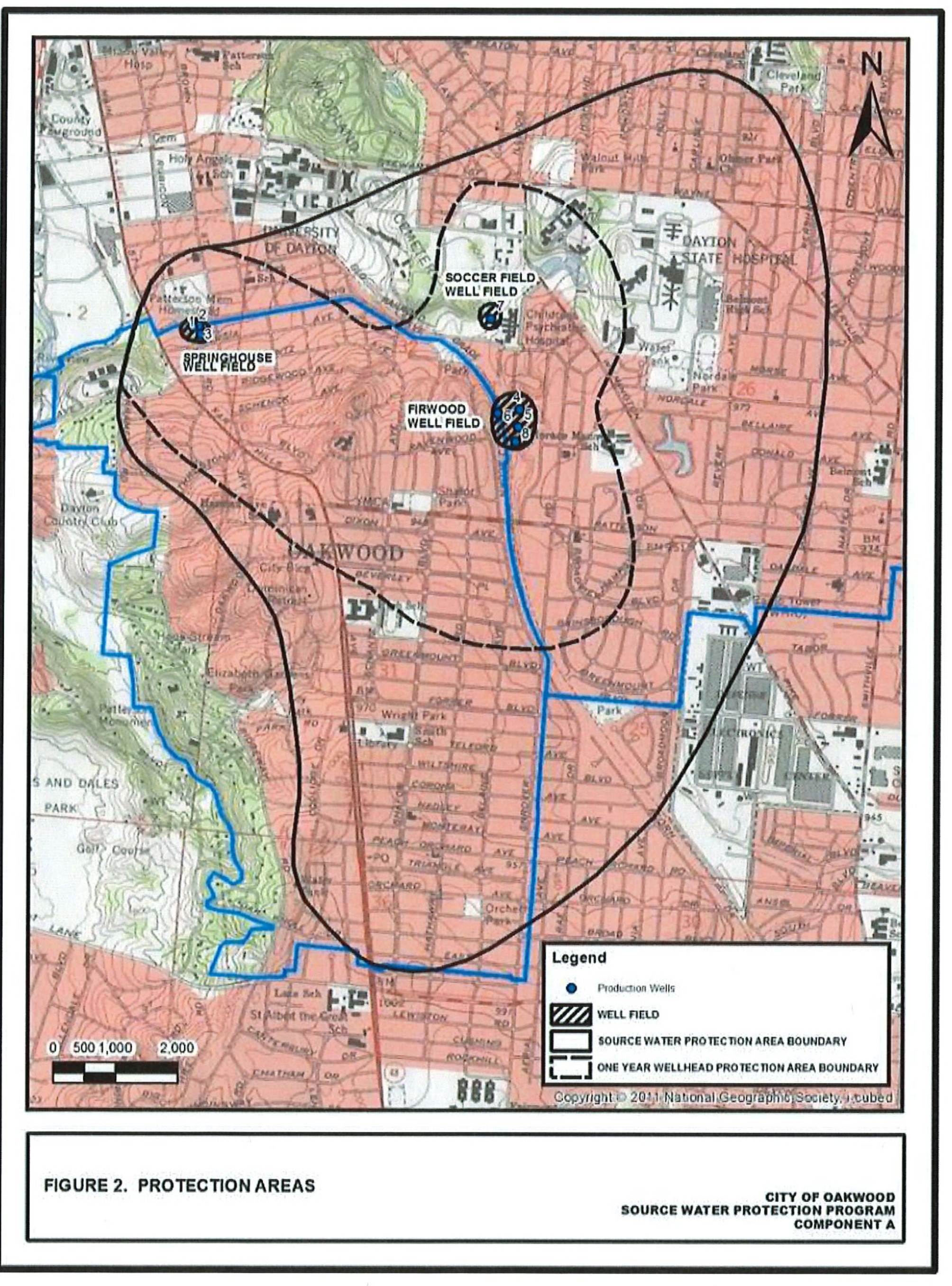
Figure 2. Protection Areas Overview
Program: City of Oakwood Source Water Protection Program — Component A (Aquifer Characterization and Delineation)
Delineated Boundaries & Features:
- Source Water Protection Area Boundary: Outermost delineated boundary encompassing wellfields and surrounding zones extending north toward University of Dayton and Dayton State Hospital, and south into Oakwood.
- One Year Wellhead Protection Area Boundary: Inner dashed boundary delineating the 1-year travel time zone around active well fields.
- Well Fields: Identified areas including Springhouse Well Field (west), Soccer Field Well Field (north), and Firwood Well Field (central).
- Production Wells: Blue production-well symbols are shown at all three named well fields: Springhouse Well Field to the west, Soccer Field Well Field to the north, and Firwood Well Field centrally. The well fields and their production-well locations are shown in relation to the dashed One Year Wellhead Protection Area Boundary and within the larger solid Source Water Protection Area Boundary.
Geographic Context: Features Oakwood, University of Dayton, Dayton State Hospital, Hills and Dales Park, Patterson Memorial Homestead, and major roadway networks.