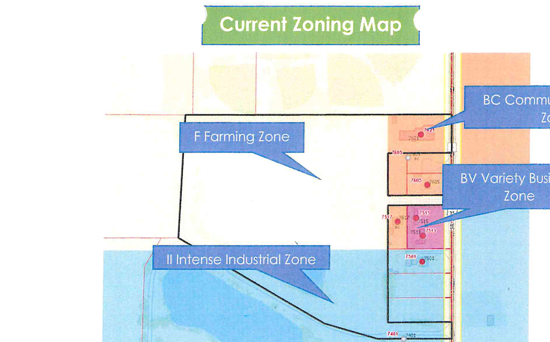
Current Zoning Map
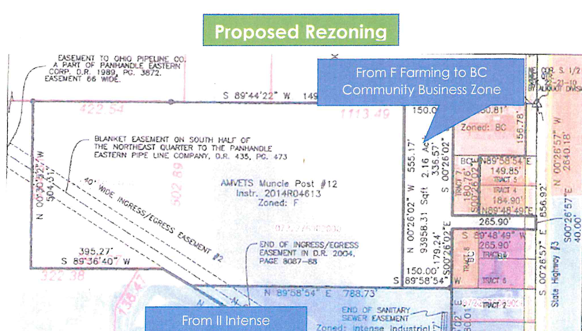
Proposed Rezoning
Accessible view
Overview of Zoning and Proposed Rezoning:
- Current Zoning: Parcels are divided between F Farming Zone (general area), II Intense Industrial Zone (south/west section), BC Community Business Zone (north/east frontage), and BV Variety Business Zone (east highway frontage). A note states: "This map was created by staff for clarification".
- Proposed Rezoning:
- North-east frontage parcel (93,958.31 Sqft / 2.16 Acres) is designated to rezone From F Farming to BC Community Business Zone.
- Southern/rear parcel (183,798.95 Sqft / 4.22 Acres) currently zoned Intense Industrial is designated to rezone From II Intense Industrial to F Farming Zone.
- Property referenced as AMVETS Muncie Post #12 (Instr. 2014R04613) with easements including Ohio Pipeline Co. easement, blanket easement to Panhandle Eastern Pipe Line Company, and sanitary sewer easement.