Excerpt from the November 6, 2025
Case Analysis from the
Delaware-Muncie Metropolitan
Plan Commission Meeting
MPC 17-25Z Estate of Donna Weiss
Description & Location: 9001 S CR 700 W, Daleville, IN and adj vacant parcel
Parcels: 14-08-400-013-000 & 14-08-400-006-000
Streets: S 700 W is classified as a Local Road with a 50 ft ROW according to the Official Thoroughfare Plan Map. SR 67 is classified as a Control Access Road with a 150 ft ROW according to the Official Thoroughfare Plan Map.
Land Use: The parcel with the house on it is currently used residentially. The adjacent parcel is currently being farmed.
Zoning: Both parcels are split zoned, BV Variety Business Zone and F Farming Zone. All four corners of this intersection are zoned BV Variety Business Zone, surrounded by F Farming Zones. In the extended area, there are additional BV Variety Business Zones sitting on intersections of SR 67 and County Roads. There are also BL Limited Business Zones and Residential Zones as shown in the map below.
Request: The request is for a change of zoning from the split zoning of BV Variety Business Zone and F Farming Zone to solely BV Variety Business Zone. This would correct the split zoning.
Additional Information: The owner intends to sell these properties. The owners are wanting to correct the split zoning so they can accurately market the property to prospective buyers.
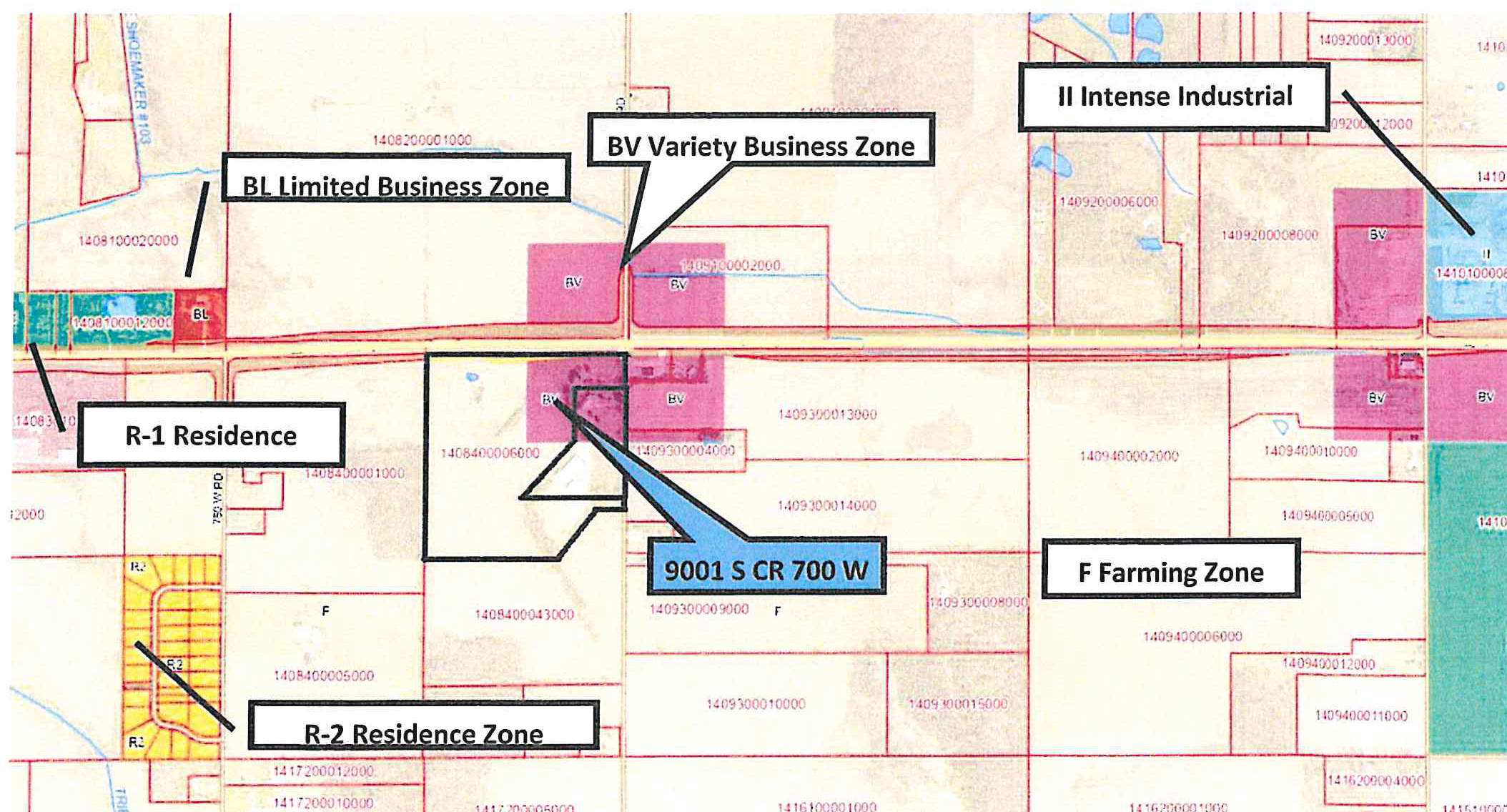
Accessible view
Map Annotations and Zoning Classifications:
- 9001 S CR 700 W: Identified parcel split-zoned between BV (Variety Business Zone) and F (Farming Zone).
- BV Variety Business Zone: Marked on properties surrounding the intersection of SR 67 and S CR 700 W.
- BL Limited Business Zone: Indicated along the northwest frontage of SR 67.
- II Intense Industrial: Designated area to the northeast along SR 67.
- F Farming Zone: Large parcels adjacent to and south/southeast of the subject property.
- R-1 Residence Zone & R-2 Residence Zone: Residential zones located to the west and southwest.