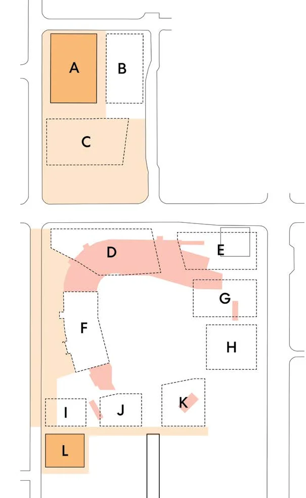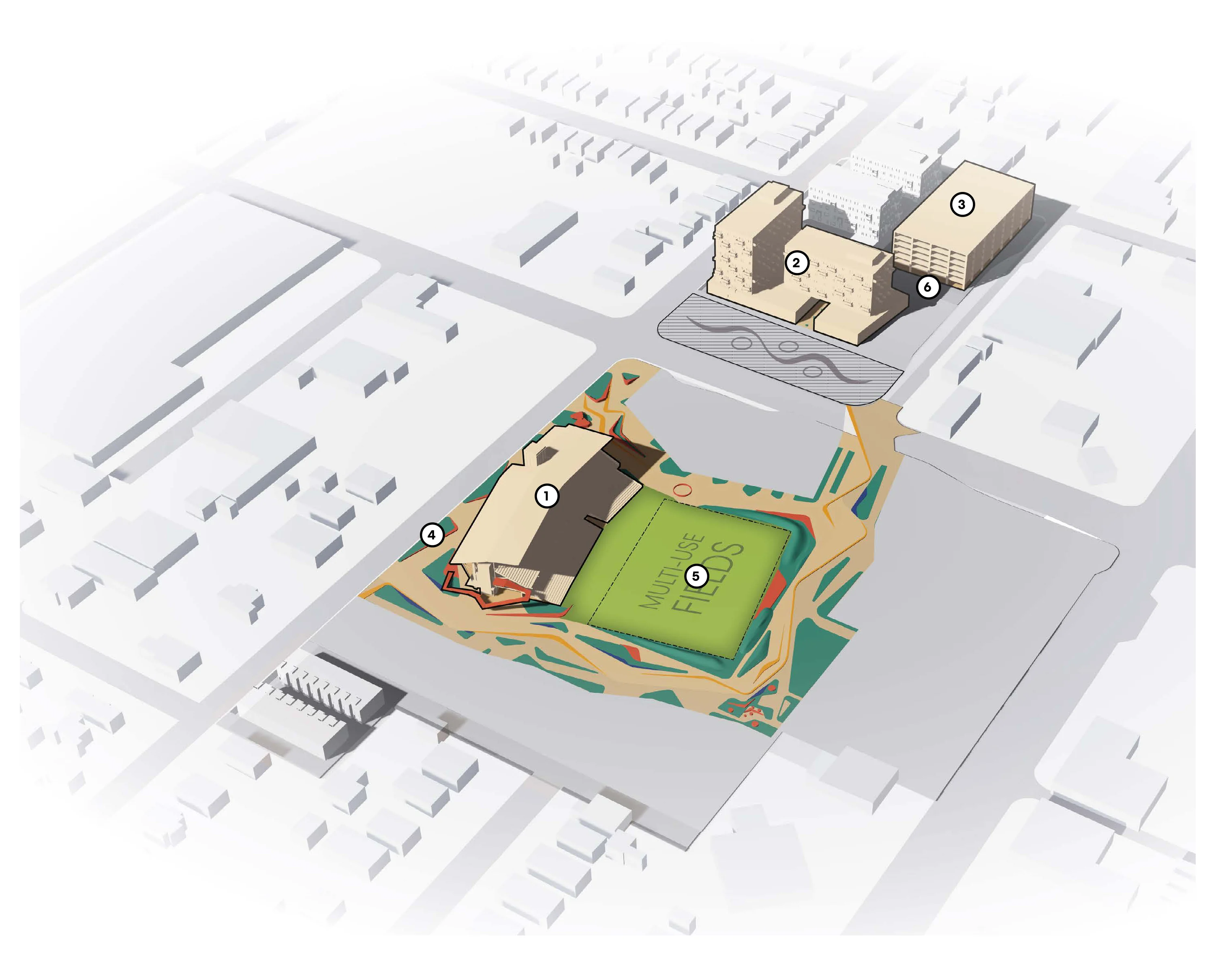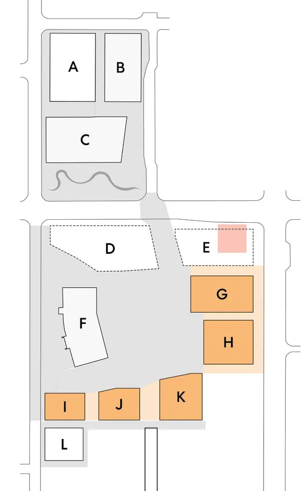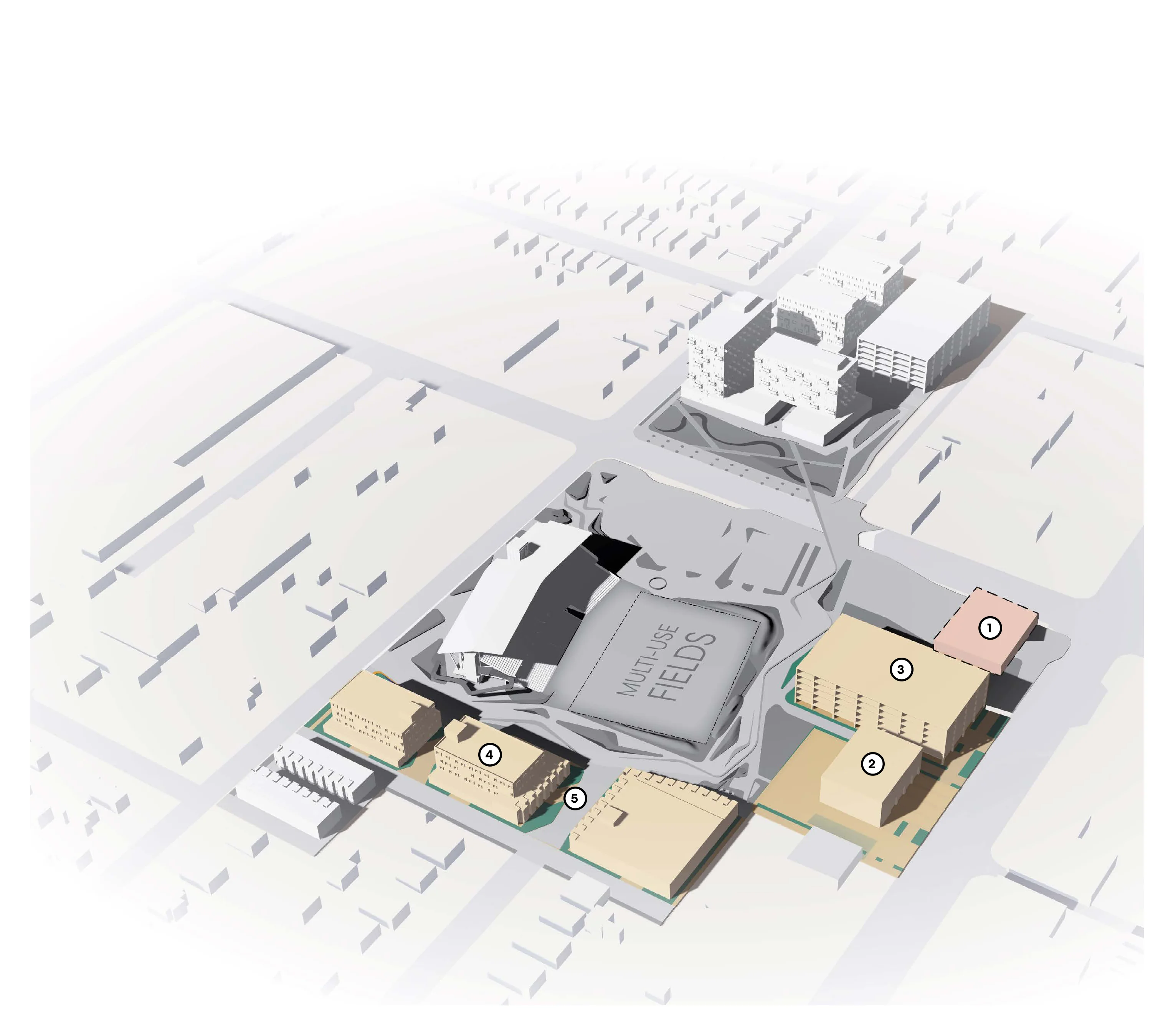









Ballpark NEXT
Community
Design Plan

August 2025

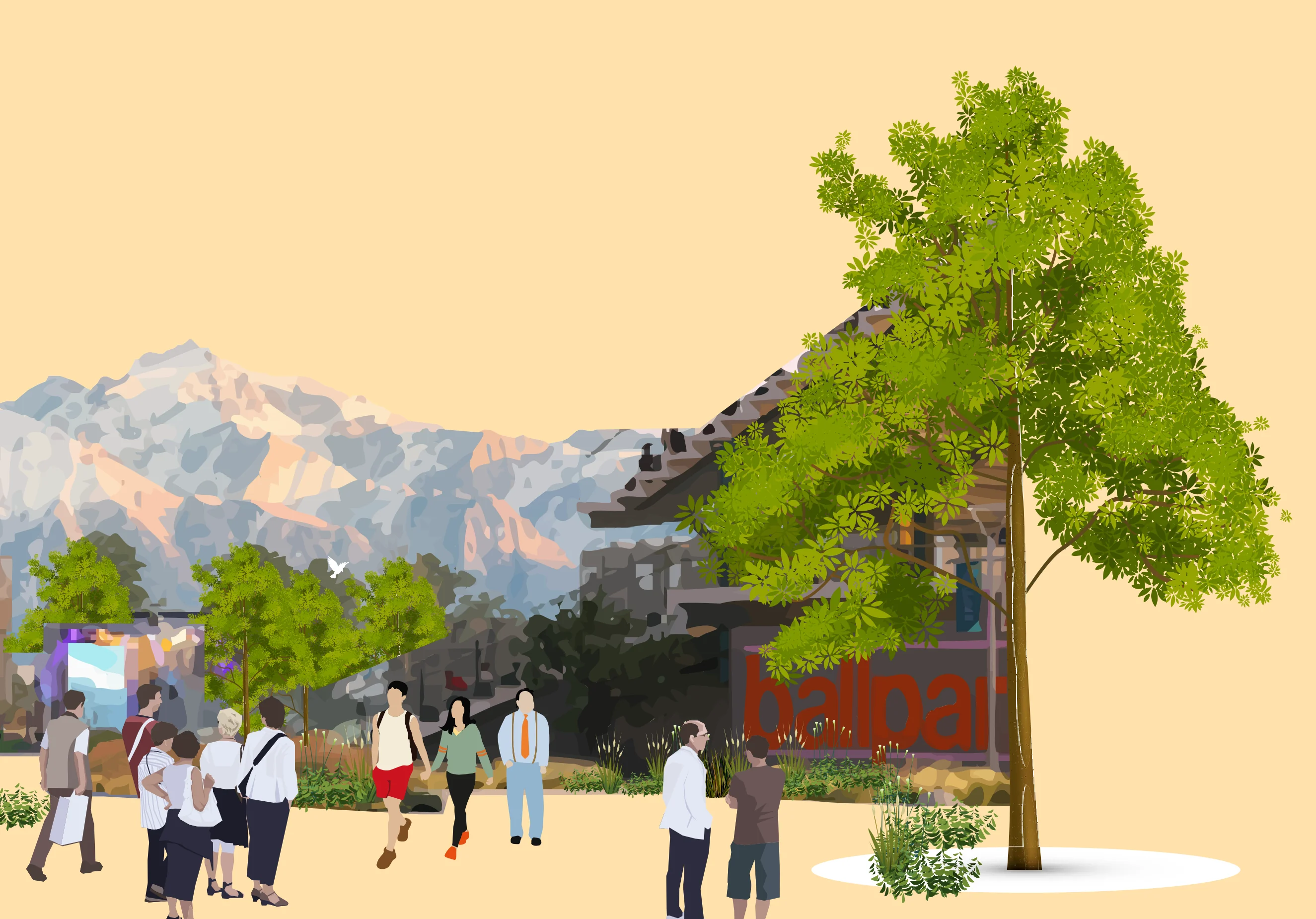
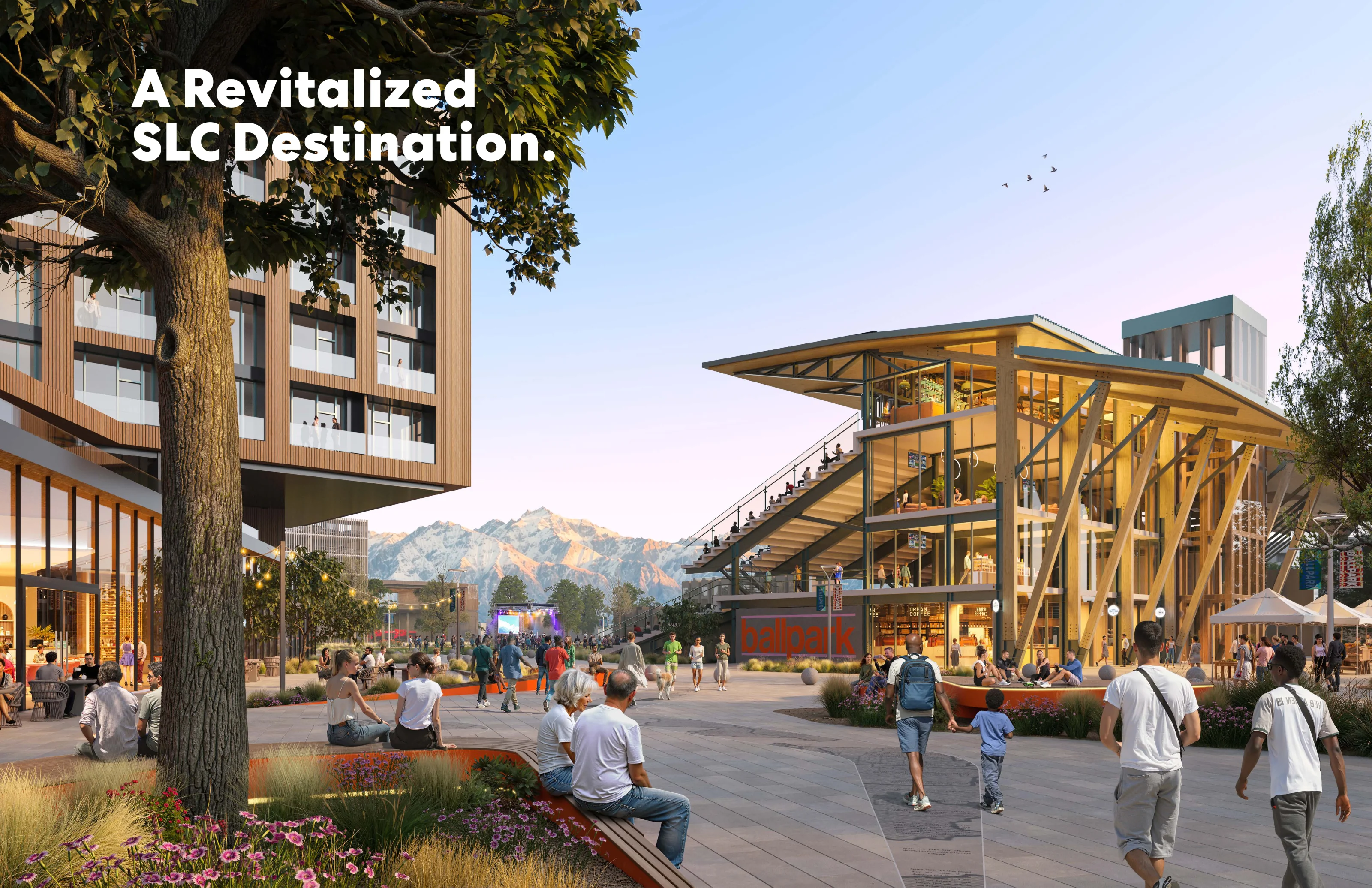
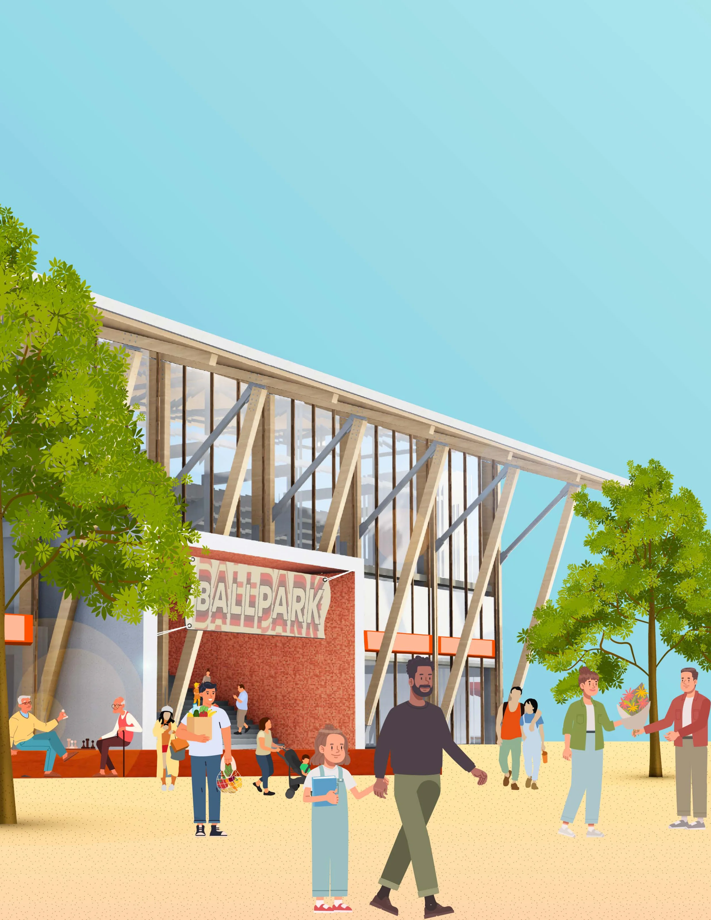
Architectural illustration of the Ballpark NEXT community plaza with people walking, sitting, enjoying outdoor spaces, and the Ballpark building in the background

Your Vision For
What’s NEXT.

Co-Creating
The Future

The Salt Lake City Community Reinvestment Agency (SLC CRA) proudly presents the Ballpark NEXT Community Design Plan, a long-term vision for the 14.8-acre, city-owned Smith’s Ballpark site.

Since 1928, the Ballpark neighborhood has been home to minor league baseball, a cherished local tradition. With the Bees’ departure, the community now has a rare opportunity to shape a new chapter grounded in shared values, inclusive planning, and long-term prosperity.

Built on years of engagement and planning, the Ballpark NEXT plan provides flexible guidance for thoughtful development and investment. Instead of a rigid blueprint, it serves as a strategic tool to drive a once-in-a-generation transformation that prioritizes community benefits.

The plan outlines a clear vision for public spaces, streets, and mixed-use development, each element contributing to a safe, welcoming, and well-connected neighborhood. It fosters economic vibrancy through high-quality jobs, diverse housing options, entertainment venues, and accessible green spaces, all shaped by a human-centered design approach.

Developed with community input and key stakeholder collaboration, the plan paves the way for transformative partnerships with local institutions and businesses. It embraces best practices in public realm design, mobility, and landscape while placing human experience, accessibility, and cultural identity at the forefront.

Above all, the Ballpark NEXT plan proposes a beautiful, welcoming space that honors its legacy while embracing future potential. Anchored in six guiding themes and principles of physical, social, and environmental health, it reflects the community’s aspirations and sets the stage for Salt Lake City’s next iconic hub for entertainment and economic vitality.

Reader’s Guide

Before delving into the document, let’s clarify the intended audience, how it should be used, and the value it provides.

Who Is This For? How to Use It? How Will You Benefit?
City Staff and Elected Officials How to Use It?Use this Plan to update zoning, guide infrastructure investments, align capital projects with long-term goals, and shape development that reflects the community’s vision and priorities. How Will You Benefit?
  • Coordinate public investments and infrastructure upgrades.
  • Align growth with climate, equity, and livability goals.
  • Foster attractive, walkable, and connected neighborhoods.
  • Provide clarity and consistency in decision-making.
  • Encourage collaboration across public and private sectors.
Residents, Business Owners, and Civic Organizations How to Use It?Use this Plan to understand how the neighborhood is evolving, advocate for improvements, and participate in shaping public spaces that are inclusive, safe, and vibrant. How Will You Benefit?
  • Better public spaces that support daily life.
  • Safer, more walkable streets and access to local amenities.
  • A stronger voice in shaping the neighborhood’s future.
Developers How to Use It?Use this Plan to align development proposals with community goals, streamline entitlement processes, and unlock long-term value through context-sensitive, future-ready design. How Will You Benefit?
  • A predictable path to approvals and investment.
  • Design strategies that add long-term value.
  • A shared vision that supports both business and community outcomes.

Contents

White bird flying in the sky
Community members gathering and bicycling under a tree
CHAPTER 01

The
Vision

Children playing and grandparents walking together
The Vision

Leading With
Community Voices

The Plan honors the voices of Ballpark neighborhood residents and business owners who have advocated for a redevelopment that fosters physical, social, and environmental well-being. Insights from two years of public engagement, culminating in the Ballpark NEXT Vision and Guiding Principles, featured below and on the corresponding page have served as this Plan’s north star, translating community priorities into a strategic, achievable framework for responsible growth and investment.

VISION STATEMENT

The future Ballpark Site is an iconic, exciting destination for the neighborhood, city, and region. It is a catalyst for the transformation of our neighborhood, attracting people and development that uplifts and celebrates the area and its residents.

GUIDING PRINCIPLES

Neighborhood Safety and Activation

Safety in Every Stride

Goal: Welcoming; visible; secure; pedestrian-first approach; enliven the heart of the neighborhood; year-round activation

Possible Strategies: Design streets and public spaces with clear sightlines, effective lighting, and Crime Prevention through Environmental Design (CPTED) principles; prioritize walkability and pedestrian friendly circulation; designate community gathering spaces and event areas; activate ground floors with a mix of uses to create diverse and active spaces throughout the site.

Connectivity

Interwoven

Goal: Connected; established; interactive; discovery

Possible Strategies: Incorporate material and textures of the adjacent residential neighborhood; provide clarity of entry and sense of arrival and procession; design massing and wayfinding that supports movement throughout the space; periphery is connected to neighborhood sidewalks, bikeways, roads, and transit; emphasize connections between the two parcels across 1300 South.

Natural Geography

Be Green

Goal: Incorporates unique and historic natural features

Possible Strategies: Incorporate design around green spaces and mature trees; incorporate natural view corridors to the Wasatch Mountain Range; acknowledge natural history of area and explore options to incorporate or reinstate natural elements.

Wellness

Culture of Health

Goal: Culture of proactive physical health and wellbeing

Possible Strategies: Attract retail and dining; incorporate areas for physical activity and social cohesion in public spaces or parks; incorporate areas for programming of physical activities; incorporate design that ensures accessibility for all abilities; integrate greenspace that helps to alleviate urban heat island.

Community-Centered

A Space for Every Face

Goal: Supportive of daily needs of residents; fosters community interaction and involvement

Possible Strategies: Incorporate uses that serve the neighborhood and foster community collaboration and participation; encourage a mix of local businesses and non-profit organizations; provide spaces for local cultural expression.

Acknowledge the Past

Honor the Neighborhood’s History

Goal: Future visitors understand the history of the site and the neighborhood

Possible Strategies: Explore adaptive reuse of primary structure or preservation of distinct design elements; incorporate hte history of the ballpark and neighborhood of the site.

Illustration of a diverse group of community members representing various ages, backgrounds, professions, and abilities.
The Vision

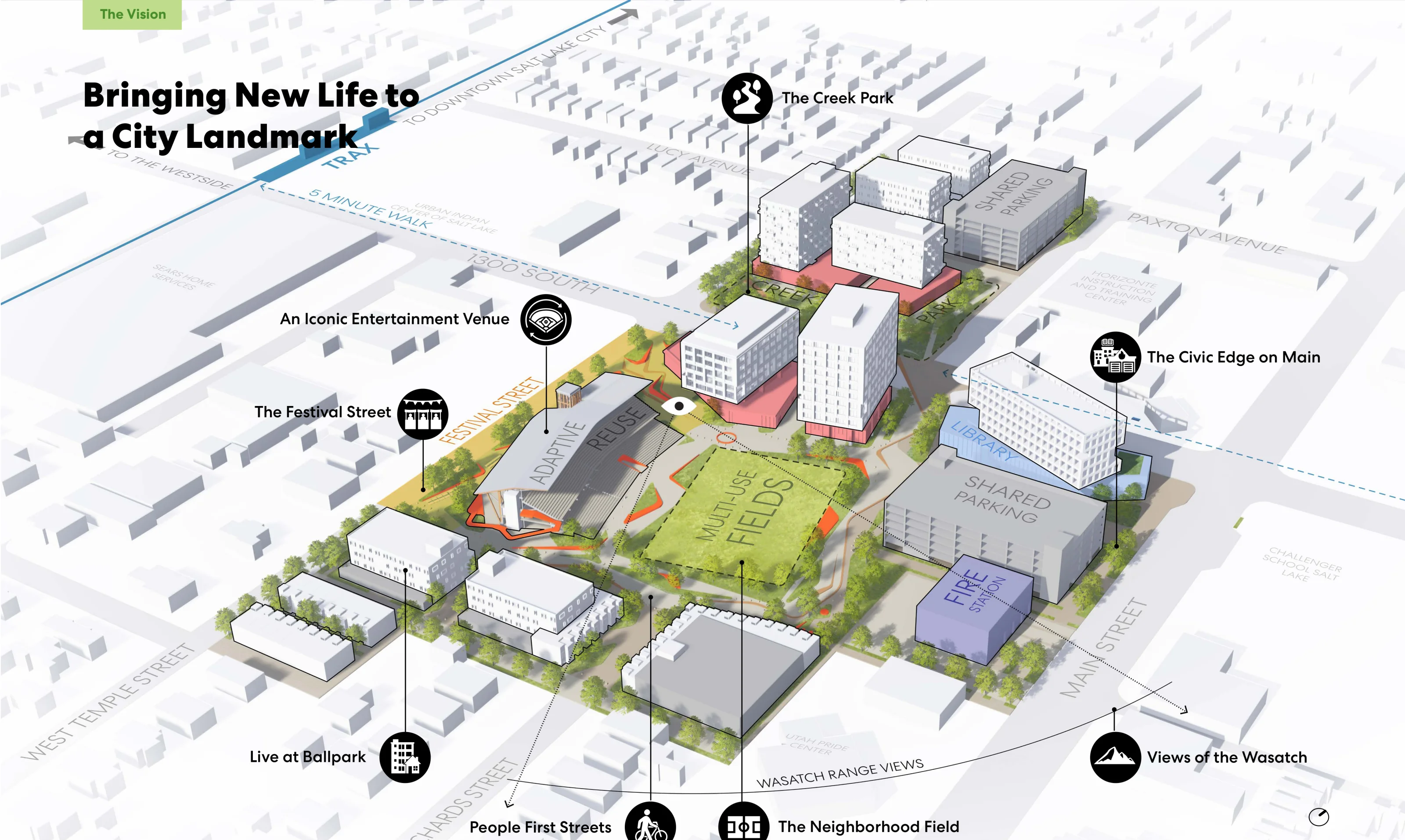
Bringing New Life to a City Landmark

Isometric site plan with eight labeled callouts around a central ballpark siteOpen full-size community design diagram
Accessible view: Diagram callouts and labels

Callouts

  • The Creek Park — upper edge of the plan.
  • An Iconic Entertainment Venue — left of the central plan.
  • The Festival Street — left side of the plan.
  • The Civic Edge on Main — right side of the plan, beside Main Street.
  • Live at Ballpark — lower-left edge of the plan.
  • People First Streets — lower edge of the plan.
  • The Neighborhood Field — lower-center portion of the plan.
  • Views of the Wasatch — lower-right edge, with the WASATCH RANGE VIEWS direction line.

Labels within the plan

  • ADAPTIVE REUSE
  • MULTI-USE FIELDS
  • CREEK PARK
  • LIBRARY
  • SHARED PARKING
  • FIRE STATION
  • FESTIVAL STREET
  • WEST TEMPLE STREET
  • RICHARDS STREET
  • MAIN STREET
The Vision
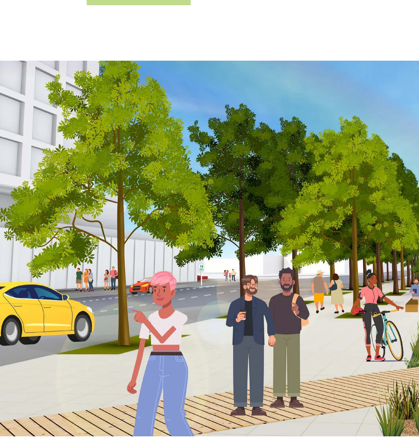
Illustration of tree-lined promenade with pedestrians, cyclists, and calm streets

People First
Streets

Tree-lined promenades create inviting, low-stress pathways through the site, offering residents and visitors seamless connections across the neighborhood.

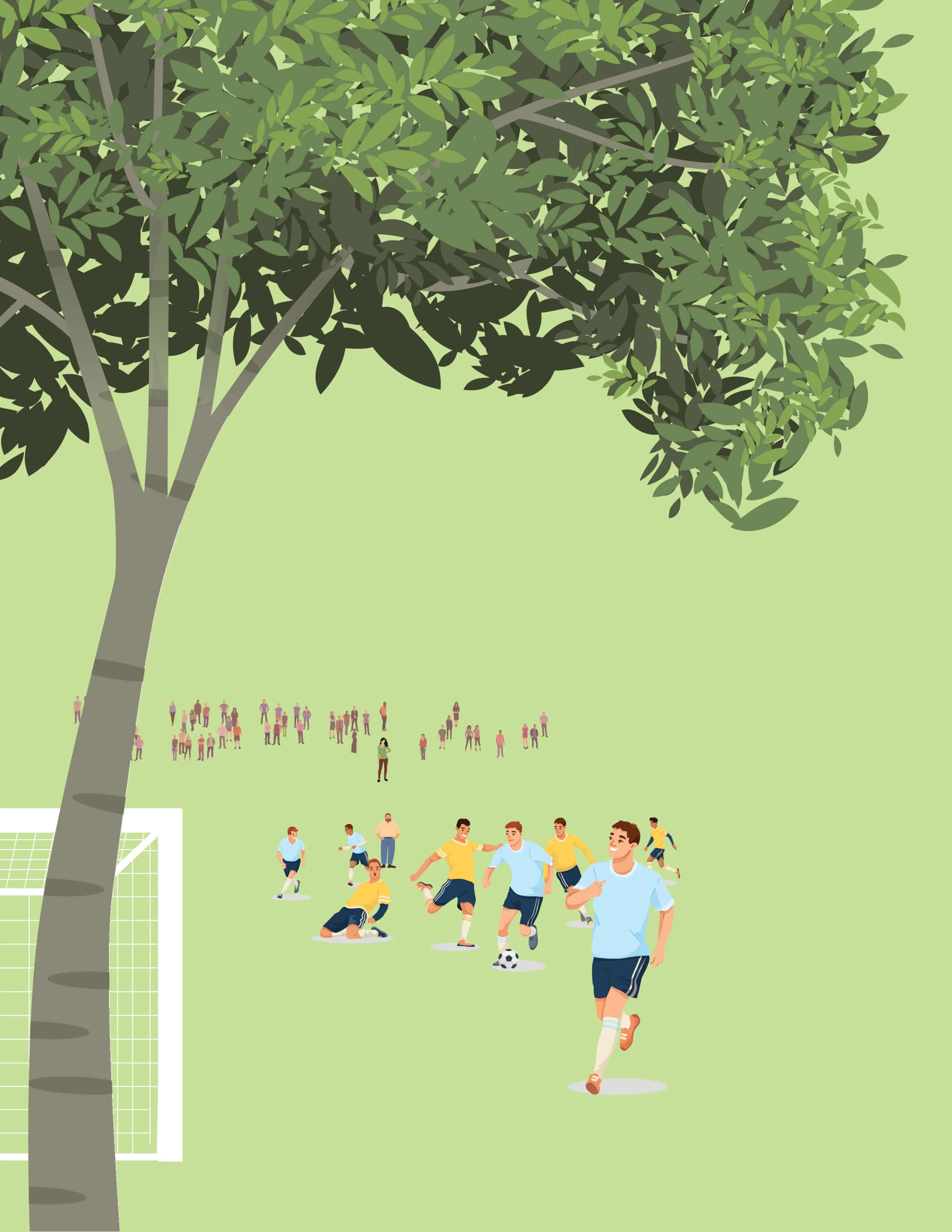
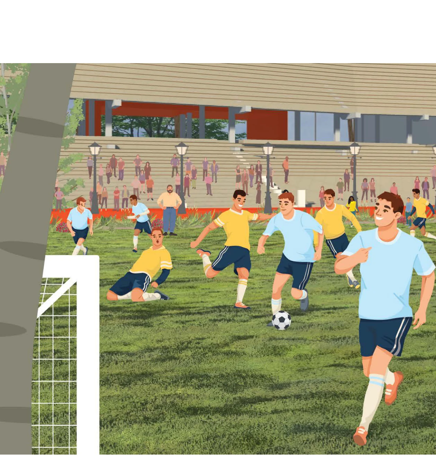
Illustration of youth playing soccer on a multi-purpose neighborhood sports field

The
Neighborhood
Field

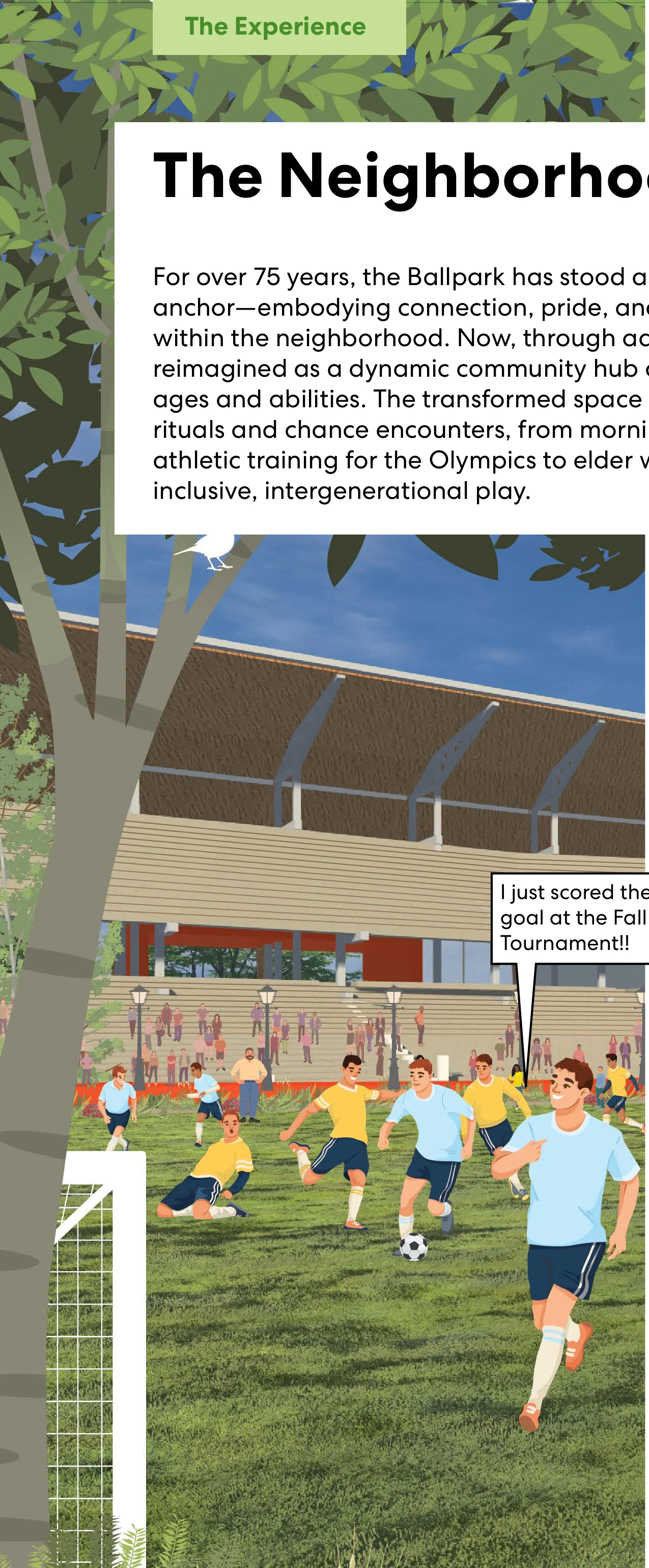
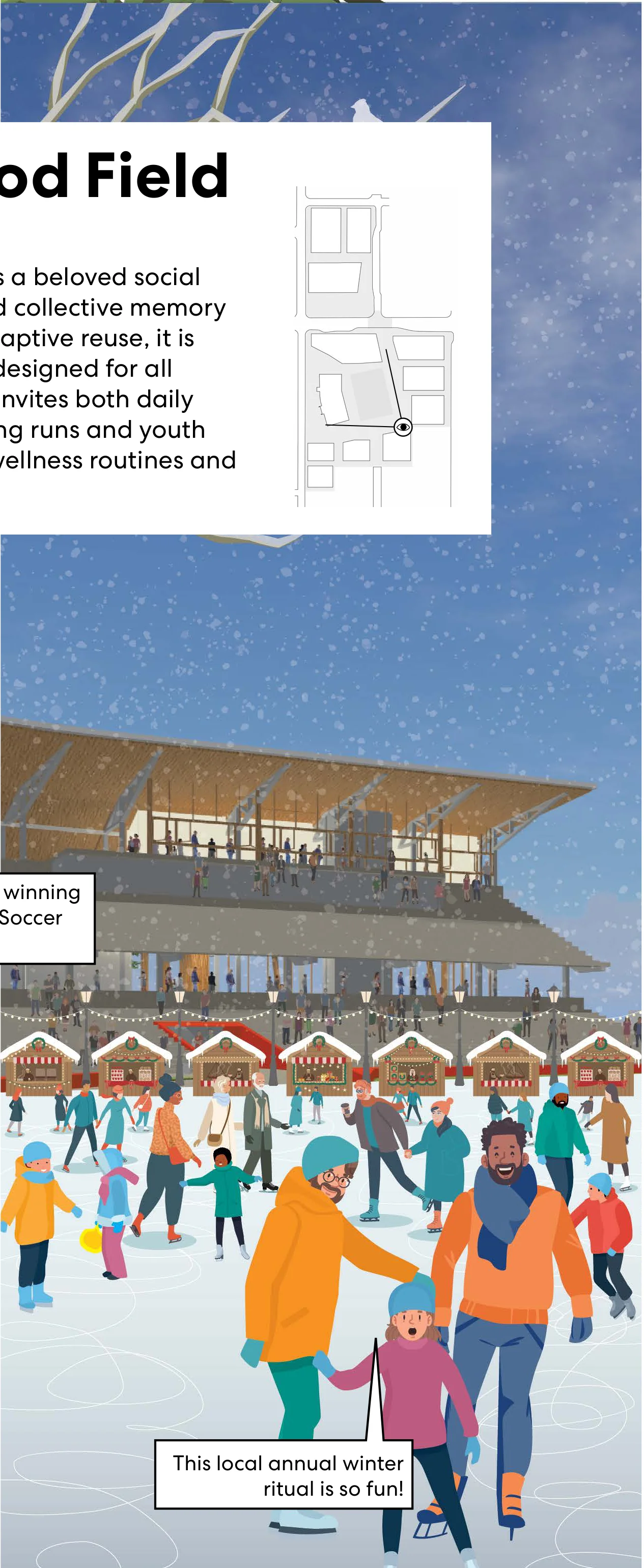
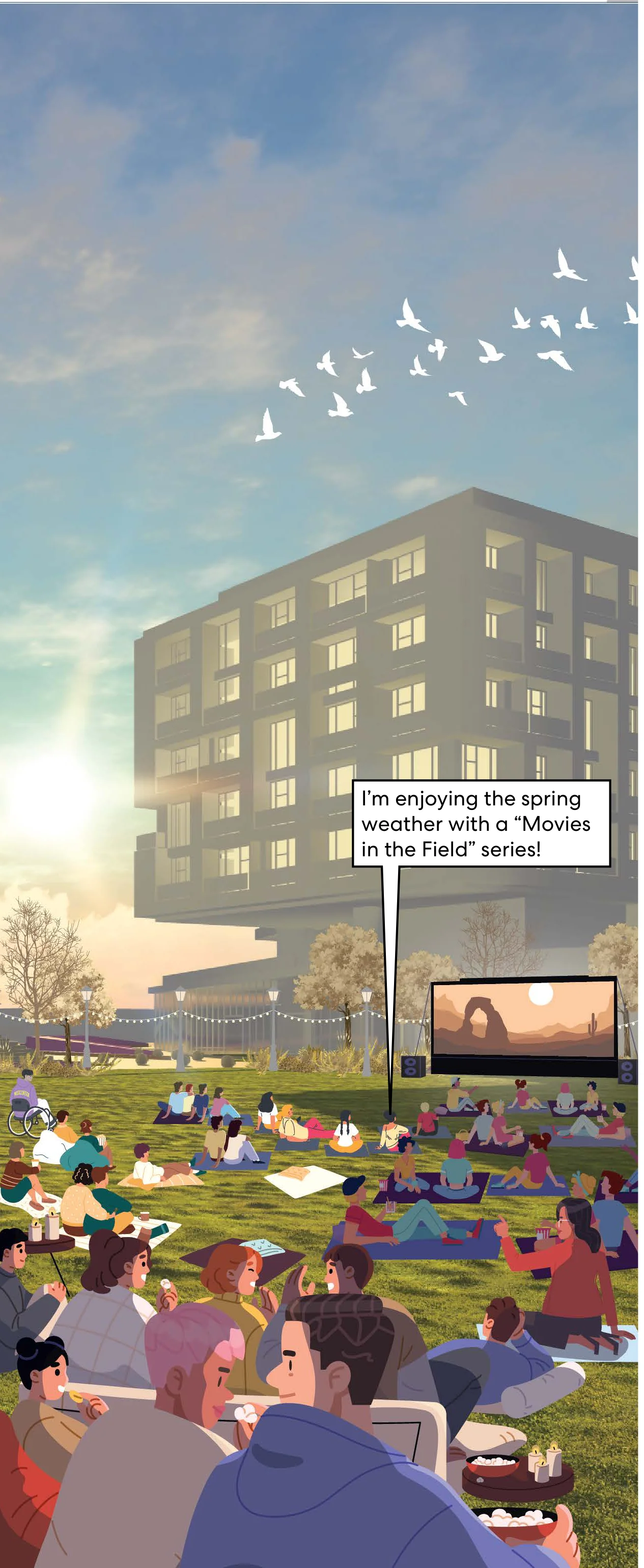
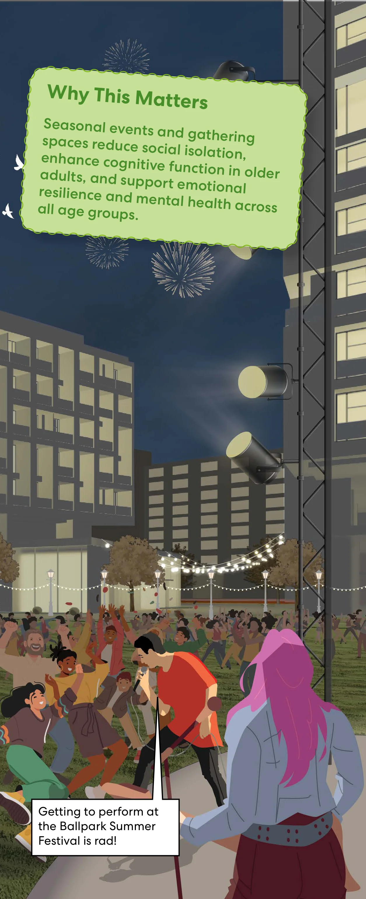
The baseball diamond and outfield now serve as a multi-purpose field, hosting both regional cultural events and neighborhood activities like youth sports.

An Iconic
Entertainment
Venue

The western portion of Smith’s Ballpark has been preserved and reimagined as a vibrant event venue and cultural hub, featuring attainable ground-floor commercial spaces for local businesses.

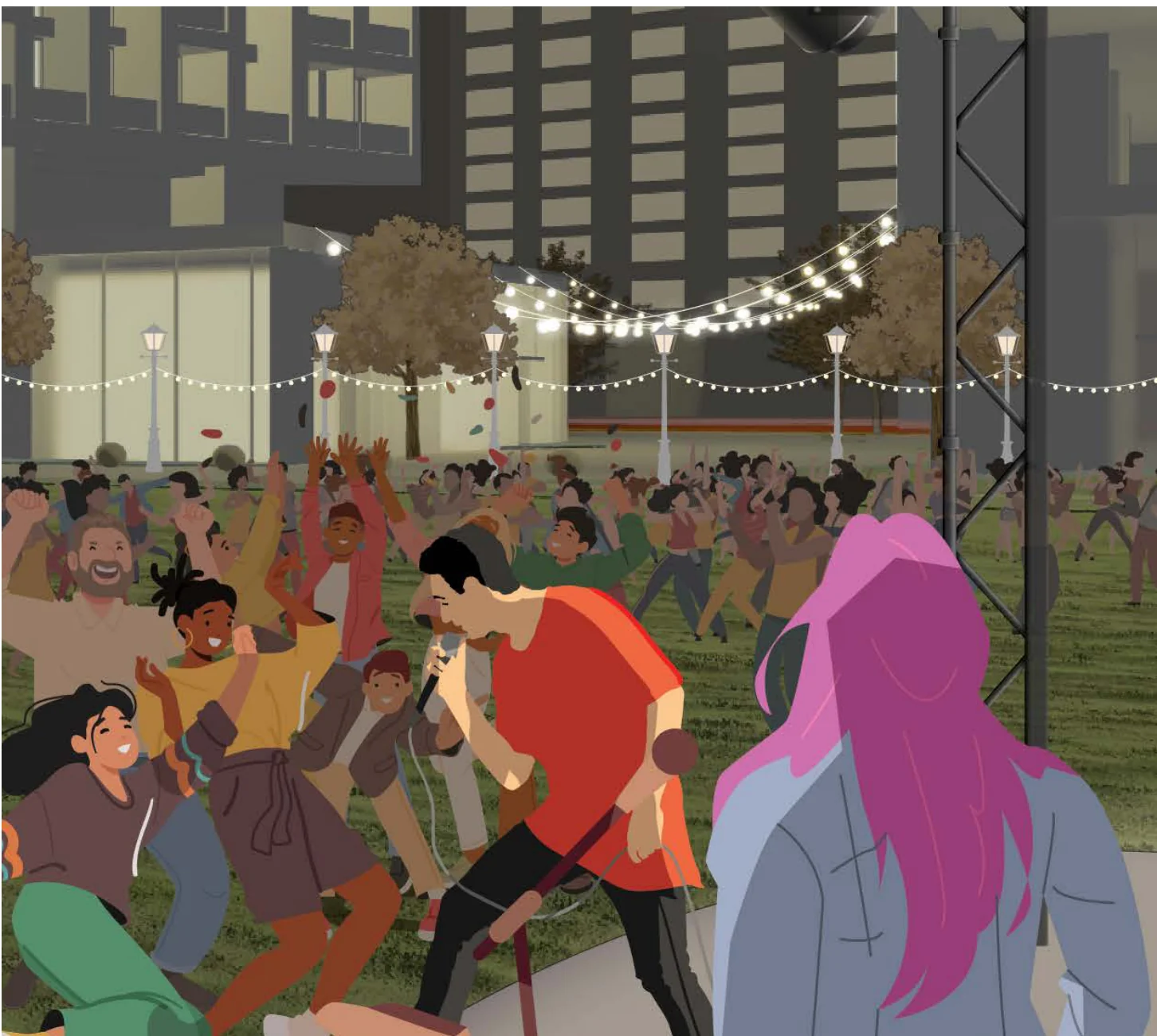
Illustration of an outdoor live music and cultural event venue with a performing band and audience

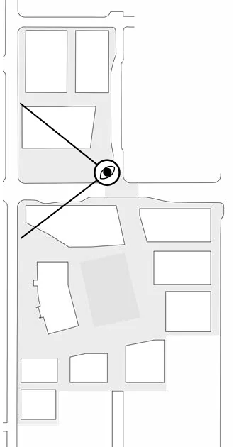
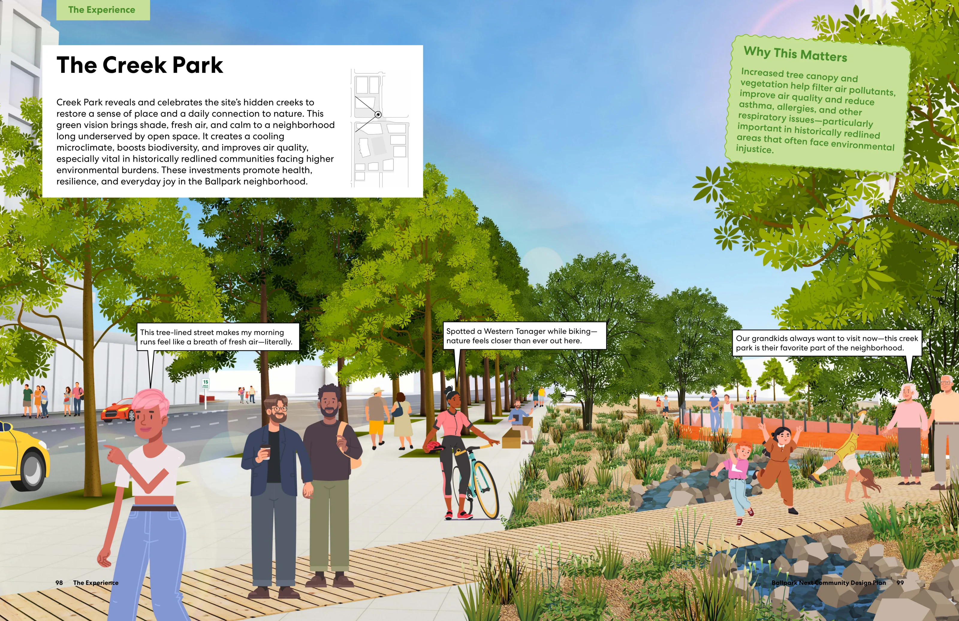
The Creek Park

Creek Park supports a broader effort to restore the Salt Lake Valley’s waterways by partially daylighting Red Butte, Emigration, and Parleys Creeks, currently flowing beneath 1300 South, transforming a portion of the existing parking lot into a lush, natural oasis at the heart of the community.

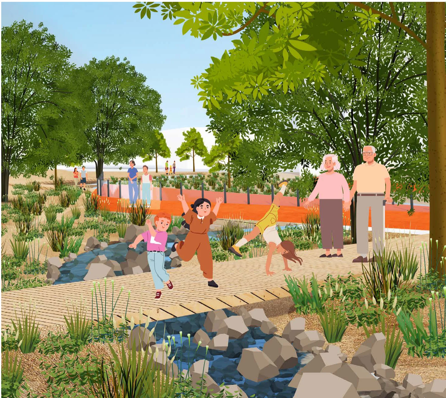
Illustration of daylighted creek park with walking boardwalk, lush greenery, and families enjoying nature
The Vision

The Festival
Street

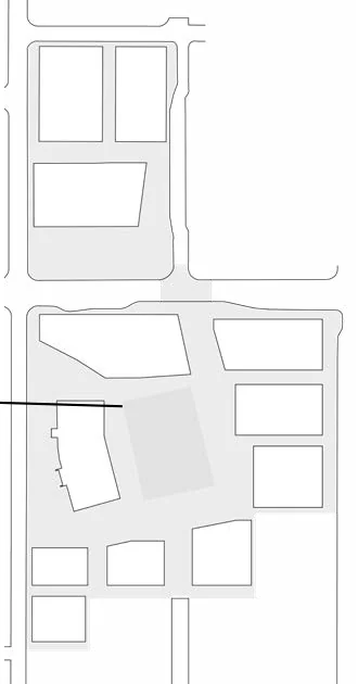
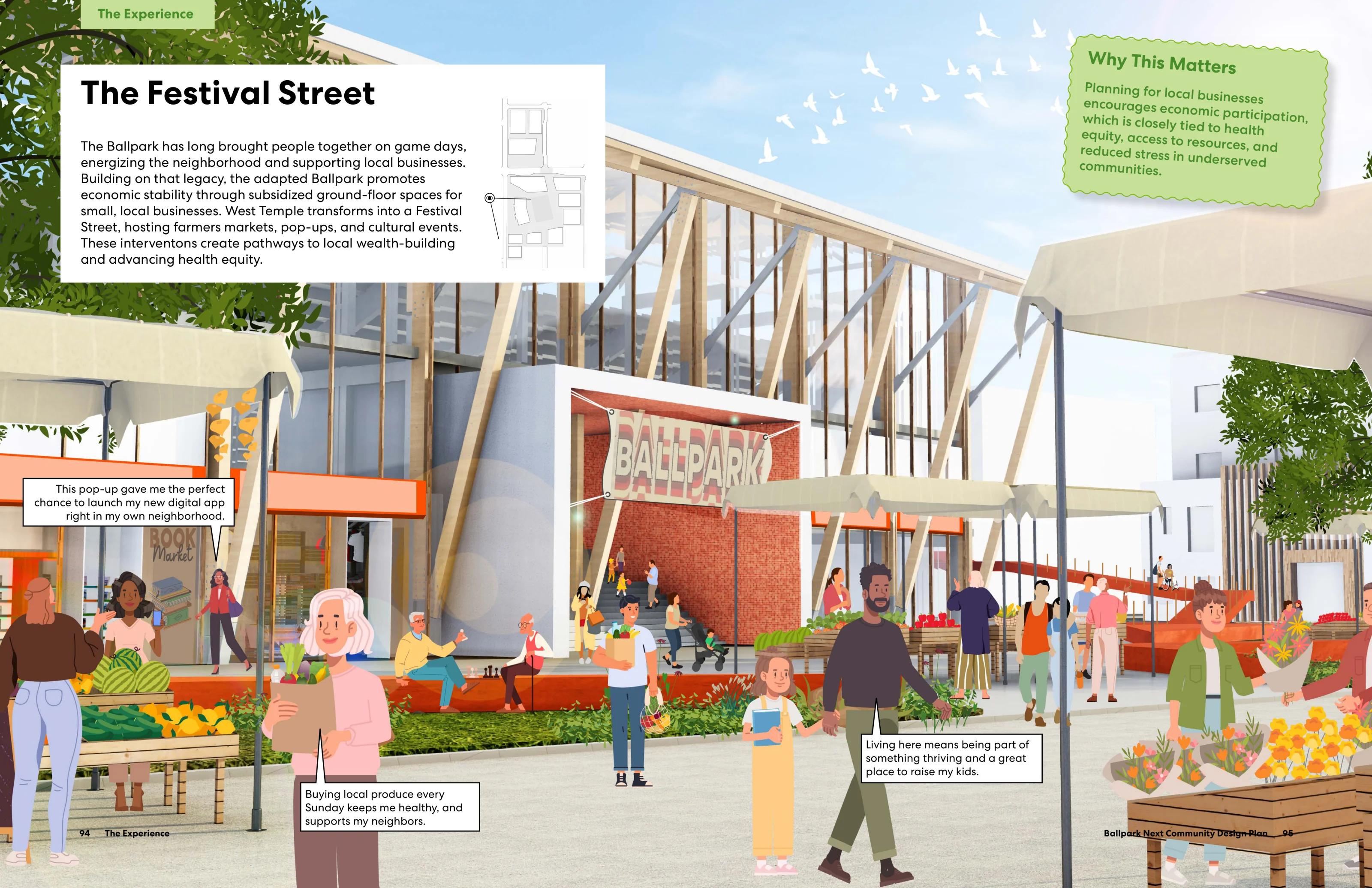
Building on the Station Area Plan, West Temple is transformed into the neighborhood’s festival street, a venue for outdoor events like farmers markets and street fairs.

The Civic Edge
on Main Street

Along Main Street, the new Salt Lake City Public Library Branch and relocated Fire Station 8 establish a civic anchor, reinforcing the neighborhood’s identity.

Views Of The
Wasatch

Development has been thoughtfully sculpted to ensure the majestic views of the Wasatch Mountains remain preserved.

Living At The
Ballpark

The park spaces, local businesses, and event spaces are anchored by a variety of housing options serving community members at different stages of life with opportunities for home ownership.

The Vision

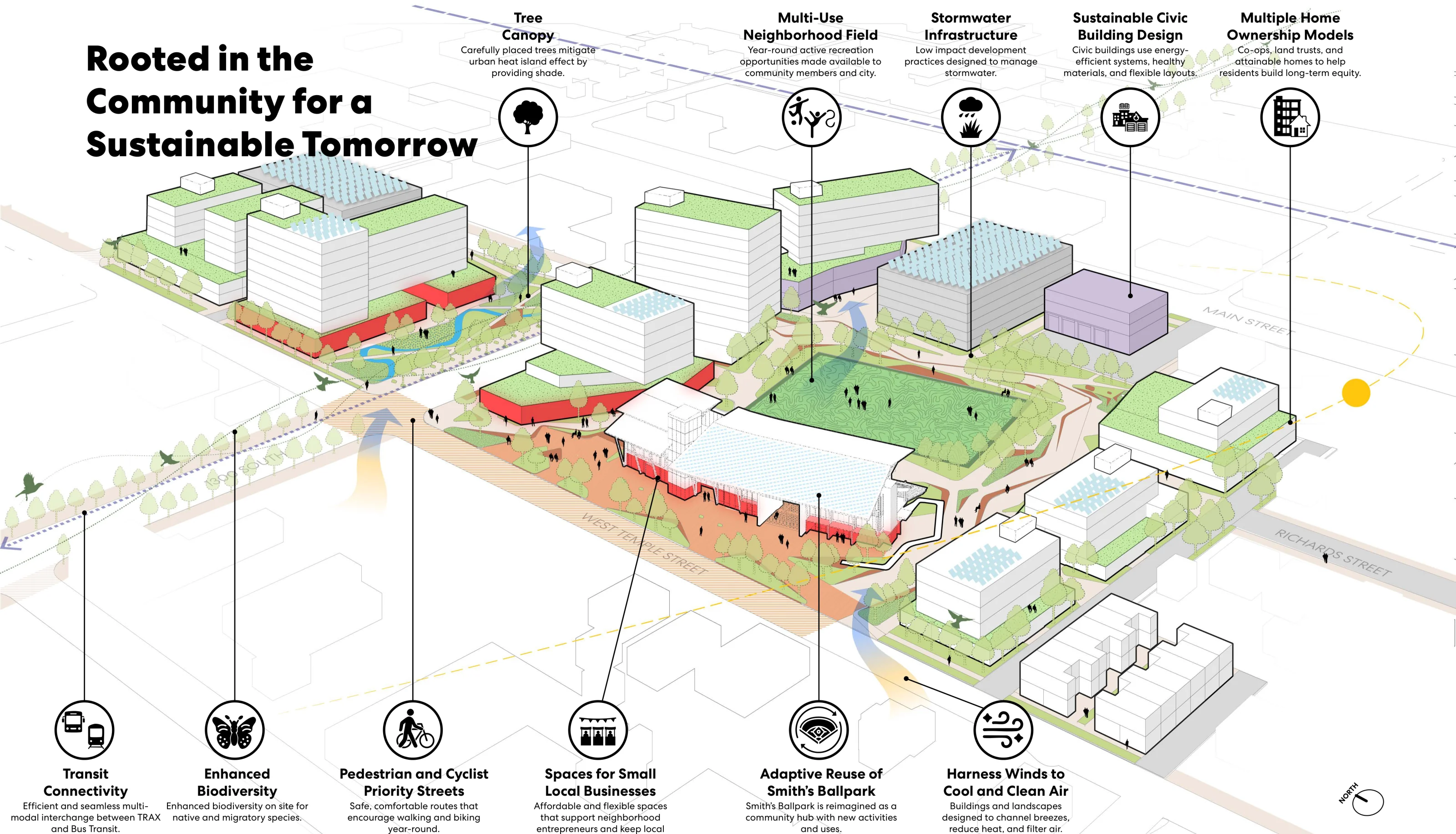
Rooted in the Community for a Sustainable Tomorrow

Isometric site plan for Ballpark Next; the Core Vision Pillars list below provides the labeled design strategies.Open full-size sustainable community diagram

Core Vision Pillars

Tree Canopy

Carefully placed trees mitigate urban heat island effect by providing shade.

Multi-Use Neighborhood Field

Year-round active recreation opportunities made available to community members and city.

Stormwater Infrastructure

Low impact development practices designed to manage stormwater.

Sustainable Civic Building Design

Civic buildings use energy-efficient systems, healthy materials, and flexible layouts.

Multiple Home Ownership Models

Co-ops, land trusts, and attainable homes to help residents build long-term equity.

Transit Connectivity

Efficient and seamless multi-modal interchange between TRAX and Bus Transit.

Enhanced Biodiversity

Enhanced biodiversity on site for native and migratory species.

Pedestrian and Cyclist Priority Streets

Safe, comfortable routes that encourage walking and biking year-round.

Spaces for Small Local Businesses

Affordable and flexible spaces that support neighborhood entrepreneurs and keep local businesses thriving.

Adaptive Reuse of Smith’s Ballpark

Smith’s Ballpark is reimagined as a community hub with new activities and uses.

Harness Winds to Cool and Clean Air

Buildings and landscapes designed to channel breezes, reduce heat, and filter air.

CHAPTER 02

The Process

Illustration of trees, flying birds, and diverse people in a community park setting
Illustration of an elderly couple walking together
The Process

Foundational
Planning Work

The Plan builds on the planning work completed in partnership with the community.

Ballpark Station Area Plan (2022)

The design framework aligns with the adopted Station Area Plan including the following actions:

  • Creating a dense urban environment and entertainment zone around the Ballpark.
  • Increase connectivity in the station area.
  • Increase urban design quality.
  • Improve safety.
  • Enhance social vibrancy.

Ballpark NEXT Design Competition (2023)

Immediately following the relocation announcement, Salt Lake City launched the Ballpark NEXT Design Competition, which invited residents, post-secondary students, and professionals to submit their creative ideas for the Ballpark Site’s future. 123 applications were received, including 92 residents, 14 post-secondary students, and 17 development professional applications. After being narrowed down to three finalists in each category, a public vote determined one winner in each. Many of the ideas from the design competition were incorporated into the final design framework including reconnecting Richards Street, the adaptive re-use of the ballpark, a publicly accessible parkspace, and daylighting of the three creeks, to name a few.

Community Visioning and Guiding Principles (2023)

The extensive community visioning process was built on the themes gathered from the Design Competition, as well as previous neighborhood planning efforts. The CRA worked with residents, businesses, and local organizations to collaborate via in-person events, online tools, and a working group where they discussed pertinent issues, provided feedback, and identified existing positives, challenges, and aspirations. This process culminated in the Community Vision Statement and Guiding Principles, which served as the basis for the preferred design scenario.

Ballpark Next Urban Design Framework Planning Process (2024 - 2025)

The Ballpark NEXT Urban Design Framework, which was an eight (8) months planning process, acknowledged and built upon previous planning work and community vision statement and guiding principles to deliver a human-centered development roadmap for the city-owned 14.82 acre site. The process included two (2) stakeholder ideation sessions, which included but not limited to representatives from Salt Lake City, Ballpark Community Council Leadership, Ballpark Action Team Leadership, Larry H. Miller Group, and Utah Transit Authority. The discourse and input from these stakeholder ideation sessions informed the selection of the preferred alternative.

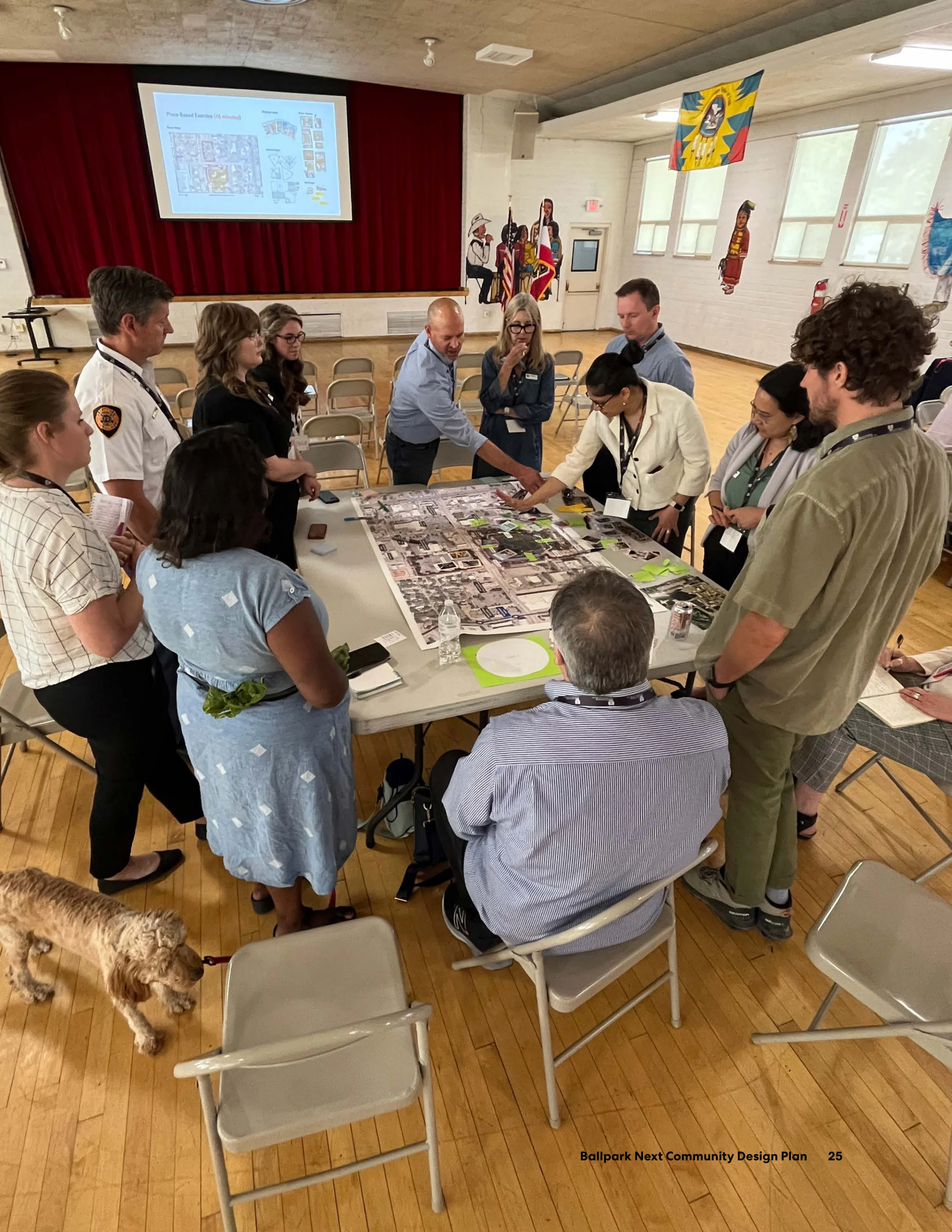
A break out group from the first
Ballpark NEXT stakeholder ideation.
A break out group from the first Ballpark NEXT stakeholder ideation gathered around a table examining architectural plans and maps.
The Process

The Site’s
History

An iconic landmark for the Ballpark neighborhood, the site has served as a sports, civic and cultural anchor in Salt Lake City for over 100 years.

Natural History

Historically, three Salt Lake Valley waterways: Red Butte Creek, Emigration Creek, and Parley’s Creek, traversed the neighborhood, terminating at the Jordan River. These creeks remained daylit as recent as 1952, but were ultimately channelized and buried under 1300 South.

Baseball Origins

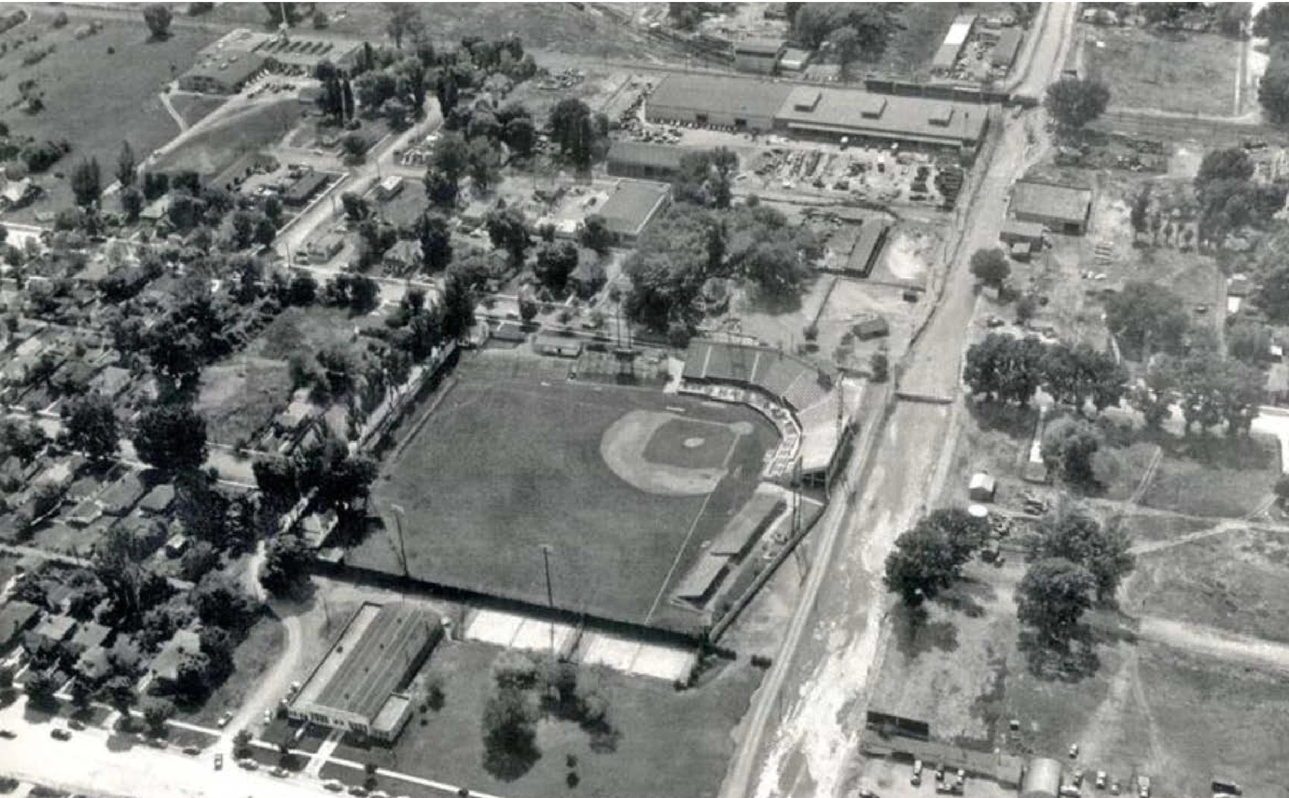
The site’s baseball legacy began in 1928 with the opening of Community Park and later Derks Field. This ballpark served as the home of the Salt Lake Bees, Gulls, and Trappers for decades as well as a beloved anchor for celebrations and civic pride, hosting events like concerts and July 4th fireworks shows.

Modern Day

In 1994, Derks Field was replaced by a modern minor league baseball facility, first named Franklin Covey Field, now known as Smith’s Ballpark, which continued the tradition of baseball as the home of the Salt Lake Bees until 2024.

Historical 1952 aerial photograph of Derks Field baseball stadium surrounded by residential streets, open land, and daylit creek corridors in Salt Lake City.
An aerial view of Derks Field with daylit creeks along 1300 South as seen in 1952. (Credit: Salt Lake Tribune)
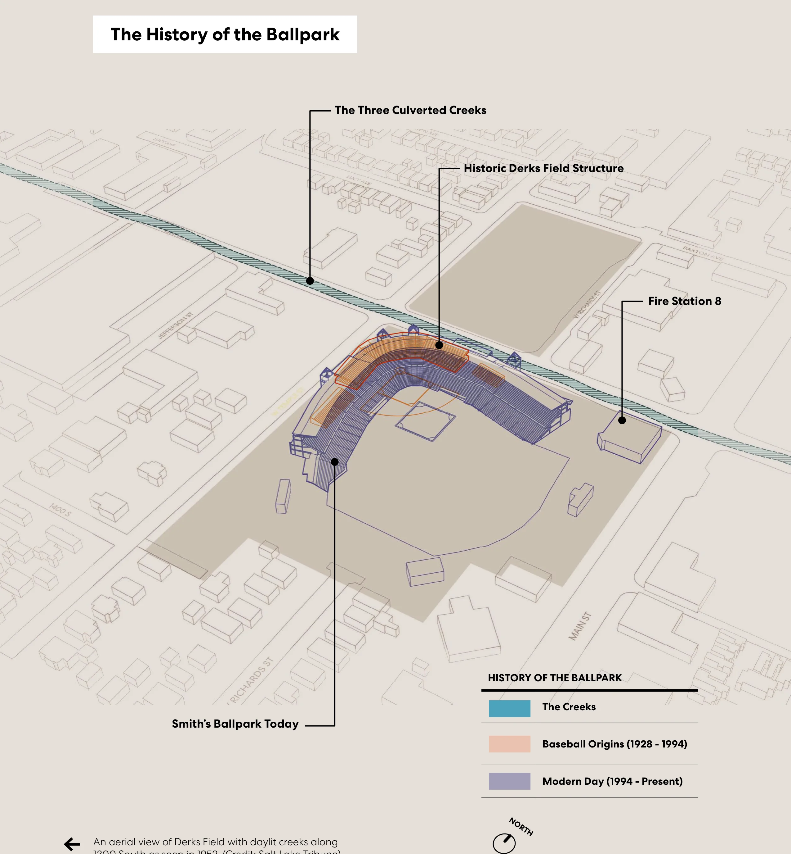
Diagram titled 'The History of the Ballpark' illustrating three historical layers: The Three Culverted Creeks under 1300 South, the historic Derks Field structure (1928-1994), and Smith's Ballpark today (1994-present), alongside Fire Station 8.
Accessible view

Historical Layers of the Ballpark Site

The diagram and aerial imagery outline three primary historical and physical layers of the site:

Swipe or scroll horizontally to view all columns.

Layer / Era Time Period Key Features & Description
The Creeks Pre-1952 to Present Three Salt Lake Valley waterways (Red Butte Creek, Emigration Creek, and Parley’s Creek) once ran daylit across the neighborhood to the Jordan River; subsequently channelized and culverted under 1300 South.
Baseball Origins 1928 – 1994 Opened as Community Park in 1928, later becoming Derks Field. Hosted the Salt Lake Bees, Gulls, and Trappers, alongside concerts and community events.
Modern Day 1994 – Present (2024) Derks Field replaced in 1994 by Franklin Covey Field (later Smith’s Ballpark), serving as the home of the Salt Lake Bees through 2024.
Fire Station 8 Historical / Modern Civic facility located east of the ballpark complex along Main Street and 1300 South.

Download table data as CSV

The Process

The Neighborhood
Impact

Ballpark NEXT can catalyze larger neighborhood networks and citywide initiatives around ecology, transportation, and social infrastructure.

Ecology
Infrastructure

Located between Jordan River and Liberty Park, the site offers ecological value beyond human networks. With intentional planting and open space design, Ballpark NEXT becomes a “stepping stone” along a migratory pollinator corridor.

Transportation
Infrastructure

The neighborhood is served by TRAX light rail and frequent bus service on State Street. The framework can deliver walkable and bikeable connections to everyday shops and services, reducing reliance on automobiles.

The site presents an opportunity to better connect to existing neighborhood social infrastructure such as educational institutions, everyday services, and health care support through green streets.

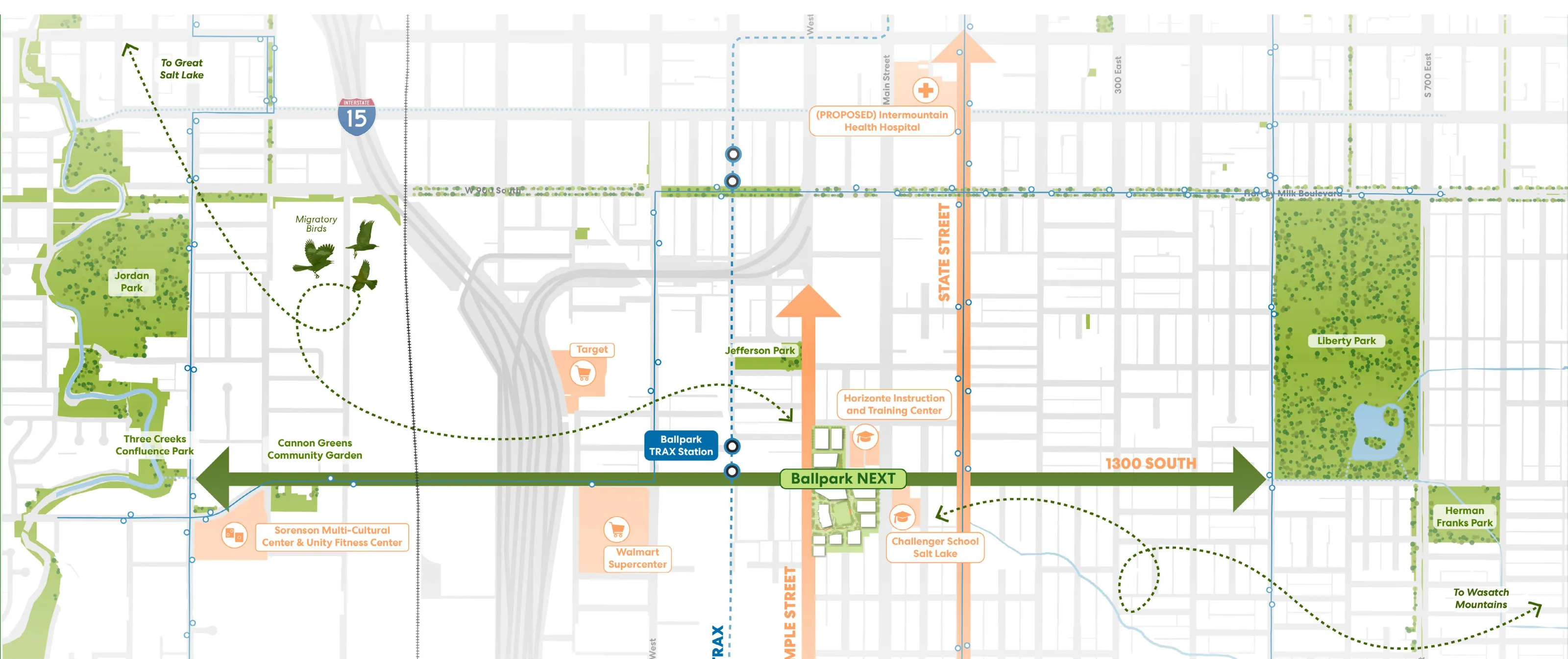
Urban planning map of the Ballpark NEXT neighborhood showing regional connections along the 1300 South corridor between Jordan River/Parks on the west and Liberty Park on the east, intersecting State Street, West Temple, Main Street, and the TRAX light rail corridor.
Accessible view: Map details and spatial network summary

The map illustrates the Ballpark NEXT site as a central nexus connecting major east-west and north-south community corridors:

  • Ecology Corridor (Green): Runs horizontally along 1300 South, bridging Three Creeks Confluence Park, Jordan Park, and Cannon Greens Community Garden on the west to Liberty Park and Herman Franks Park on the east, extending toward the Wasatch Mountains and Great Salt Lake for migratory birds and pollinators.
  • Transit Corridor (Blue & Orange): North-south axes along TRAX light rail, West Temple Street, Main Street, and State Street connecting Ballpark TRAX Station with downtown and regional transit networks.
  • Social & Civic Anchors: Highlights local institutions including Horizonte Instruction and Training Center, Challenger School Salt Lake, Salt Lake Community College, Target, Walmart Supercenter, Sorenson Multi-Cultural Center & Unity Fitness Center, and the proposed Intermountain Health Hospital.
The Process

The Ballpark
NEXT Site

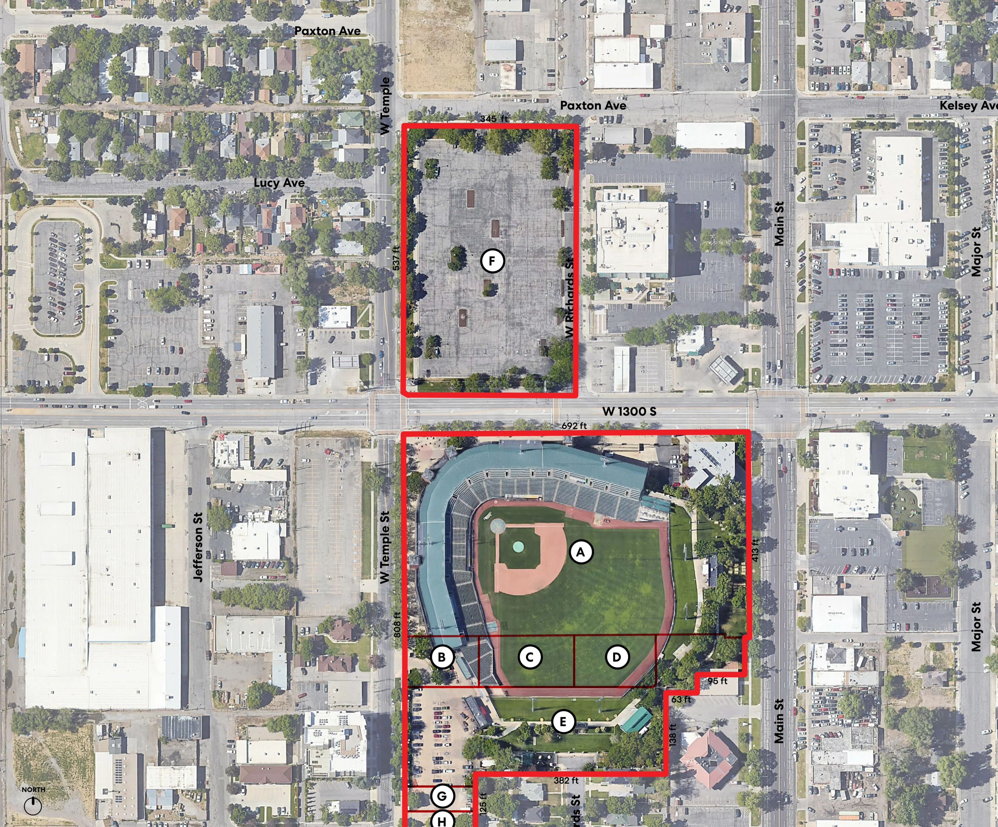
The site consists of two city-owned blocks, separated by 1300 South, totaling 14.8 acres.

The south block is currently home to Smith’s Ballpark with several ancillary ballpark structures including canteen and restrooms, and a sheltered pavilion. Salt Lake City’s Fire Station 8 is currently located on the corner of 1300 South and Main Street.

The north block is currently a surface parking lot serving Ballpark events. A large portion of the site are zoned as Public Land with the southern parcels zoned as Moderate Density Multi-Family Residential. Parcel F is located in an area with a 0.2% annual chance of flooding.

Swipe or scroll horizontally to view all columns.

PARCEL ID ACREAGE ZONING
A 6.47 Public Land (PL)
B 0.35
C 0.45
D 0.39
E 2.54 Public Land (PL)
Moderate Density Multifamily Residential (RMF-35)
F 4.30 Public Land (PL)
G 0.16 Moderate Density Multifamily Residential (RMF-35)
H 0.16
Aerial map of the Ballpark NEXT site, with red boundaries around two blocks, surrounding streets, and parcels A through H
Ballpark NEXT site context and parcel boundaries. Select the map to open an enlarged view, or open the full-size map.
Accessible view

The aerial map is oriented with north at the top. Red outlines mark two parts of the Ballpark NEXT site: a rectangular north block and a larger south block, separated by W 1300 S.

  • The north block is between Paxton Ave and W 1300 S, with W Temple St on its west side and W Richards St on its east side. Parcel F is inside this block.
  • The south block lies below W 1300 S. W Temple St and Jefferson St are shown to the west, while Main St and Major St are shown to the east.
  • Within the south block, parcel A occupies the main baseball-field area toward the upper and eastern side. B is along the west side; C and D sit side by side below the field, with C west of D. E is below them in the central lower area. The small parcels G and H are at the southwest end, with G north of H.
Download the parcel table as CSV
The Process

Neighborhood Health Metrics

Ballpark NEXT is grounded in the belief that health is shaped not just by hospitals or clinics, but by the conditions in which people live, work, and play.

Guided by the U.S. Centers for Disease Control and Prevention’s (CDC) Social Determinants of Health framework, the plan prioritizes human-centered design strategies that address root causes of health disparities in the Ballpark neighborhood.

According to the CDC, Social Determinants of Health are “conditions in the environments where people are born, live, learn, work, play, worship, and age that affect a wide range of health, functioning, and quality-of-life outcomes and risks.” These are organized into five key domains:

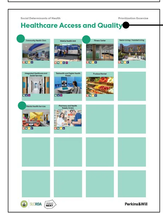
Healthcare Access and Quality

The CDC highlights that timely, affordable, and quality healthcare is essential. Many people lack insurance or providers nearby, making it harder to get preventive care or manage health conditions.

Social and Community Context

The CDC notes that strong social connections improve health and resilience. But many people, especially those facing discrimination or isolation, lack support. Building relationships at home, work, and in community spaces helps people thrive.

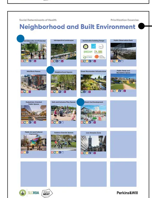
Neighborhood and Built Environment

Where people live affects their exposure to violence, pollution, and other risks. The CDC stresses that safer streets, clean air and water, and access to parks and transportation can greatly improve health.

Economic Stability

According to the CDC, steady income and access to basic needs like housing, food, and healthcare are critical for good health. Poverty, low wages, and lack of job opportunities increase risk for chronic illness and poor outcomes.

Education Access and Quality

The CDC links education to long-term health. Students who attend quality schools are more likely to succeed and stay healthy. Barriers like poverty, discrimination, or underfunded schools increase health risks over time.

The Ballpark neighborhood faces significant disparities compared to Salt Lake County, underscoring the urgent need for place-based, health supportive design interventions. Below are a few key metrics:

Salt Lake County
Ballpark Census Tract

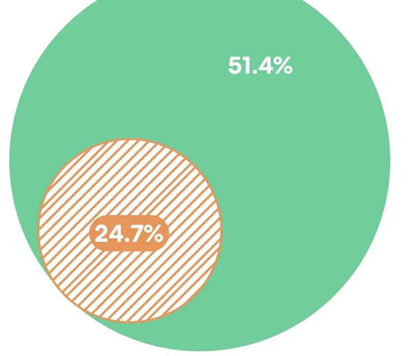
Housing Cost Burden

Housing cost burden shows when housing costs take up too much income, leaving less for essentials that support health.

Housing Cost Burden: Ballpark Census Tract 51.4%, Salt Lake County 24.7%

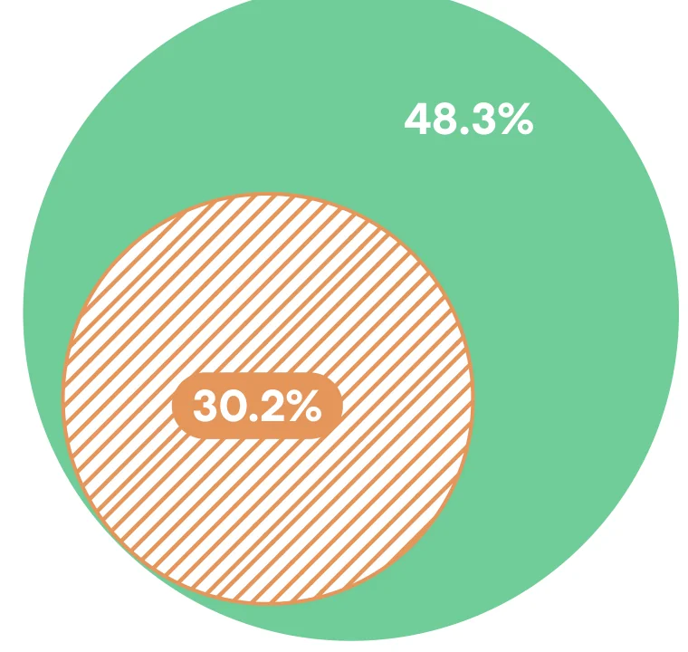
Racial/Ethnic Minority Status

Racial/ethnic minority status highlights groups that often face systemic barriers to health, housing, education, and economic opportunity.

Racial/Ethnic Minority Status: Ballpark Census Tract 48.3%, Salt Lake County 30.2%

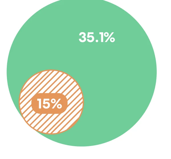
Poverty

Poverty reflects limited income and access to basic needs, which can negatively impact health and deepen long-term inequality.

Poverty: Ballpark Census Tract 35.1%, Salt Lake County 15%

No High School Diploma

No high school diploma signals limited education access, which is linked to lower income, fewer job opportunities, and poorer health outcomes.

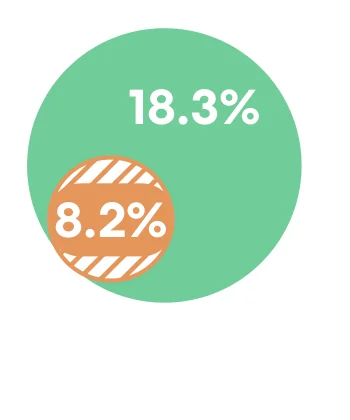
No High School Diploma: Ballpark Census Tract 18.3%, Salt Lake County 8.2%
Accessible view

Key disparity metrics comparing Ballpark Census Tract to Salt Lake County:

Swipe or scroll horizontally to view all columns.

Health & Demographic Metric Salt Lake County Ballpark Census Tract
Housing Cost Burden 24.7% 51.4%
Racial/Ethnic Minority Status 30.2% 48.3%
Poverty 15.0% 35.1%
No High School Diploma 8.2% 18.3%

Download disparity metrics CSV

The Process

Ideation with City and
Neighborhood Partners

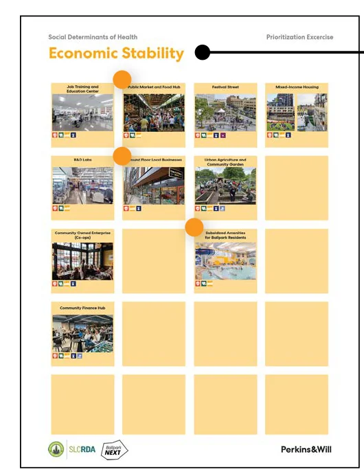
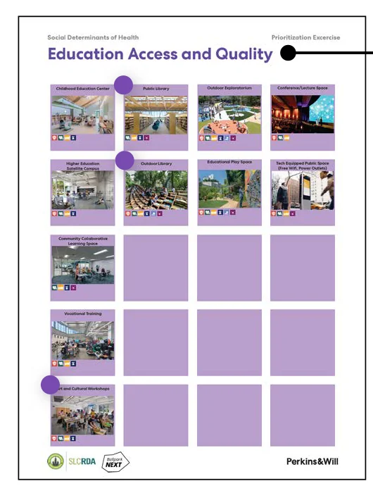
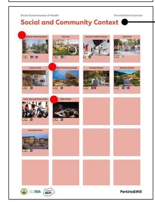
The planning process invited stakeholders to provide input on priority programs they would like to see at the Ballpark site, organized around the five domains of Social Determinants of Health.

Top 3 Programs

  • Public Market and Food Hub
  • Ground Floor Local Businesses
  • Subsidized Amenities for Residents

Top 3 Programs

  • Public Library
  • Outdoor Exploratorium
  • Arts and Cultural Workshops

Top 3 Programs

  • Outdoor Performance Stage
  • Community Gathering Spaces
  • Night Market

Top 3 Programs

  • Fitness Center
  • Produce Market
  • Mental Health Services

Top 3 Programs

  • Wide Sidewalk and Protected Bike Lanes
  • Neighborhood Square
  • Mixed-Use Development

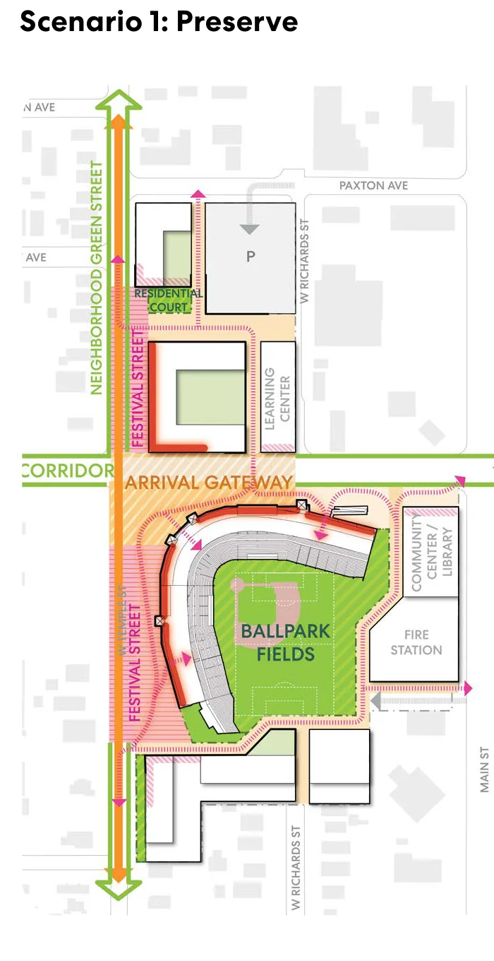
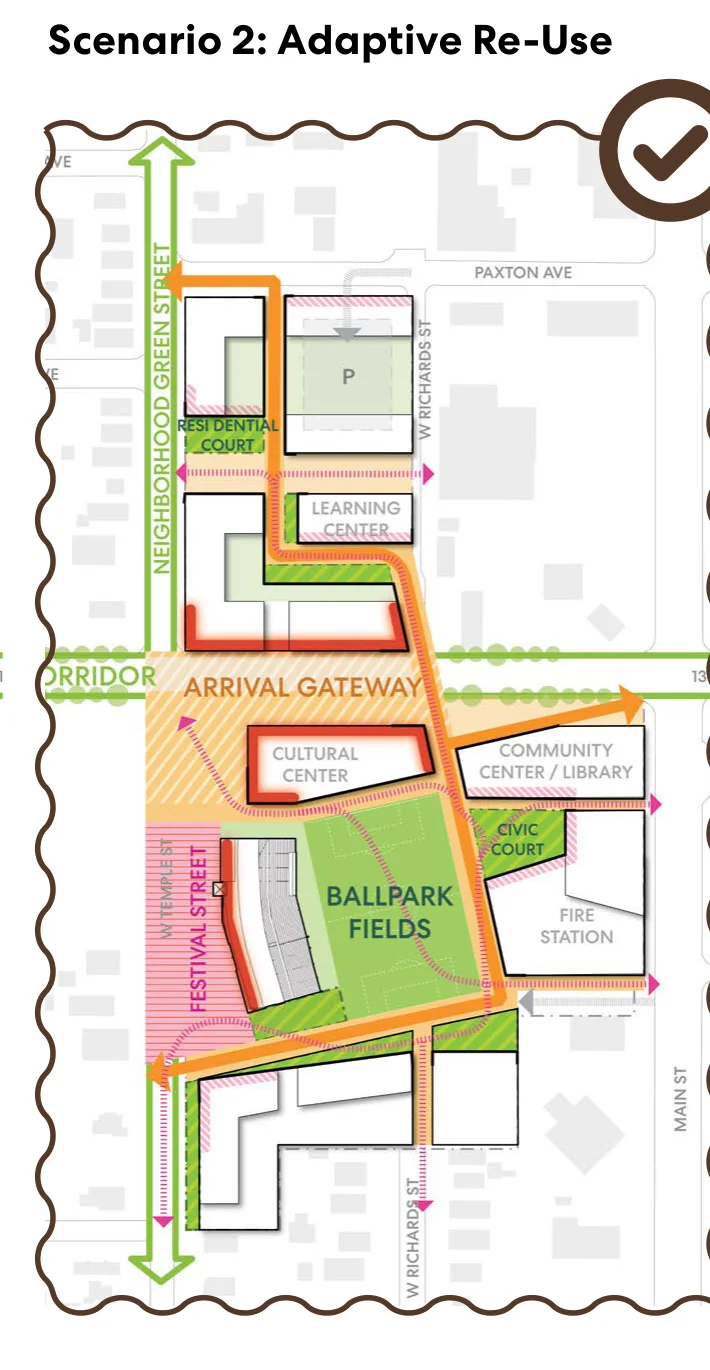
Three distinct design test fits were developed to illustrate different scenarios for the future of Smith’s Ballpark. Based on community input, Scenario 2: Adaptive Re-Use was chosen as the preferred alternative.

Scenario 1: Preserve

Scenario 1: Preserve design test fit map

Scenario 2: Adaptive Re-Use

Scenario 2: Adaptive Re-Use design test fit map (preferred alternative)

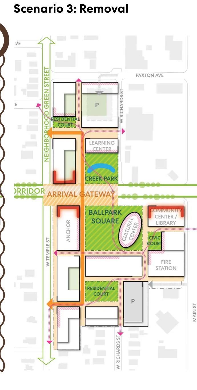
Scenario 3: Removal

Scenario 3: Removal design test fit map
Accessible view

The three plans compare different ways of organizing Smith’s Ballpark site, including the ballpark structure, surrounding development, open space, and connections through the site.

Scenario 1: Preserve

  • The existing ballpark is retained as the principal site element.
  • Surrounding development, open space, and circulation are arranged around the preserved ballpark.
  • Gateway and entry connections relate the ballpark and surrounding site to the circulation network around its edges.

Scenario 2: Adaptive Re-Use

  • The western portion of the stadium is preserved and partially reused.
  • New development and open space are combined with the retained stadium portion to create a cultural and civic destination centered on arts, performance, and community activities.
  • Gateways and circulation connect the retained stadium portion with the surrounding mixed-use site and its open spaces.

Scenario 3: Removal

  • The existing ballpark is removed rather than retained or partially reused.
  • The site is reorganized as new development and open-space areas connected by the site circulation network.
  • Gateway and entry connections lead from the surrounding circulation network into the reorganized site.

Scenario 2 reimagines the Ballpark as a cultural and civic landmark, blending art, performance, and community driven activities while preserving the western portion of the stadium.

Community stakeholders appreciated the balance of historic preservation with new development, incorporating partial re-use of the stadium while creating a vibrant, mixed-use destination centered on arts, culture, and community gatherings space.

The Process

Key Themes from
Ideation Sessions

The ideation sessions revealed a series of key themes and design ideas that have been integrated into the final urban design framework.

Scroll horizontally to view all themes.

Land Use Relocate Fire Station 8 for enhanced operations. Activate the ground floor for small, local businesses. Accommodate civic uses such as a public library and fitness center. Bring affordable homeownership opportunities, including townhomes and condos, to support families. Create an entertainment and concert venue at 1300 South and West Temple.
Public Spaces Acknowledge and celebrate the confluence of the creeks. Enhance connectivity across the blocks by creating pedestrian and/or vehicular streets. Carry forward the “Festival Street” from the Station Area Plan. Improve 1300 South to be a safe street for pedestrians and vehicles alike. Create an open green space for children and the community at large.
Investments
and Activations
Partial preservation of the Ballpark as a symbolic node to the baseball legacy. Programming should support year-round activities like sports, concerts, markets, and seasonal events Seek out private partnerships to support publicly accessible amenities to ensure long-term vitality. Address crime and homelessness and create secure, welcoming spaces. Cater to multigenerational populations, with parks and grocery stores.
The Process

Human-Centered
Design Approach

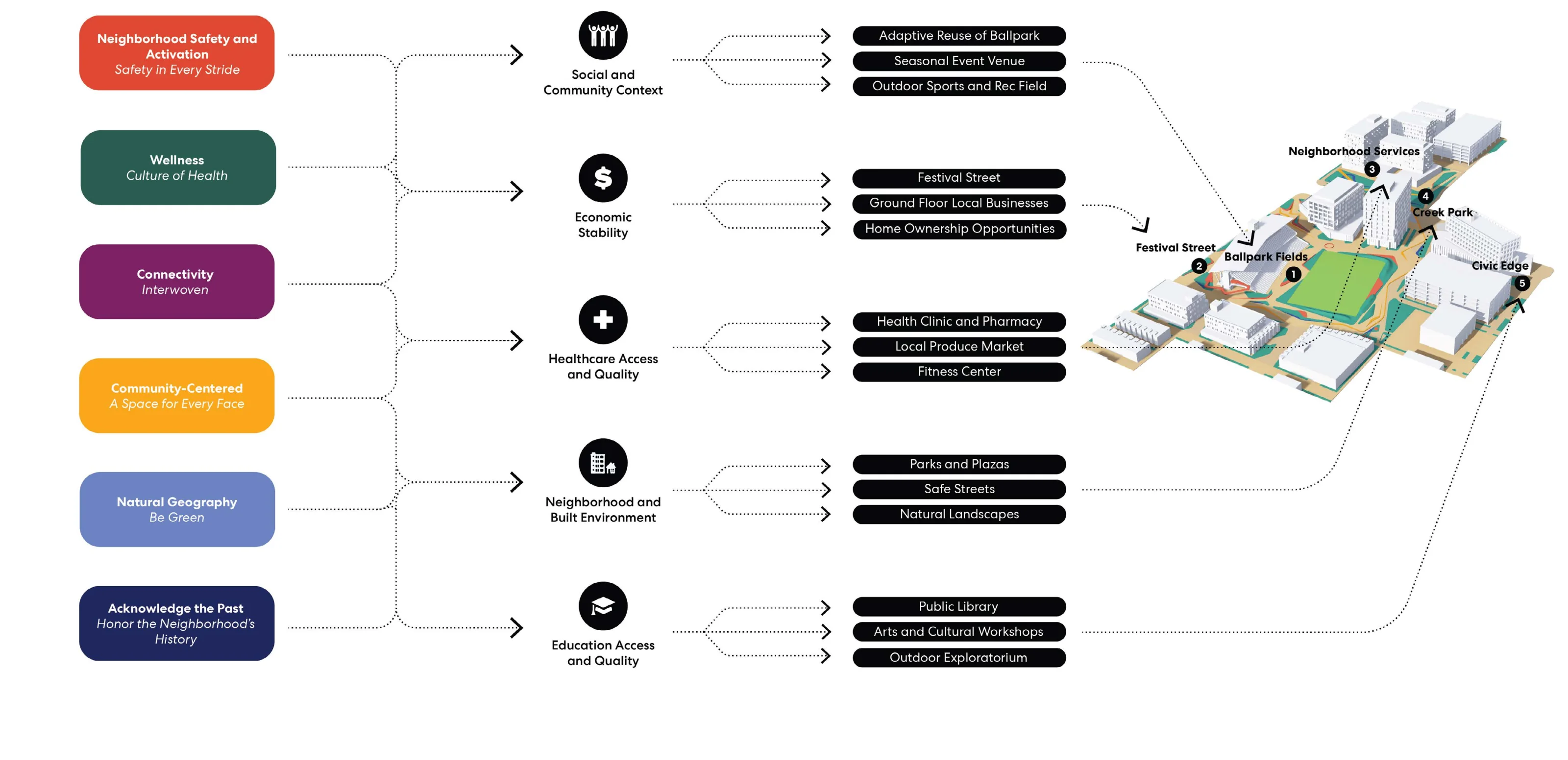
The design process integrated physical conditions analysis, public health assessment, and key programming ideas to shape the preferred land use and urban design framework.

Acknowledge the Ballpark Neighborhood’s Guiding Principles established by the Ballpark community for the transformation of the site.

Organize design ideas into the CDC’s five domains of Social Determinants of Health.

Filter the elements indicated as important by the community.

Integrate the ideas into the design of new parks, streets, and buildings.

Accessible view

Design Approach Framework Mapping:

The diagram maps 6 community guiding principles through 5 CDC Social Determinants of Health (SDOH) domains, into specific prioritized program elements, and onto physical locations in the master plan.

Swipe or scroll horizontally to view all columns.

Guiding Principles CDC Health Domain Community-Filtered Program Elements Integrated Site Design Elements
• Neighborhood Safety and Activation (Safety in Every Stride)
• Wellness (Culture of Health)
• Connectivity (Interwoven)
• Community-Centered (A Space for Every Face)
• Natural Geography (Be Green)
• Acknowledge the Past (Honor the Neighborhood's History)
Social and Community Context • Adaptive Reuse of Ballpark
• Seasonal Event Venue
• Outdoor Sports and Rec Field
1. Ballpark Fields
(Cross-cutting across all guiding principles) Economic Stability • Festival Street
• Ground Floor Local Businesses
• Home Ownership Opportunities
2. Festival Street
(Cross-cutting across all guiding principles) Healthcare Access and Quality • Health Clinic and Pharmacy
• Local Produce Market
• Fitness Center
3. Neighborhood Services
(Cross-cutting across all guiding principles) Neighborhood and Built Environment • Parks and Plazas
• Safe Streets
• Natural Landscapes
4. Creek Park
(Cross-cutting across all guiding principles) Education Access and Quality • Public Library
• Arts and Cultural Workshops
• Outdoor Exploratorium
5. Civic Edge
Download framework data (CSV)
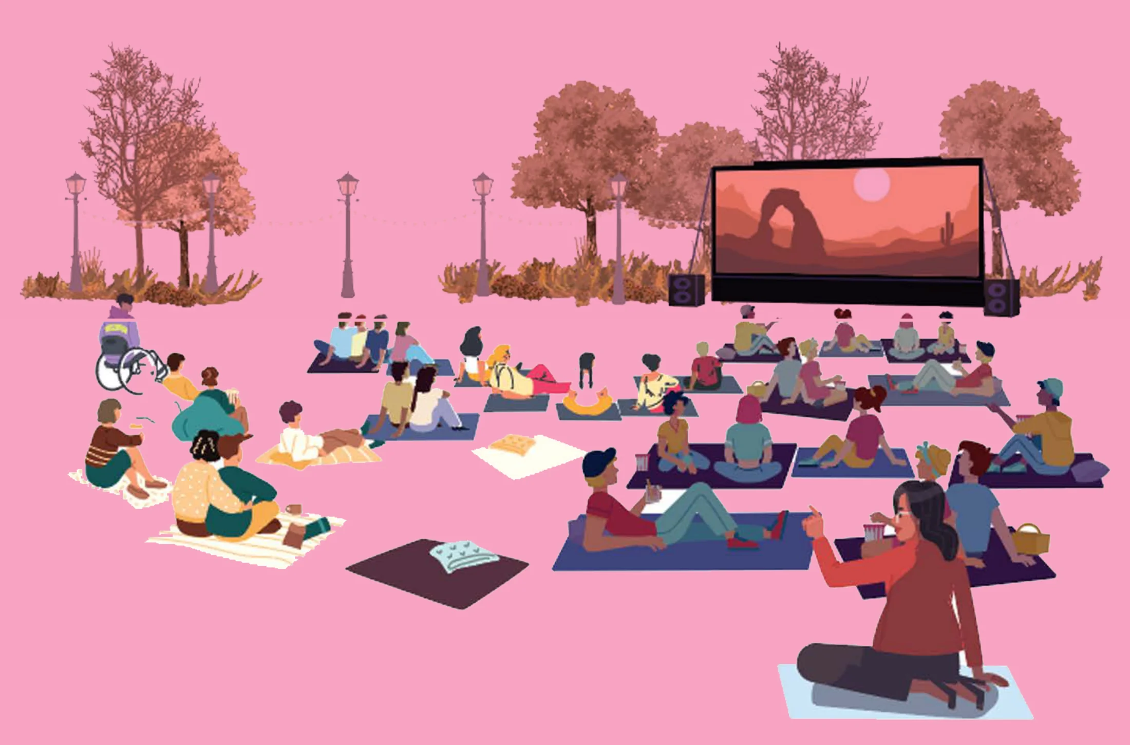
Illustration of people gathered on blankets outdoors in a park setting, watching a movie projected on a large screen among trees and lampposts

Chapter 03

The Framework

The Framework

Mobility
Framework

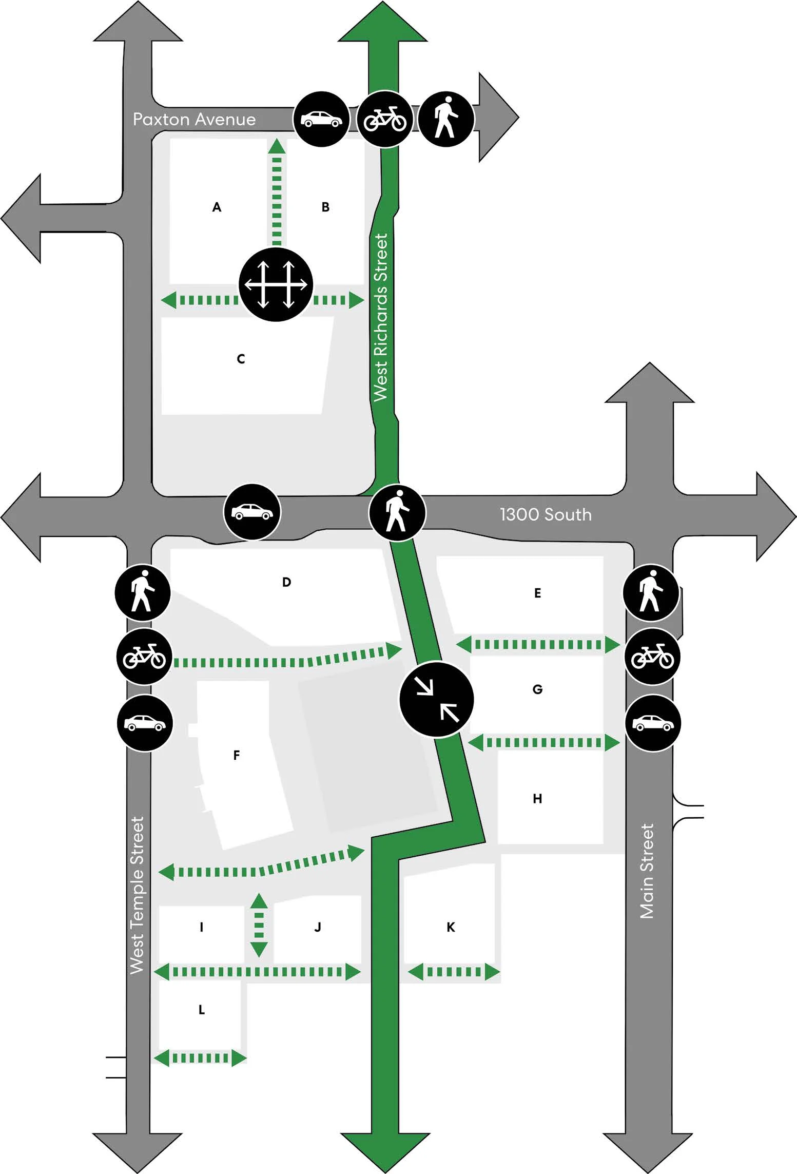
Streets are envisioned not just as infrastructure, but as shared public spaces that create a seamless transit experience and foster greater social connectedness. The mobility framework prioritizes breaking down large blocks to make the site walkable and welcoming to the neighborhood.

Keep Cars on the Perimeter

Vehicle access is concentrated along the site’s perimeter - 1300 South, Main Street, Paxton Avenue, and parts of West Temple—preserving interior streets as pedestrian-priority zones.

Reconnect Richards Street

Restitching the fragmented segments of Richards Street creates a key north-south pedestrian link through the site’s mid-block.

Break Up the Super Block

By opening the edges and inviting the pedestrian to traverse the site through a series of connected alleyways and walkways, the super block is broken down into smaller pieces. This intentional porosity encourages walking and biking through the neighborhood as well as informing the scale and form of new buildings.

Integrate Pedestrian and Bicycle Infrastructure

The proposed bike infrastructure within the Ballpark site aligns with the Ballpark Station Area Plan, which recommends bike routes along Main Street and Paxton Avenue. Additionally, the West Temple Festival Street will provide a comfortable and accessible north-south bikeway. Interior streets throughout the site are intentionally designed to promote walking and biking, creating a safe and inviting environment for active transportation.

Mobility framework map for Ballpark site illustrating vehicle perimeter routes along Paxton Avenue, Main Street, and 1300 South; green north-south pedestrian corridor along West Richards Street; and dotted green pedestrian/bikeway links breaking up blocks A through L.
Accessible view

Mobility Framework Diagram Key:

  • Perimeter Streets: Paxton Avenue (North), 1300 South (East-West Midline), Main Street (East), and West Temple Street (West) maintain concentrated vehicle access.
  • Mid-block Connection: West Richards Street is reconnected as a dedicated north-south pedestrian spine.
  • Block Porosity: Blocks A through L are intersected by green pedestrian and bicycle corridors connecting West Temple Street, Richards Street, and Main Street.
The Framework

Street
Typologies

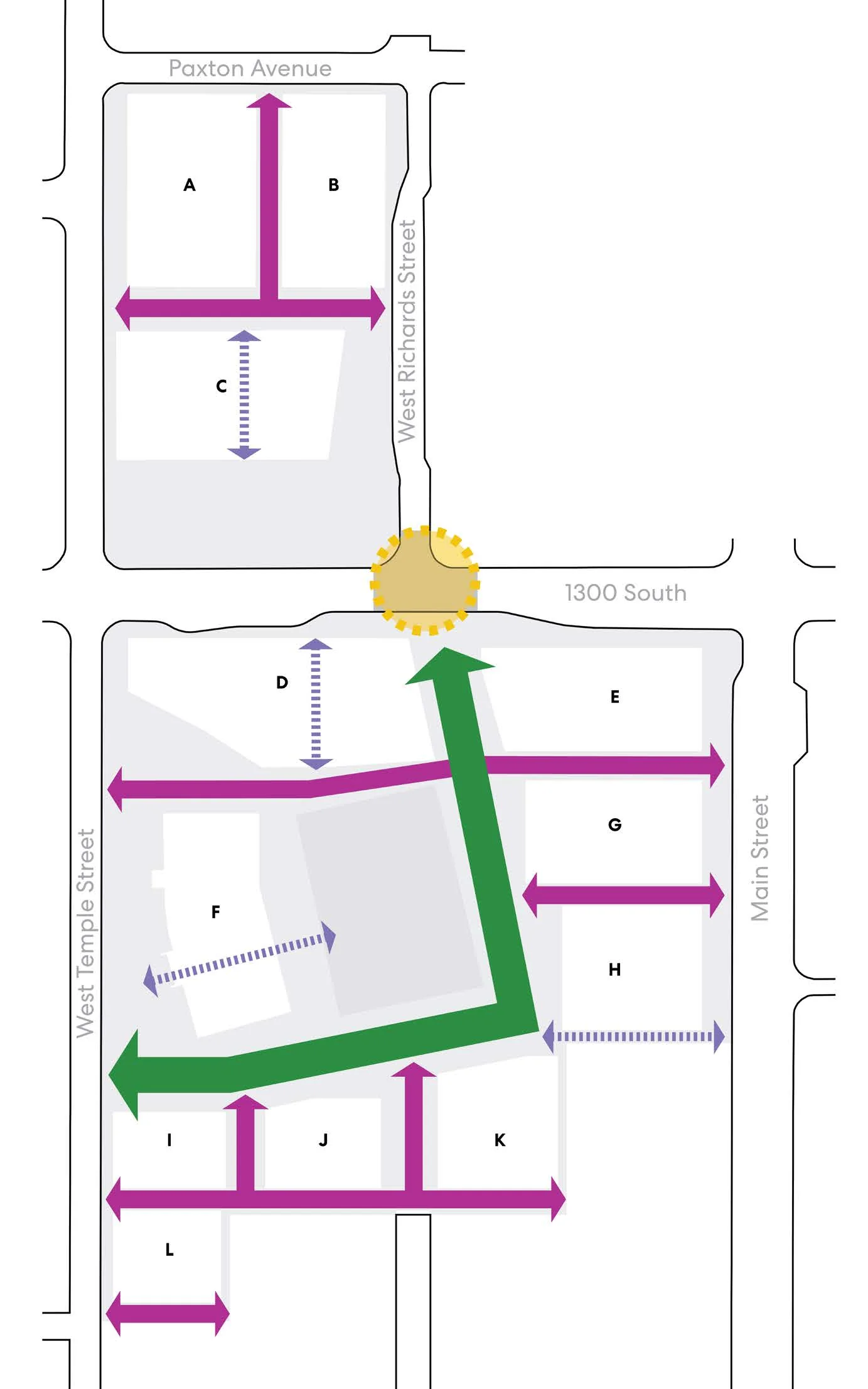
The framework applies three distinct street typologies: Park Promenade, Shared Streets, and Walkways, to support multi-modal movement and service needs. Together, they create safe, navigable pathways for pedestrians and vehicles throughout the development.

Champion a Park Promenade

The Park Promenade which wraps around the perimeter of the neighborhood field serves as a primary pedestrian link through the site, connecting West Temple to 1300 South in a biophilic environment that is restorative, safe, and welcoming.

Establish Ground Floor Walkways

New buildings with a long frontage should establish public walkways to allow additional options for pedestrians to enter into the interior of the site.

Enable Shared Streets

These internal streets, shown as pink arrows in the corresponding figure, serve as secondary pedestrian connectors to the Park Promenade. At the same time, they must accommodate emergency vehicles, event loading and servicing, as well as access to parking and loading areas for adjacent buildings.

Create a 1300 South Mid-Block Scatter Crossing

A mid-block scatter crossing is introduced to ensure seamless movement between the two parcels on either side of the street. Positioned at the heart of the site, this crossing allows people to move diagonally, laterally, and directly across the intersection, improving convenience, walkability, and visibility.

Site diagram map illustrating street typologies across parcels A through L, showing connections between Paxton Avenue, West Richards Street, 1300 South, West Temple Street, and Main Street with overlaid arrows for Park Promenade, Shared Streets, Walkways, and the mid-block Scatter Crossing.
NORTH
STREET TYPOLOGIES
  • Park Promenade
  • Shared Streets
  • Walkways
  • Scatter Crossing
Accessible view

Site Map Typologies Breakdown:

  • Northern Parcel (Paxton Avenue to 1300 South): Contains blocks A, B, and C. Pink shared streets connect Paxton Avenue southward and cross horizontally between West Temple Street alignment and West Richards Street. A dashed walkway runs north-south through block C.
  • 1300 South Intersection: Features a central yellow circular Scatter Crossing linking the northern and southern development zones.
  • Southern Parcel (1300 South to Southern Boundary): Contains blocks D through L. The green Park Promenade loops from West Temple Street through the central open space towards the 1300 South crossing. Magenta shared streets traverse horizontally between West Temple Street, internal blocks, and Main Street. Dashed walkways provide internal mid-block permeability through blocks D, F, and H.
The Framework

Development
Blocks

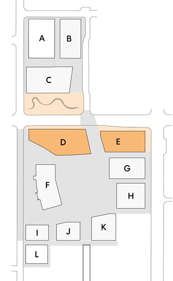
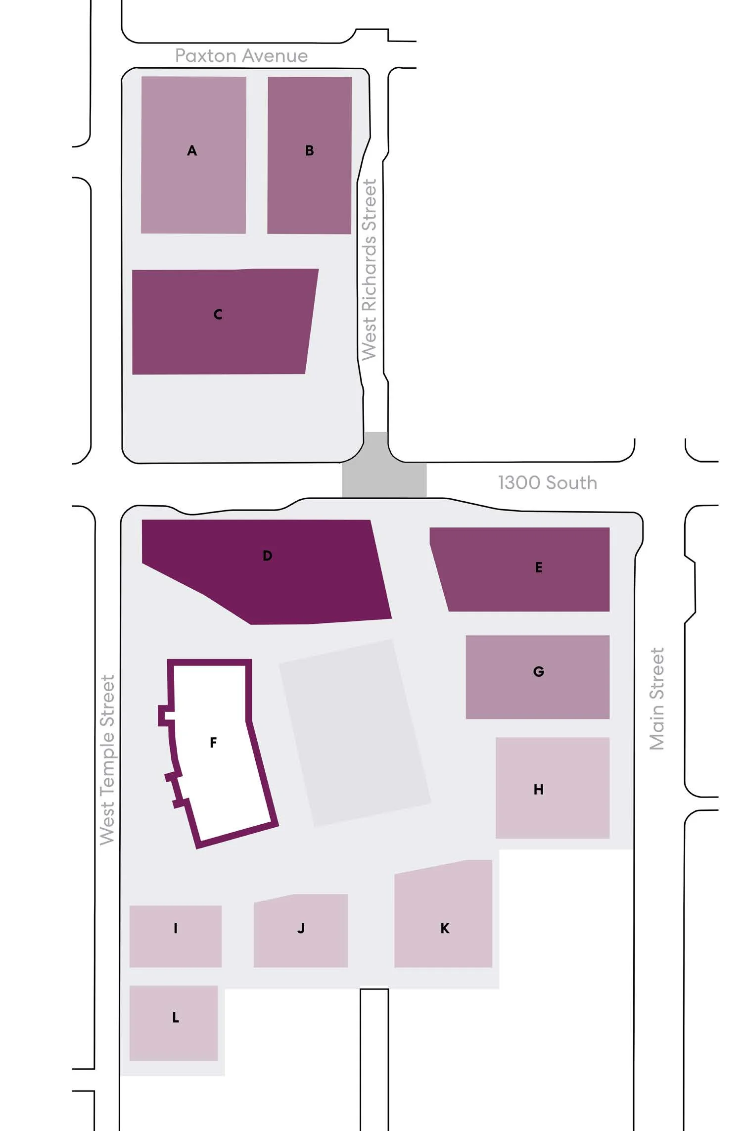
Informed by the mobility framework and with an emphasis on a fine grain, human scaled urban fabric, the site is organized into 11 blocks for vertical development.

Land Parcelization

Development blocks are the foundation for walkable urban fabric and well-proportioned, visually engaging, and high-performing architecture. The approximate acreage for each block is listed in the table below and approximate dimensions are featured on the figure on the corresponding page.

Public Realm Allocation

All development blocks provide space for roadways, parks, and plazas. The acreage for Blocks C and F are larger due to the proposed location of parkspace.

PARCELS ACREAGE
A 1.0
B 0.9
C 2.3
D 1.6
E 1.0
F 3.4
G 1.0
H 0.9
I 0.5
J 0.8
K 0.9
L 0.5
The Framework

Urban
Form

The shape, scale, and height of buildings play a key role in defining the character and experience of a place. The proposed urban form framework sculpts building heights through the site to balance the need for density with access to natural light and views.

Highest Density Around 1300 South

The framework concentrates the tallest height at the southwestern corner of 1300 South and West Temple, with allowable heights of up to 150 feet. This height reinforces a bold and iconic western gateway to the site. The parcels directly north and east step down to an allowable height of 120 feet.

Both parking garages on the south and north block have an allowable height of 85 feet. However, to reduce the height of the Block G parking garage while maintaining adequate parking capacity, underground parking decks could be considered in future phases. While this approach could preserve views of the Mountains, it comes with significant cost and sustainability implications.

Preserve Vews of the Wasatch Mountains

To preserve the views to the Wasatch Mountains, parcels K and H are limited to 45 feet. This allows clear views from the revitalized stadium as well as key site locations such as the intersection of 1300 South and West Temple Street.

Thoughtfully Blending into the Neighborhood

The parcels at the northern and southern edges are planned for higher density, but their scale is carefully calibrated to transition smoothly into the surrounding neighborhood, ensuring the new development feels integrated, not out of place.

Urban form framework site map detailing allowable building heights by parcel from Paxton Avenue to the south block
65 Feet 85 Feet 120 Feet 150 Feet 120 Feet 85 Feet 45 Feet 45 Feet 45 Feet 45 Feet 45 Feet

ALLOWABLE BUILDING HEIGHTS

Ballpark Structure
85 Feet
150 Feet
60 Feet
120 Feet
45 Feet
Accessible view

Swipe or scroll horizontally to view all columns.

Parcel allowable building heights
Parcel Location / Street Frontage Allowable Height
A North block along Paxton Avenue & West Temple 65 Feet
B North block along Paxton Avenue & West Richards Street 85 Feet
C North block, south of parcels A & B 120 Feet
D SW corner of 1300 South & West Temple Street 150 Feet
E SE corner of 1300 South & Main Street 120 Feet
F Central stadium structure Ballpark Structure
G East block along Main Street 85 Feet
H East block, south of parcel G along Main Street 45 Feet
I South block along West Temple Street 45 Feet
J South block, central parcel 45 Feet
K South block, east parcel 45 Feet
L Southwest corner parcel along West Temple Street 45 Feet
Download parcel data (CSV)
The Framework

Service and
Access

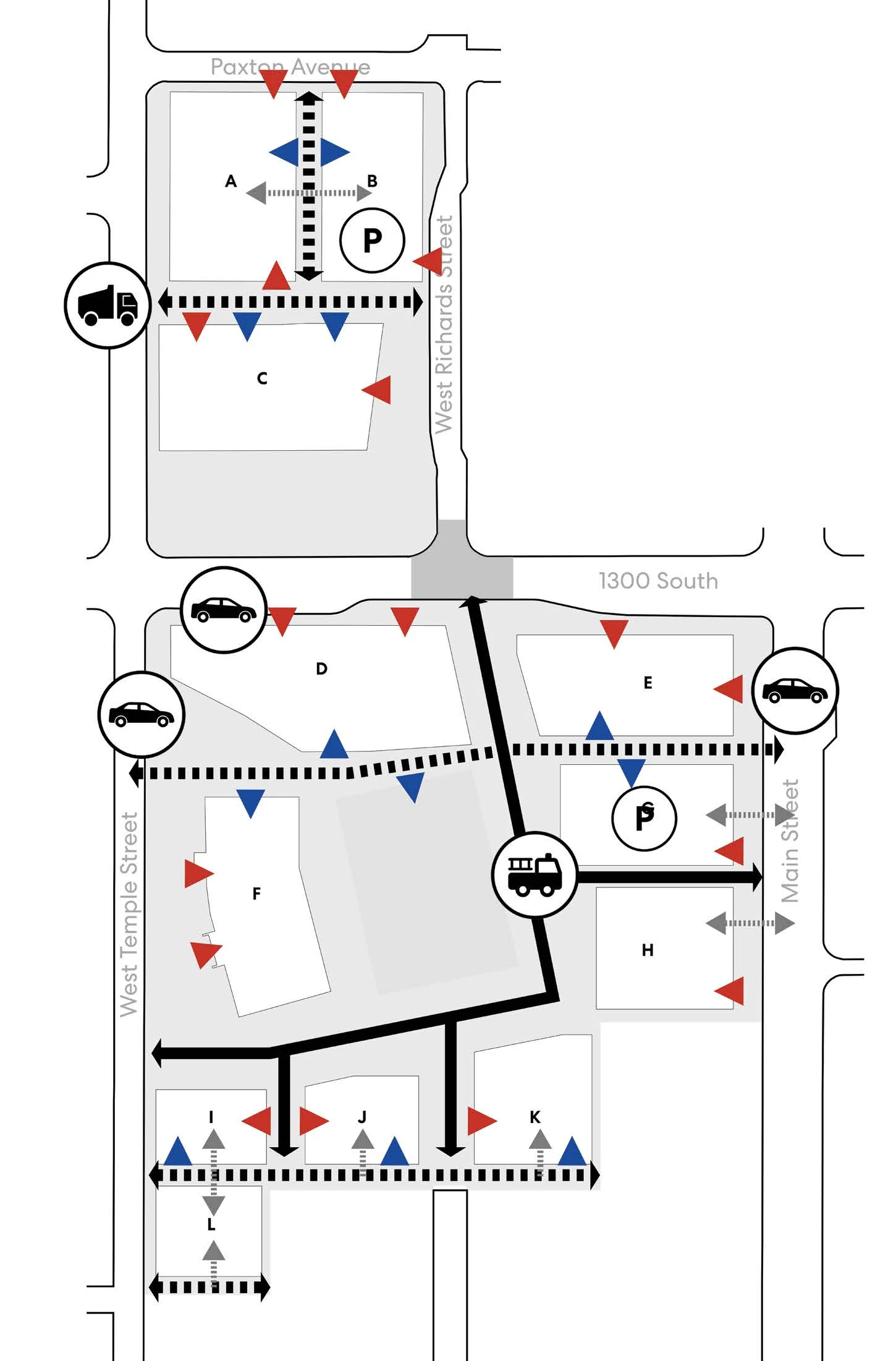
While prioritizing pedestrian movement, the framework ensures interior roadways can accommodate vehicles, meeting fire requirements and providing clearly demarcated areas for service, parking, and pick up/drop off.

Emergency Access Streets

The internal roadways are designed for everyday use but built to support fire access when needed. The Park Promenade and Shared Pathways are designated as emergency access streets with the appropriate width for fire access. The approximate roadway width for emergency access streets is 40 feet.

Service and Lobby Entries

Main Street provides direct vehicular access for Fire Station 8.

All service entries are sited on service streets along the backside of new development.

Lobby entries are primarily sited along existing roadways like West Temple Street, 1300 South, Main Street, Richards Street, and Paxton Street. However, multi-family housing blocks have lobby entries along the shared streets and/or alleyways.

Service Streets

These are shared streets with appropriate width for garbage trucks and other service vehicles. The approximate roadway width for the service streets is 30 feet.

Designated Pick-Up/Drop-Off

Designated pick-up/drop-off areas for events are located on West Temple, 1300 South, and Main Street.

Shared Parking Garages

Two shared parking garages are located on either side of 1300 South. Parking Garage South has access from Main Street and Parking Garage North has access from mid-block service street.

Service and access map showing emergency access streets, service entries, lobby entries, vehicle access, and parking garages across the Ballpark district.
Accessible view

Service and access map description

The map is arranged north to south. Paxton Avenue borders the upper edge, West Richards Street runs along the right side of the upper cluster, 1300 South separates the upper and lower clusters, West Temple Street borders the left side of the lower cluster, and Main Street borders its right side.

The upper cluster contains labeled blocks A, B, and C and a shared parking garage marked P near block B. The lower cluster contains labeled blocks D, E, F, G, H, I, J, K, and L and a second shared parking garage marked P near block E.

  • Emergency Access Streets: solid black, arrow-ended routes run through the upper A-C cluster and from 1300 South through the lower cluster, with connections toward West Temple Street and Main Street.
  • Service Streets: black dotted, arrow-ended routes cross the upper A-C cluster, the middle of the lower cluster, and the bottom I-L area.
  • Vehicle Access: gray dotted, arrow-ended segments appear within and alongside the block groups, including the upper A-B area, the E-H area, and the lower I-L area.
  • Service Entries: blue triangular markers are placed along building edges throughout the A-C and D-L clusters.
  • Lobby Entries: red triangular markers are placed along building edges throughout the A-C and D-L clusters.
  • Pick-Up/Drop-Off: circular vehicle symbols mark locations along West Temple Street, 1300 South, and Main Street.
  • Parking Garages: the two circular P markers identify the shared garages north and south of 1300 South.
Service and Loading
Emergency Access Streets Service Entries Lobby Entries
Service Streets Pick-Up/Drop-Off
Vehicle Access P Parking Garages
The Framework

A Walkable,
Transit-Oriented Future

The Smith’s Ballpark site, just a five minute walk from TRAX and UTA bus service, is ideal for Transit-Oriented Development. To unlock its potential, 1300 South must be redesigned as a safe, low-stress, multi-modal street that enhances transit access and walkability.

Currently, the pedestrian environment between the Ballpark TRAX Station and the development site is suboptimal. The existing 10-foot-wide sidewalk along 1300 South lacks a landscaped buffer from traffic, leaving pedestrians exposed to high vehicle volumes and speeds. This results in an unpleasant and potentially unsafe walking experience.

To enhance walkability, safety, and multimodal connectivity, the following pedestrian-focused urban design strategies are recommended:

  • Wider sidewalks with landscaped buffers to separate pedestrians from traffic.
  • Enhanced pedestrian crossings for safer street navigation.
  • Improved lighting and wayfinding to support visibility and orientation.

A high-level design concept for 1300 South proposes several key improvements:

  • No direct vehicle access to the development from 1300 South, reinforcing a pedestrian-priority corridor.
  • Raised intersection at 1300 South & Richards Street, designed to prioritize pedestrian movement while maintaining vehicle access.
  • Upgrade of the existing pedestrian hybrid beacon (PHB) to a full pedestrian signal for improved safety.
  • Development setbacks on both the north and south parcels of the Ballpark site, enabling widened sidewalks accommodating a comfortable pedestrian zone with a double row of trees.

Beyond the boundaries of the Ballpark Next project, further improvements to the pedestrian realm along 1300 South will require collaboration with adjacent property owners to ensure a cohesive and inviting street experience.

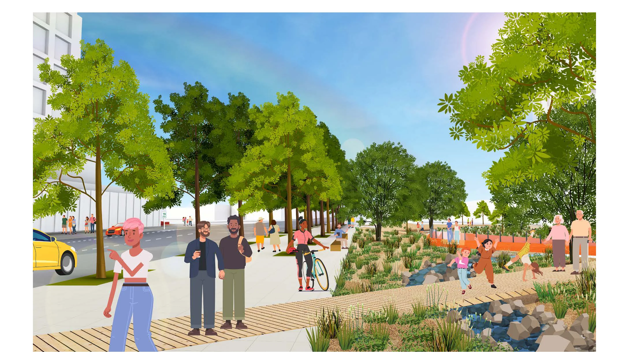
An illustrative vignette showing a wide, active, tree-lined pedestrian promenade along 1300 South with people walking, biking, and gathering near natural landscaping.
An illustrative vignette of the 1300 South Street experience features a generous sidewalk that supports a comfortable pedestrian pathway, alongside a furnishing zone designed to accommodate a double row of trees and street furniture such as benches and pedestrian scale street lights.
Design concept diagram of 1300 South showing proposed lane configurations, widened sidewalks with tree buffers, raised pedestrian crossing at Richards Street, pedestrian connection from TRAX station, and future alleyway connections.

Select the street-plan graphic to open a larger view.

The Framework

Development
Scenario

This development scenario presents a long-term vision for the site, adaptable to evolving market conditions and community priorities.

Zoning

The site is primarily zoned Public Lands (PL). Future rezoning efforts should align permitted uses with the proposed land uses and densities specified in this scenario.

Program Notes and Assumptions

In order to calculate the approximate yield shown below, the following assumptions were used:

  • Residential Unit Size: 1000 sq.ft.
  • Hotel Room Size: 400 sq.ft.
  • Parking Stall Size: 400 sq.ft.

The programs and resulting yields are listed below:

Multi-family housing is broadly defined to accommodate market-rate, workforce, student, and below market rate to ensure diverse options that meet community needs. Future phases of work will determine more details of the housing mix including family size units and pathways for homeownership.

As part of this planning effort, a proposed Public Library branch is identified for the corner of Main Street and 1300 South. However, the final site selection will occur in a future phase of the project.

PROGRAM AREA (SQUARE FEET)
Multi-Family Housing
400,000 (400 Units)
Senior Housing
60,000 (60 Units)
Hotel
50,000 (125 Keys)
Retail (Grocery, Restaurants, Retail)
75,000
Adapted Ballpark Structure
20,000
Library*
30,000
Fire Station
25,000
Parking
385,000 (964 Stalls)
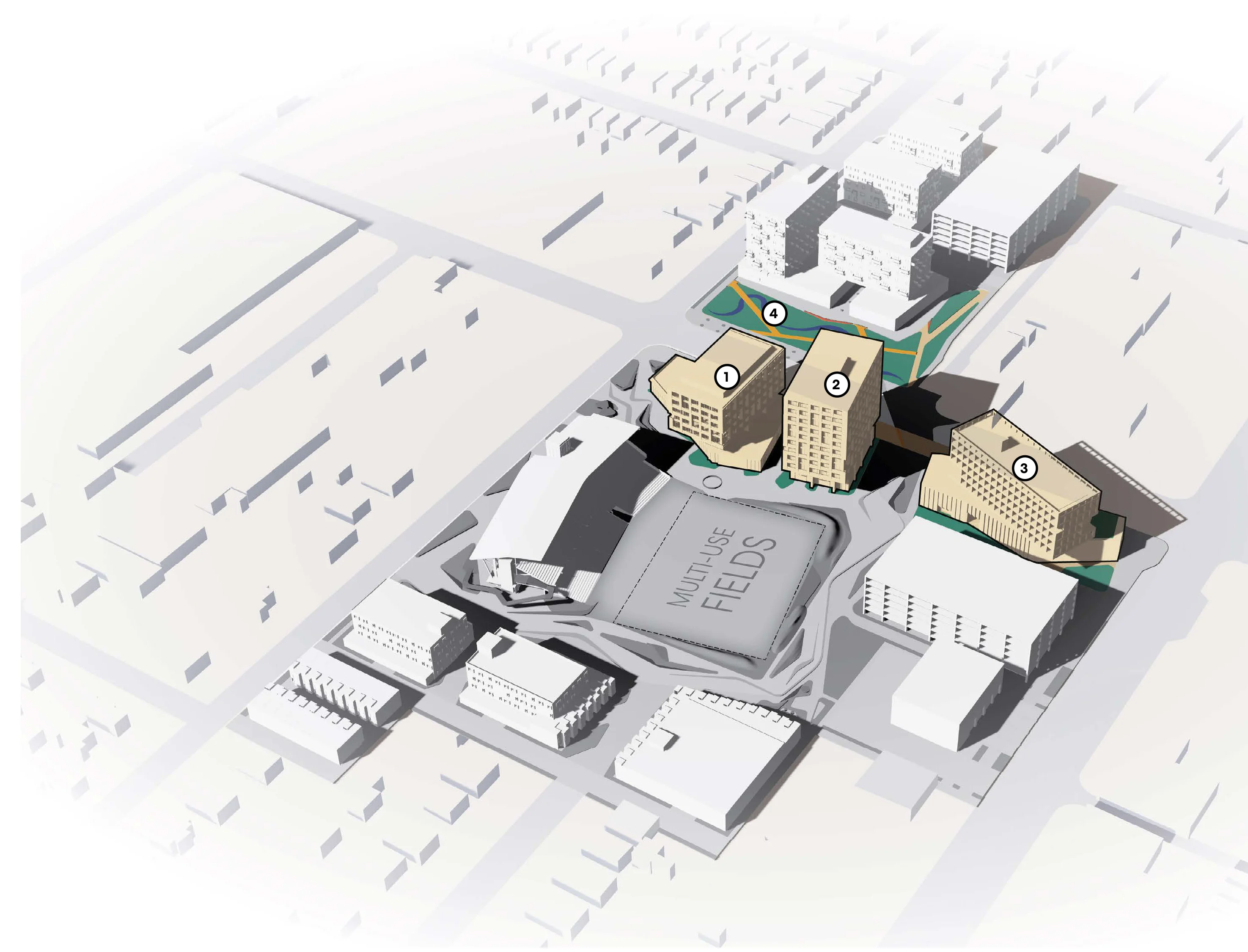
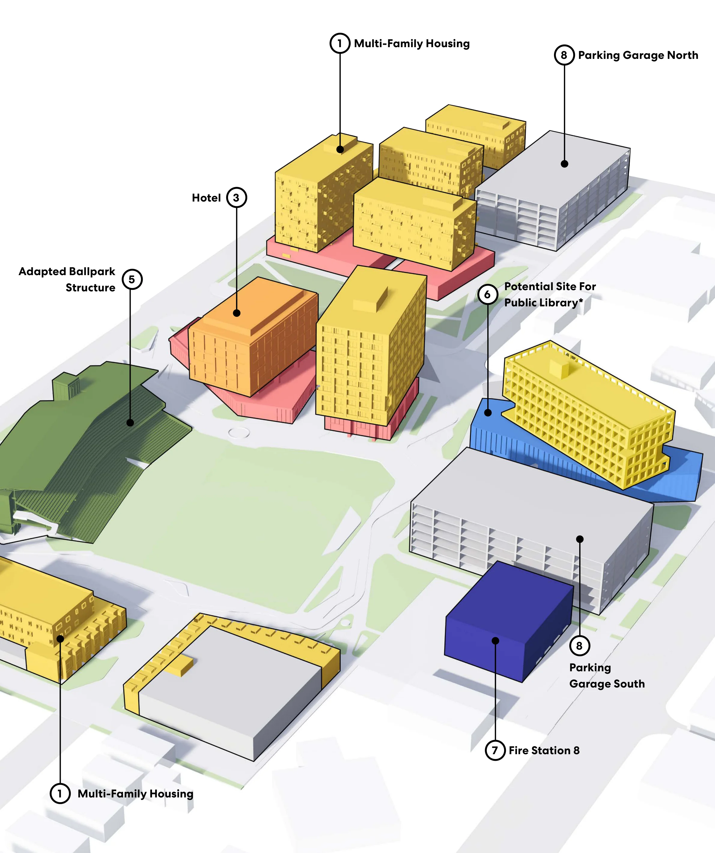
Axonometric site plan showing the development scenario's numbered buildings and sites.Open full-size development scenario diagram
Accessible view

The figure's numbered callouts identify the following locations:

  • 1 — Multi-Family Housing, shown in an upper central cluster and at the lower-left edge.
  • 3 — Hotel, left of the central development cluster.
  • 5 — Adapted Ballpark Structure, on the left side of the site.
  • 6 — Potential Site For Public Library*, on the right side of the central open area.
  • 7 — Fire Station 8, in the lower-right portion of the site.
  • 8 — Parking Garage North at the upper right and Parking Garage South at the lower right.

The central open green area separates the left-side ballpark from the central development cluster and the right-side library and parking area.

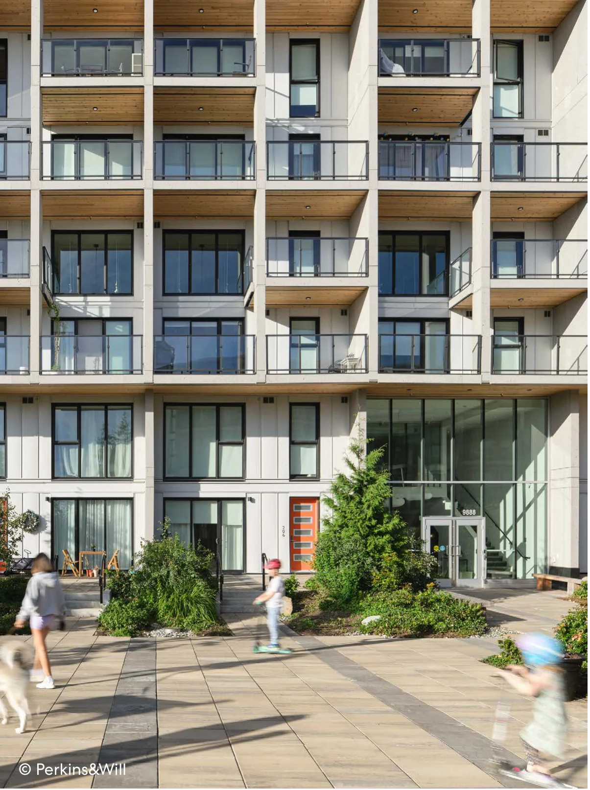
Multi-family residential building with balconies and active pedestrian courtyard

Multi-family housing is permitted throughout the site, with a total of approximately 400 new units planned. The framework focuses higher-density development along 1300 South and the northern block, while lower-density housing is concentrated along the southern edge. This approach is intended to maximize flexibility, accommodating a diverse mix of housing types, from rental apartments to townhomes to support residents across various income levels and life stages.

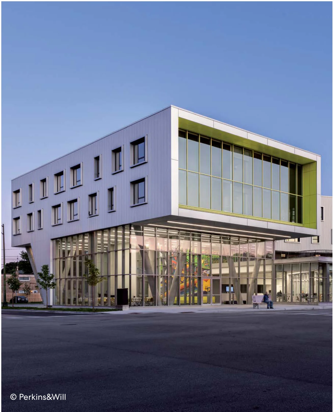
Senior Housing is proposed above the public library branch at the corner of 1300 South and Main Street. This allows seniors direct access to the library’s services and programming, reinforcing resilience and aging in place. The Northtown Library in Chicago featured in the image below is a good example of how a public library and senior housing can successfully co-locate.

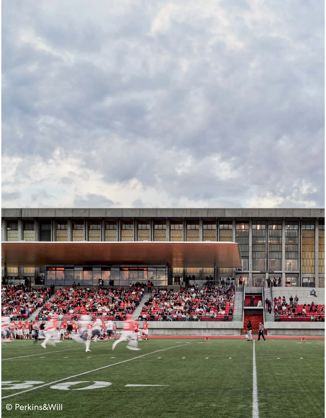
Athletic field and stadium seating with crowds during an event

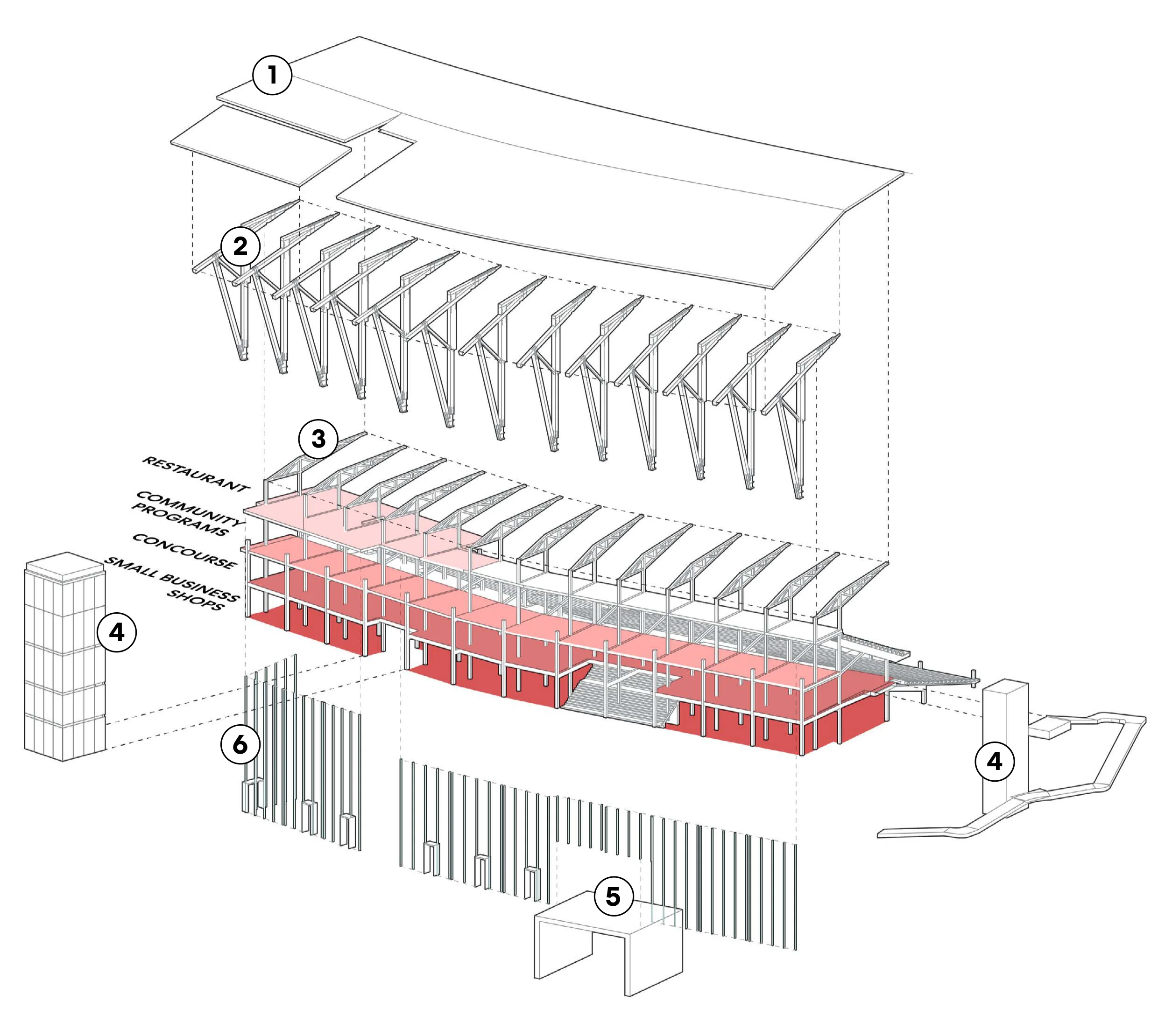
A Sports and Entertainment Event Venue is the primary use for the adapted Smith’s Ballpark. The ground floor includes local shops on West Temple as well as storage, restrooms and concession areas. The upper floors include leasable commercial spaces and a rooftop restaurant/bar. There are approximately 3,700 stadium seats preserved.

A library branch is proposed at the corner of 1300 South and Main Street, establishing an eastern civic gateway into the site. The location was selected in part for its proximity to key educational anchors, including the Horizonte School and Challenger School. The timing of the library’s development will be contingent upon the relocation of the existing fire station.

A hotel is proposed at the corner of 1300 South and West Temple, adjacent to the adapted ballpark structure and the neighborhood park. Incorporating hospitality use with ground-floor retail aims to activate this intersection throughout the day and week.

Ground-floor retail is permitted along the edges of the development, with local shops and neighborhood services envisioned for the adapted ballpark structure and new buildings fronting both sides of 1300 South. The intersection of 1300 South and West Temple is designed as a prominent western gateway into the site, animated by a vibrant mix of shops and restaurants. Additional retail may also be integrated along Main Street to support broader urban design goals for a more walkable and active streetscape.

Northtown Library in Chicago featuring multi-story co-located senior housing above a glass-fronted public library

Fire Station 8 is relocated further south on Main Street. The ground floor includes four truck bays, a front office, as well as operational facilities including tool and medical gear storage. The upper floors include a large central kitchen, fitness area, and dormitories.

Parking is distributed across with two municipal parking garages one on each block, serving adjacent development and events.

Parking Garage North on 1300 South and Paxton Avenue contains approximately 405 parking spaces. Parking Garage South on Main Street contains approximately 370 parking space.

Multi-family housing on select blocks have on-site parking where as mixed-use blocks on 1300 South will utilize the parking garages.

Parking needs for the fire station are not be shared with the rest of the development.

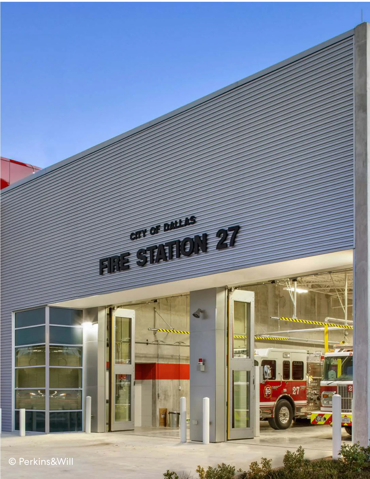
City of Dallas Fire Station 27 exterior showing vehicle bays and facility design
The Framework

Parking
Framework

To take advantage of the site’s proximity to transit while ensuring adequate parking for residents and events, the parking framework calibrates the supply to meet demand appropriately.

Shared Parking

The site is designed to support a shared parking model, maximizing efficiency and ensuring optimal use of parking spaces by different user groups throughout the day and night.

While some multi-family buildings include on-site parking reserved for residents, most parking is shared at the site’s two parking garages.

Block Parking
Garage
On-Site
Parking
Block 1 (North) 405 100
Block 2 (South) 370 89
Total 775 189

Park Once Environment

Parking entrances are strategically positioned to minimize the presence of vehicles within the site’s interior and to encourage sustainable modes of transportation such as walking and biking

Parking Requirements

Section 21A.44.040 of the Salt Lake City Code of Ordinances establishes minimum requirements for off-street parking. As this development falls under the transit context, there are no minimum parking requirements.

Parking Supply

The development plan includes approximately 964 parking stalls overall, with 505 located in the northern block and 459 in the southern block. A detailed breakdown is provided in the accompanying table. Parcels are categorized as follows: those with on-site parking, where dedicated resident spaces are integrated within the building; ‘Garage,’ which refers to shared parking facilities accessible to all users of the development; ‘No On-Site Parking,’ where residents utilize the shared garages; and the fire station, which will have its own dedicated spaces.

Parcels Parking
A On-Site Parking
B Garage
C No On-Site Parking
D No On-Site Parking
E No On-Site Parking
F No On-Site Parking
G Garage
H Fire Station Reserved Parking
I On-Site Parking
J On-Site Parking
K On-Site Parking
L On-Site Parking
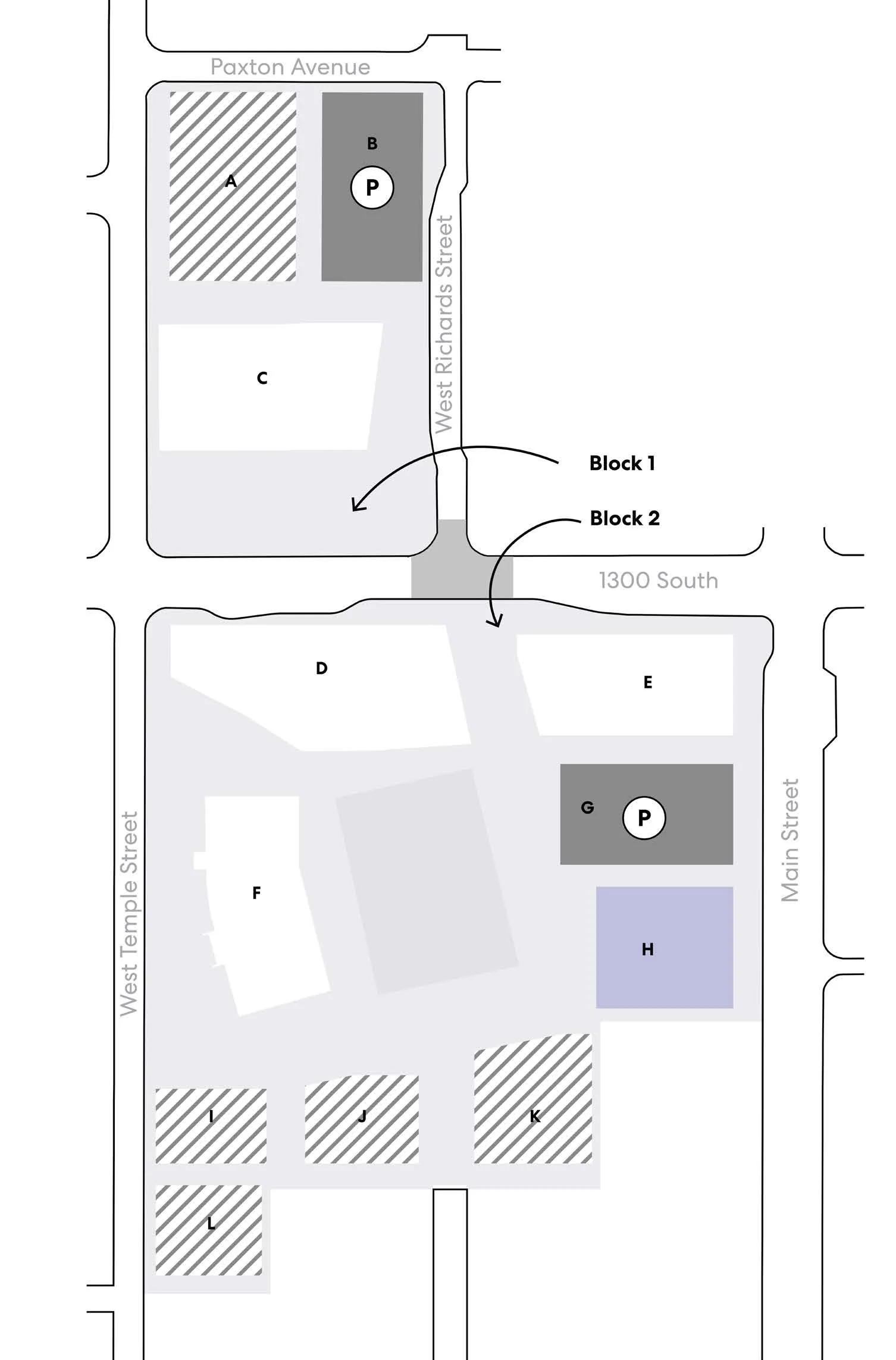
Parking framework map, north up, showing Block 1 north of 1300 South and Block 2 south of it, parcels A through L, surrounding streets, parking symbols, and a north indicator.
Accessible view

The map is oriented with north at the top. Block 1 is north of 1300 South, with Paxton Avenue along its north edge and West Richards Street along its east side. Block 2 is south of 1300 South, between West Temple Street on the west and Main Street on the east.

Parcel labels A–C are in Block 1; D–L are in Block 2. Diagonal stripes mark A and I–L, gray areas marked “P” are at B and G, white areas are C–F, and the purple area is H. The curved arrows near 1300 South point toward the areas labeled Block 1 and Block 2.

The map symbols represent shared parking garage (gray with “P”), on-site parking (diagonal stripes), no on-site parking (white), and fire station (purple).

Parking Framework

G
Shared Parking Garage
Diagonal stripes
On-Site Parking
No On-Site Parking
Fire Station
The Framework

Alcohol Proximity
Considerations

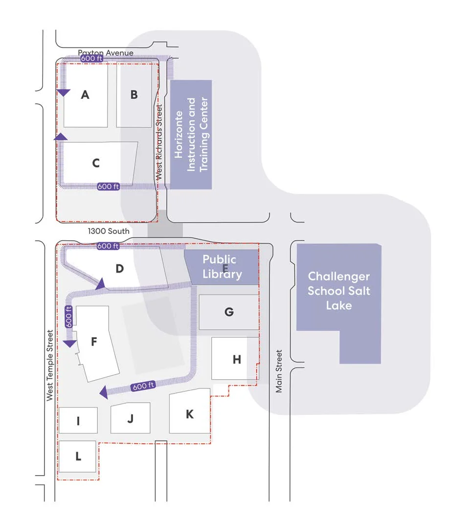
Utah imposes strict regulations on the siting of alcohol-serving establishments, restricting their proximity to community-oriented uses. The diagrams below illustrate how state-mandated buffer zones - 300 feet for restaurants and 600 feet for other types of alcohol outlets - shape where these establishments may be located. These spatial constraints are a key consideration in ground-floor planning and ensuring alignment with regulatory requirements.

Proposed Community Locations With Required Buffers

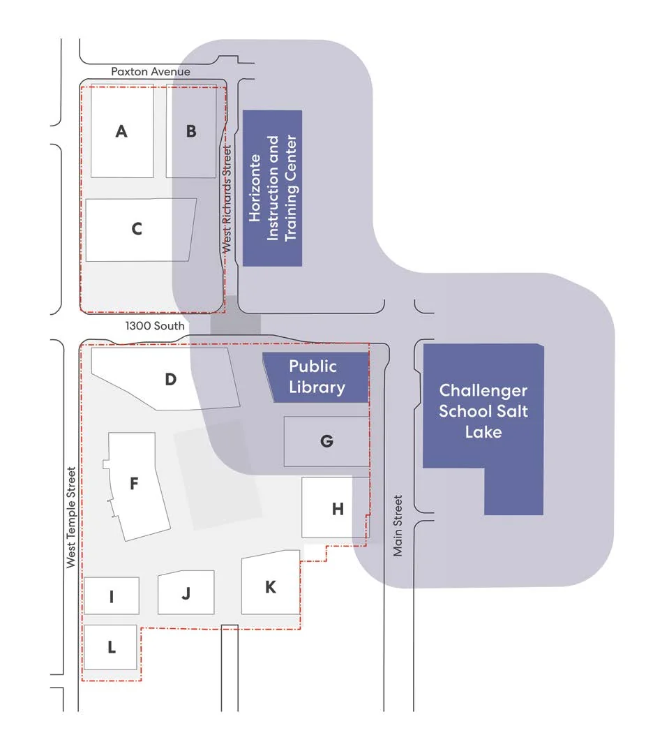
Site map illustrating community facilities: Horizonte Instruction and Training Center, Challenger School Salt Lake, and the proposed Public Library at 1300 South and Main Street with initial proximity buffer zones highlighted around them.

The site includes two existing community facilities: Horizonte Instruction and Training Center and Challenger School as well as a proposed public library at the corner of 1300 South and Main Street, which is also considered a community location.

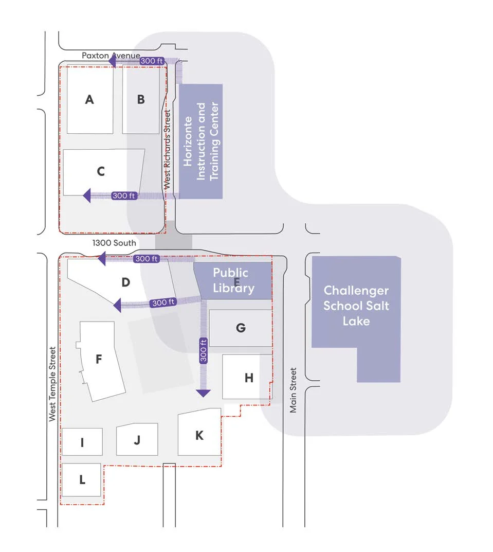
Alcohol-Serving Restaurants Must Be 300 Feet from Protected Uses

Site map illustrating 300-foot pedestrian walking buffer paths measured from protected community location boundaries to surrounding development parcels.

This diagram measures 300 feet in pedestrian walking distance from the nearest patron entrance of the proposed outlet to the property boundary of the community location.

All Other Alcohol Outlets Must Be 600 Feet from Protected Uses

Site map illustrating 600-foot pedestrian walking buffer paths measured from protected community location boundaries across the site blocks.

This diagram measures 600 feet in pedestrian walking distance from the nearest patron entrance of the proposed outlet to the property boundary of the community location.

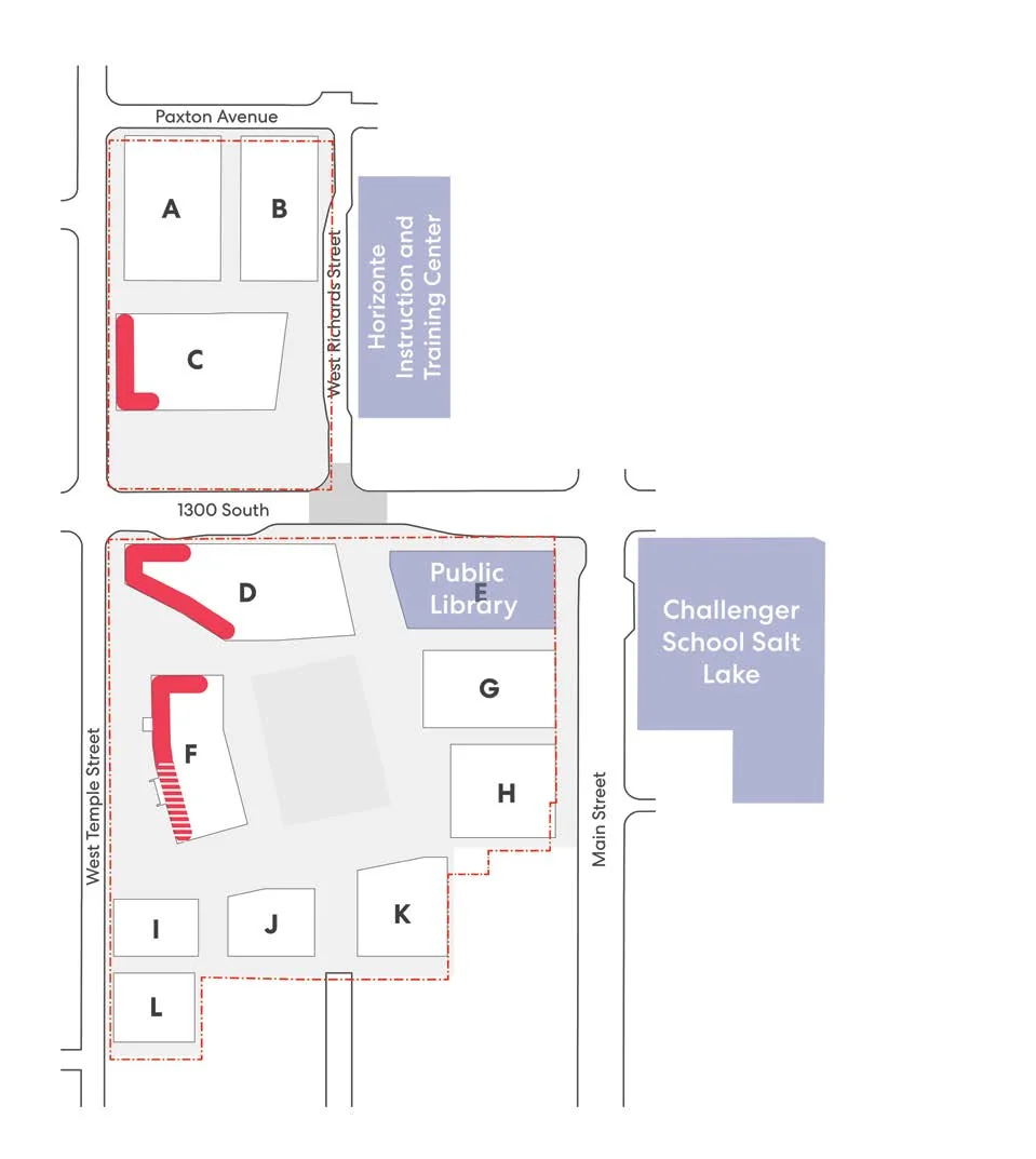
Allowable Locations for Restaurants and All Other Alcohol Outlets

Restaurants Serving Alcohol
All Other Alcohol Outlets
Site plan showing allowable frontages: parcel C west and south edges and parcel D/F frontages for restaurants serving alcohol; select southwest frontage on parcel F for all other alcohol outlets.

This diagram show the remaining eligible locations for alcohol-serving restaurants and other alcohol outlets after applying buffer regulations.

Accessible view

Regulatory buffer and proximity description:

  1. Proposed community locations. The site map identifies Horizonte Instruction and Training Center, Challenger School Salt Lake, and the proposed Public Library at 1300 South and Main Street as community locations. It shows the surrounding site parcels labeled A through L and the initial proximity areas around the protected locations.
  2. Restaurants serving alcohol. The required buffer is 300 feet. The map marks pedestrian walking-distance routes labeled “300 ft,” measured from the nearest patron entrance of the proposed outlet to the property boundary of the community location.
  3. All other alcohol outlets. The required buffer is 600 feet. The map marks pedestrian walking-distance routes labeled “600 ft,” measured from the nearest patron entrance of the proposed outlet to the property boundary of the community location.
  4. Allowable locations. After the buffer regulations are applied, the final map marks eligible frontages for restaurants serving alcohol on the west and south edges of parcel C and on parcel D and parcel F frontages. It separately marks a select southwest frontage on parcel F for all other alcohol outlets. The legend identifies solid red as restaurants serving alcohol and the striped red treatment as all other alcohol outlets.

Swipe or scroll horizontally to view all columns.

Establishment Type Required Buffer Distance Measurement Method Protected Community Locations Eligible Site Locations
Restaurants Serving Alcohol 300 feet Pedestrian walking distance from nearest patron entrance to property boundary Horizonte Instruction and Training Center, Challenger School, Proposed Public Library Parcel C west and south edges; parcel D and parcel F frontages
All Other Alcohol Outlets 600 feet Pedestrian walking distance from nearest patron entrance to property boundary Horizonte Instruction and Training Center, Challenger School, Proposed Public Library Select southwest frontage on parcel F
The Framework

Ground Floor
Active Uses

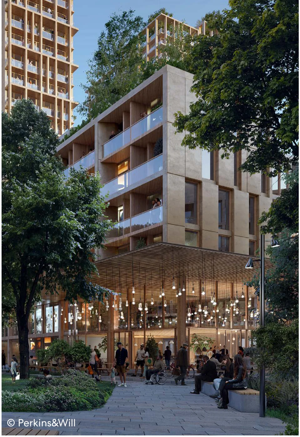
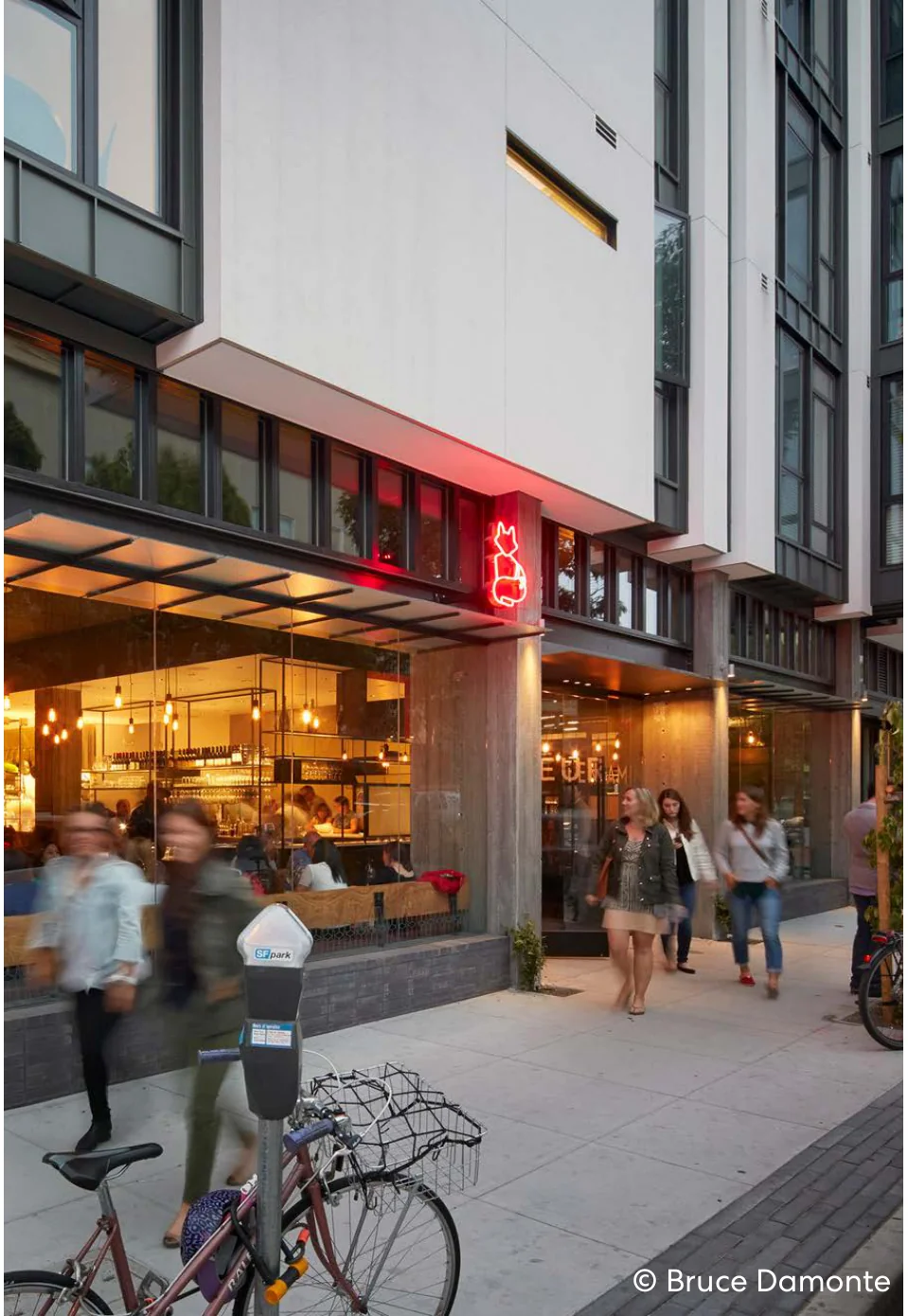
Active ground floor uses are concentrated along 1300 South, West Temple Street, and Main Street to enhance vibrancy, support walkability, and create a lively public realm.

Architectural rendering of timber mid-rise building with active ground floor public space © Perkins&Will

Material choices, canopy depths, and window transparency are all considered to support street-level comfort. Design for the ground floors is tactical, making the everyday act of walking, meeting, or pausing feel natural and safe.

Programming along these frontages prioritizes uses that extend into the public realm—cafés, corner stores, coworking hubs, and community spaces that invite people to linger, gather, and return. These edges are social anchors.

Pedestrians walking past an active ground floor restaurant with warm lighting and indoor-outdoor frontage © Bruce Damonte
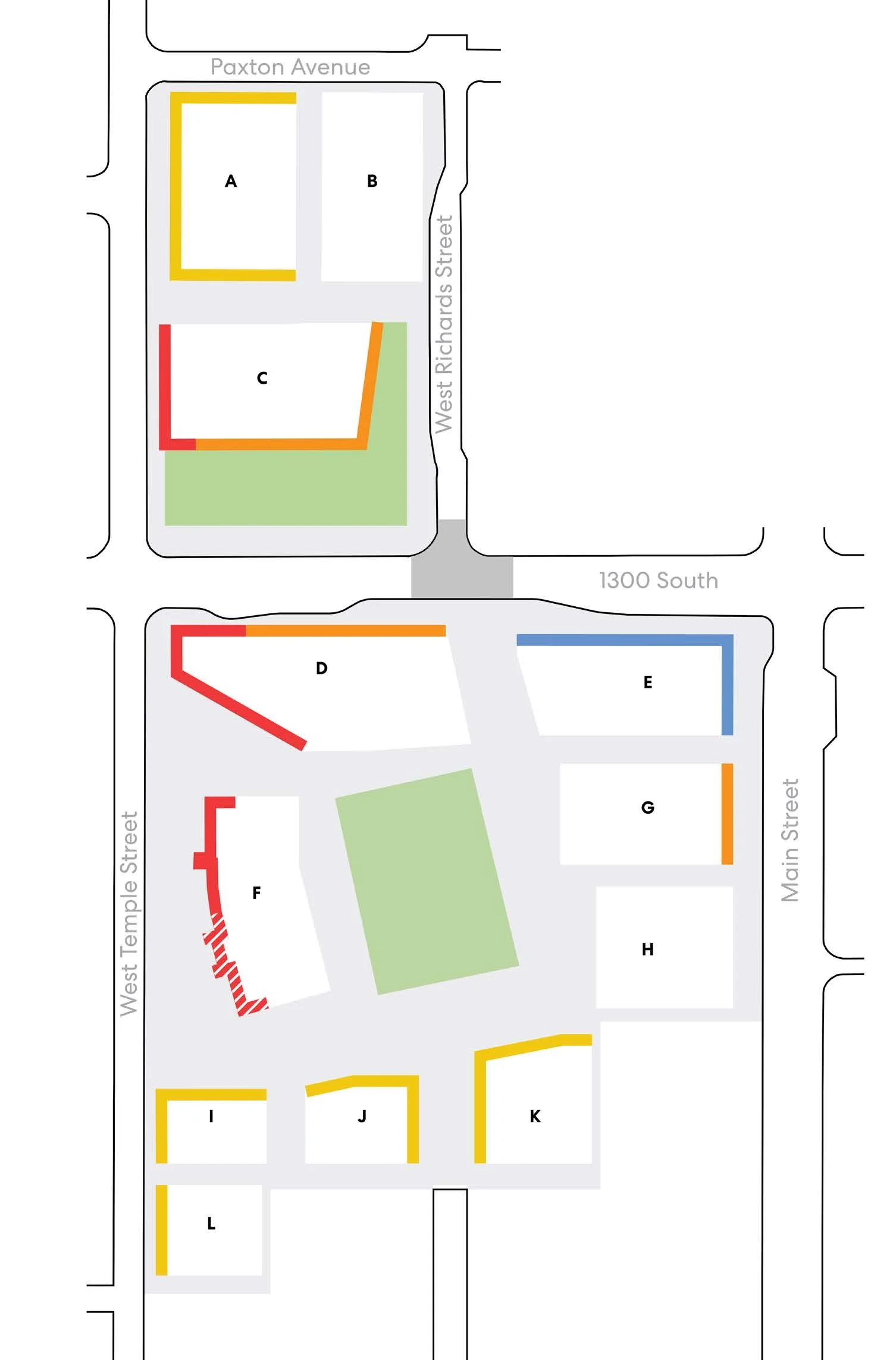
Ground-floor-use map showing buildings A through L and colored frontage and entry categories; see the Accessible view below for a structured description of the streets and building associations.
Accessible view

The map labels the surrounding streets as Paxton Avenue at the north of the upper block, West Richards Street along its east side, and 1300 South between the upper and lower blocks. The lower block is bounded by 1300 South to the north, West Temple Street to the west, and Main Street to the east.

The map's legend defines the colored frontage and entry categories as follows: red, Active Use (Restaurants Serving Alcohol Permitted); orange, Active Use (No Alcohol Permitted); yellow, Residential Entry; red-and-white stripes, Active Use (All Other Alcohol Outlets Permitted); and blue, Library Entry.

Building/frontage associations visible in the map are:

  • A: yellow Residential Entry frontage.
  • B: no legend-colored frontage is visibly marked.
  • C: red Active Use (Restaurants Serving Alcohol Permitted) and orange Active Use (No Alcohol Permitted) frontage.
  • D: red Active Use (Restaurants Serving Alcohol Permitted) and orange Active Use (No Alcohol Permitted) frontage.
  • E: blue Library Entry frontage.
  • F: red Active Use (Restaurants Serving Alcohol Permitted) and red-and-white striped Active Use (All Other Alcohol Outlets Permitted) frontage.
  • G: orange Active Use (No Alcohol Permitted) frontage.
  • H: no legend-colored frontage is visibly marked.
  • I, J, K, and L: yellow Residential Entry frontage.

This description records the building and colored-frontage relationships visible in the map without assigning an uncolored frontage to a category.

NORTH
GROUND FLOOR USES
Active Use (Restaurants Serving Alcohol Permitted)
Active Use (No Alcohol Permitted)
Residential Entry
Active Use (All Other Alcohol Outlets Permitted)
Library Entry
The Framework

Landscape
Framework

Inspired by the tree-covered canyons that cascade into the valley, the landscape framework invites nature to weave seamlessly throughout the site. Drawing from the rich ecology of the Wasatch Front, such as the Great Basin Sagebrush and the verdant Shurband canyons where natural creeks carve through the landscape, it reflects a deep connection to the region’s natural character.

1

Preserve Existing Street Trees

The urban forestry approach prioritizes the preservation of existing street trees, while promoting native tree plantings that rehabilitate habitat and provide a canopy of shade and cover for understory plants and people.

2

The Softscape Plan

The design strikes a balance between manicured spaces for entertainment and sporting events at the neighborhood field to surrounding native plantings to improve overall habitat.

3

The Hardscape Plan

The design puts forward a paving system which extends across the site, encouraging a pedestrian first environment. The pavers are designed in sync with built in benches and landscaped areas. Educational placards are integrated into the paving, telling the rich history of the site.

4

Urban Elements

The design of urban elements like built in benches, lighting with banners, and planters are coordinated with a distinct color palette and environmental signage to establish the unique identity of Ballpark NEXT.

Ballpark Next Landscape Framework Plan illustrating street trees, hardscape, softscape, neighborhood field, creek park, and urban elements.
LANDSCAPE ELEMENTS
Preserved Street Trees
Urban Elements
Softscape Elements
Hardscape Elements
The Framework

Open Space
Typologies

Open spaces are the heart of community life. This section presents a range of public spaces intentionally designed to foster connection, support well-being, and cultivate a strong sense of place.

The Creek Park

0.7 acres

Located on the northern edge of 1300 South, the Creek Park is a natural space that reveals and celebrates the site’s hidden creeks - Red Butte Creek, Emigration Creek, and Parley’s Creek.

The Festival Street

1.3 acres

Located on a segment of West Temple Street in front of the Ballpark, the Festival Street is intended to be a venue for weekly local neighborhood events like farmer’s markets, while being open to traffic on non-event days.

The Neighborhood Field

1.2 acres

The former baseball diamond and outer fields have been converted into a multi-functional field serving local and city sporting and entertainment events. The field is connected to the adaptive re-use of the Ballpark.

The Park Promenade

1.5 acres

A linear park that weaves through the site, the Park Promenade has generous shade trees, nature-based play areas, and a variety of seating options for rest, gathering, and casual activity.

The Library Court

0.1 acres

This is an activated urban plaza along Main Street, used primarily as a space to showcase the Library’s programs and events. The court also serves as a mid-block walkway to the Park Promenade and Neighborhood Field.
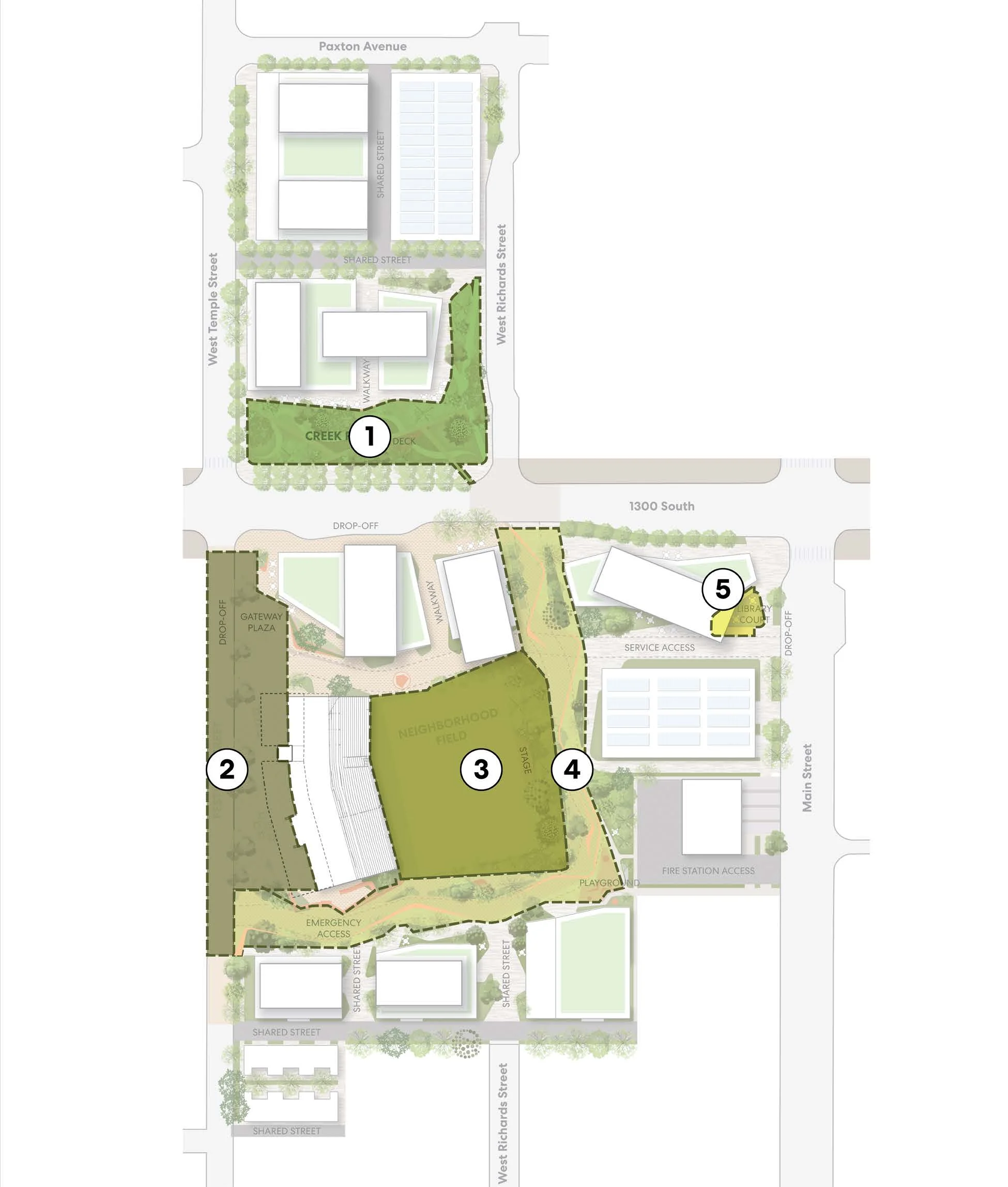
Site plan map showing the five open space typologies numbered 1 through 5 across the Ballpark district layout, with a north indicator.
Accessible view

Map orientation and spatial relationships

North is indicated by the arrow on the map; the map’s top is north.

  • 1, The Creek Park: north of 1300 South, at the northern edge of the site.
  • 2, The Festival Street: west of the Neighborhood Field, along West Temple Street.
  • 3, The Neighborhood Field: the large central field in the middle of the site.
  • 4, The Park Promenade: a linear space running along the east side of the Neighborhood Field.
  • 5, The Library Court: east and north of the Neighborhood Field, near 1300 South and Main Street.
The Framework

Landscape
Framework: Water

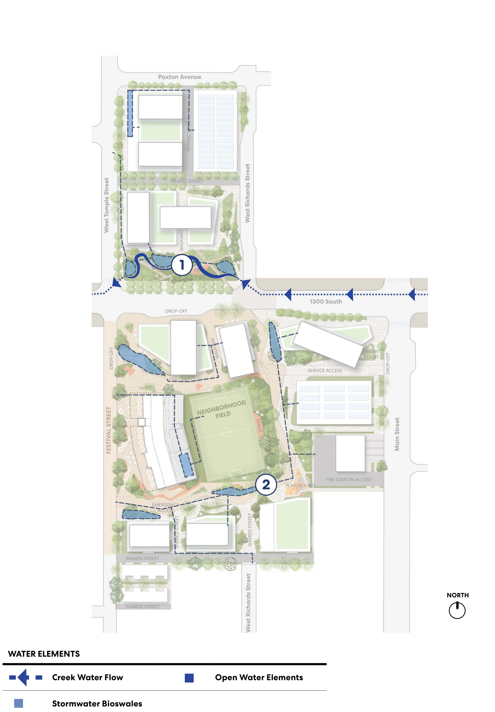
The water framework focuses on two key ideas: first, the daylighting of three creeks; and second, the integration of water elements throughout the site to support cooling, biodiversity, and overall environmental health.

Daylighting Creeks

The Creek Park brings water back to the surface, partially daylighting three creeks buried beneath 1300 South. One potential strategy to achieve this is by installing diversion structures to remove water from the existing 1300 South system and a control structure to re-enter the 1300 South system.

This act of restoration turns forgotten flows into a living feature—cooling the site, supporting ecosystems, and inviting people to gather around water as a source of life, beauty, and connection in the city.

Stormwater Swales

Several open water elements, designed as stormwater swales, are integrated around the Neighborhood Field. While they may not hold water year-round, depending on rainfall and seasonal conditions, they play a vital role in managing stormwater on site.

These swales help filter pollutants, support native planting, and create small pockets of cleaner, cooler air, offering both ecological and public health benefits for the community.

Site Plan Map of the Landscape Water Framework, showing daylighted creek flow at Creek Park (Marker 1), stormwater swales and bioswales around the Neighborhood Field (Marker 2), along with streets including Paxton Avenue, 1300 South, West Temple Street, West Richards Street, and Main Street.
Accessible view

Map Details & Water Elements:

  • Marker 1 (Daylighting Creeks): Located at Creek Park along 1300 South between West Temple Street and West Richards Street, showing creek water flow diverted to the surface.
  • Marker 2 (Stormwater Swales): Positioned surrounding the Neighborhood Field, showing open water elements and stormwater bioswales.
  • Legend Items: Creek Water Flow (directional flow line), Open Water Elements (blue zones), and Stormwater Bioswales (light blue filtration corridors).
The Framework

Landscape Framework: North Block

Neighborhood life in the North Block centers around the Creek Park, which celebrates the site’s restored creeks and urban biodiversity. Adjacent hardscaped plazas create opportunities for restaurants, cafés, and local shops to spill out into gathering spaces along the park’s edge.

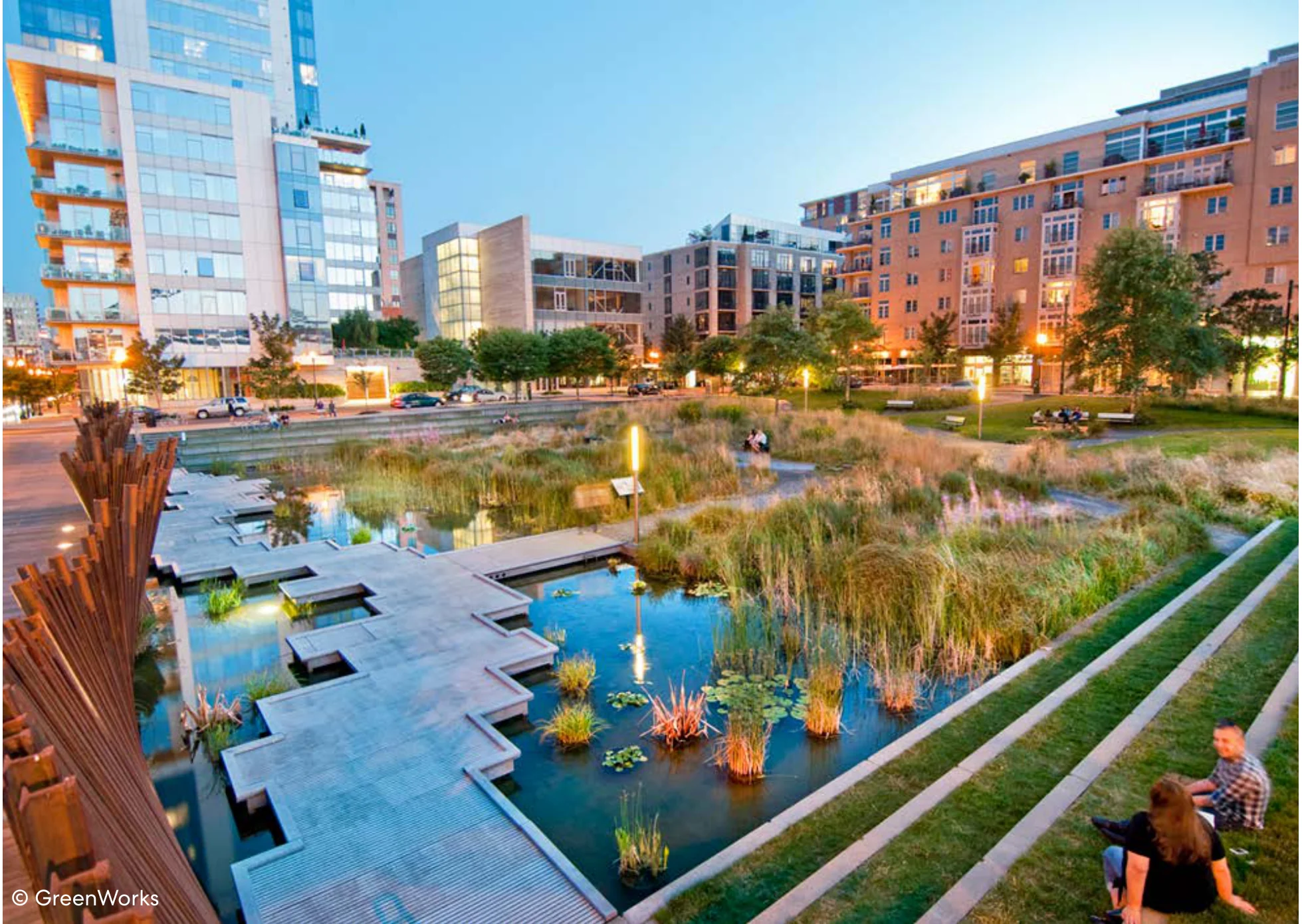
Tanner Springs Park in Portland featuring an urban wetland with boardwalks, native reeds, terraced seating, and adjacent residential and commercial buildings at dusk. © GreenWorks
Like Tanner Springs Park in Portland, the Creek Park weaves stormwater function, native ecology, and layered history into a central public space. It restores visibility to hidden creeks while offering a place for gathering, reflection, and everyday connection to nature.
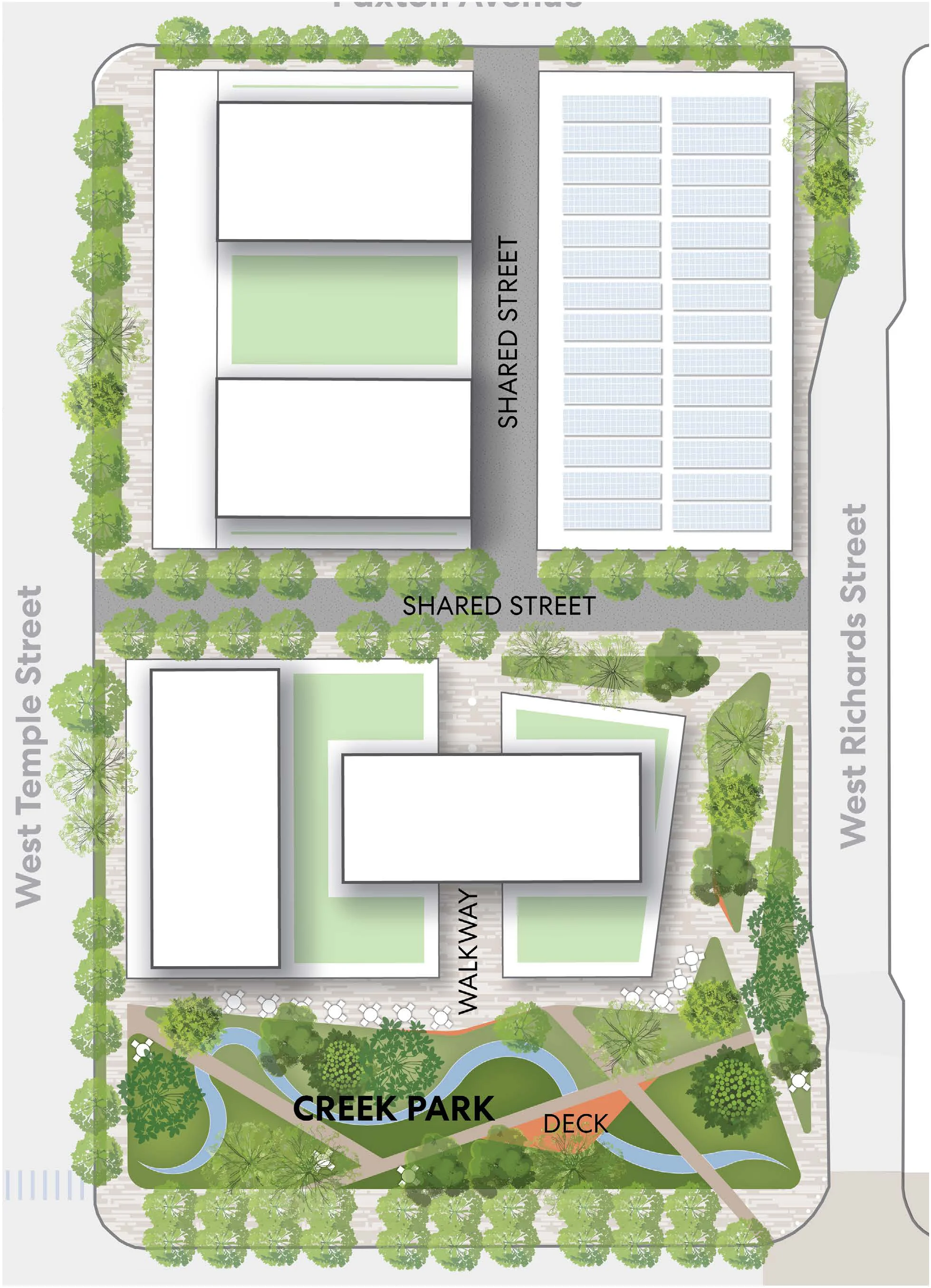
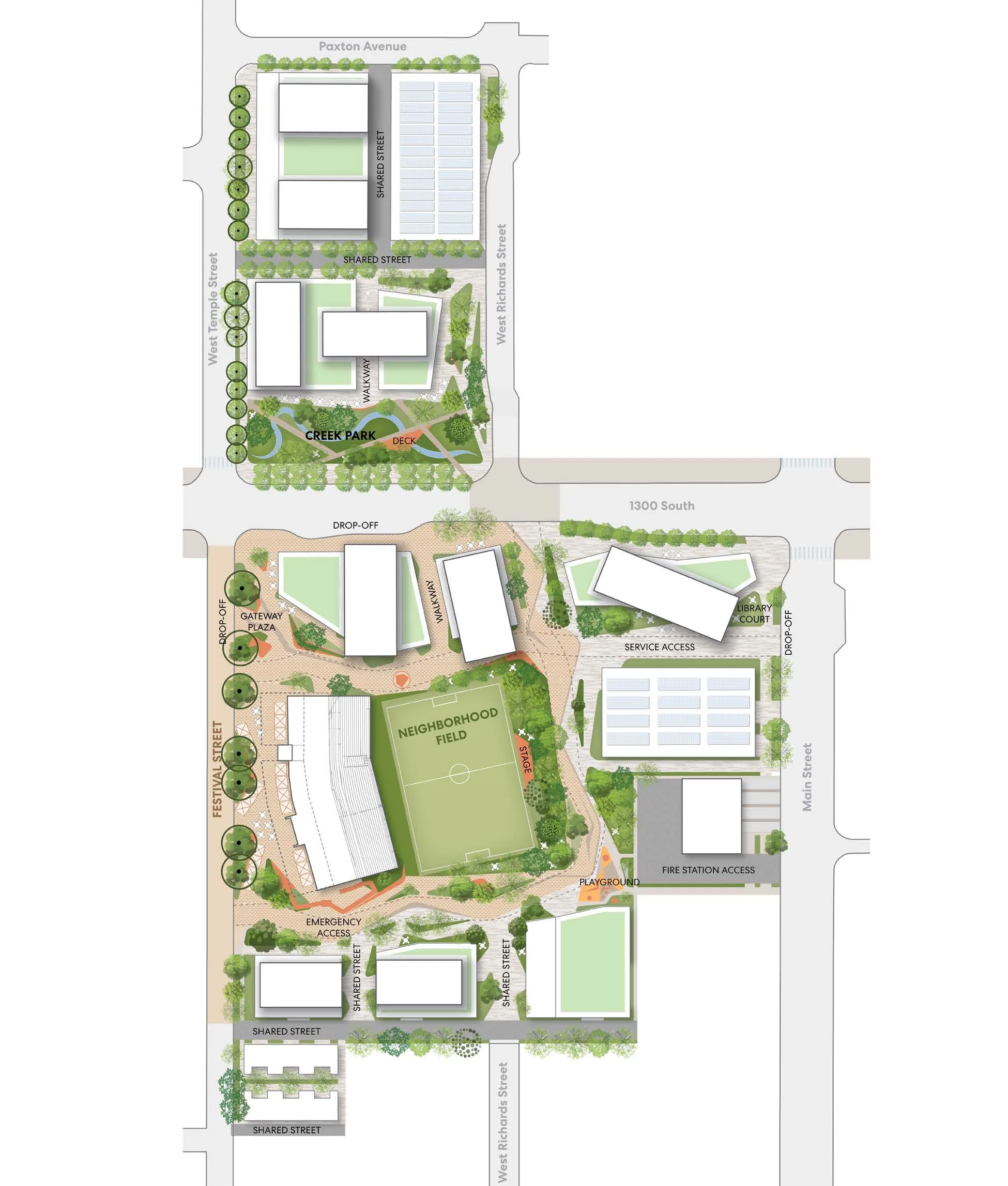
Site plan for the North Block showing West Temple Street on the left, West Richards Street on the right, Shared Streets, Walkway, Creek Park with meandering stream and Deck, surrounded by tree canopies and mixed-use buildings.
Accessible view of North Block Plan

The North Block plan illustrates key spatial relationships and neighborhood elements:

  • Streets & Circulation: West Temple Street (west boundary), West Richards Street (east boundary), interconnected east-west and north-south Shared Streets, and pedestrian Walkways.
  • Buildings & Courtyards: Multiple building footprints with central green courtyards and rooftop/canopy installations.
  • Creek Park: Located at the southern portion of the block, featuring a restored winding creek, accessible boardwalk Deck, open green gathering spaces, outdoor plaza seating, and dense tree canopies along the edges.
The Framework

Landscape Framework: South Block

The South Block is organized around the adapted Neighborhood Field. A tree-shaded Park Promenade runs through the block, linking all parcels with a continuous path and offering quiet moments to pause, gather, or play along the way.
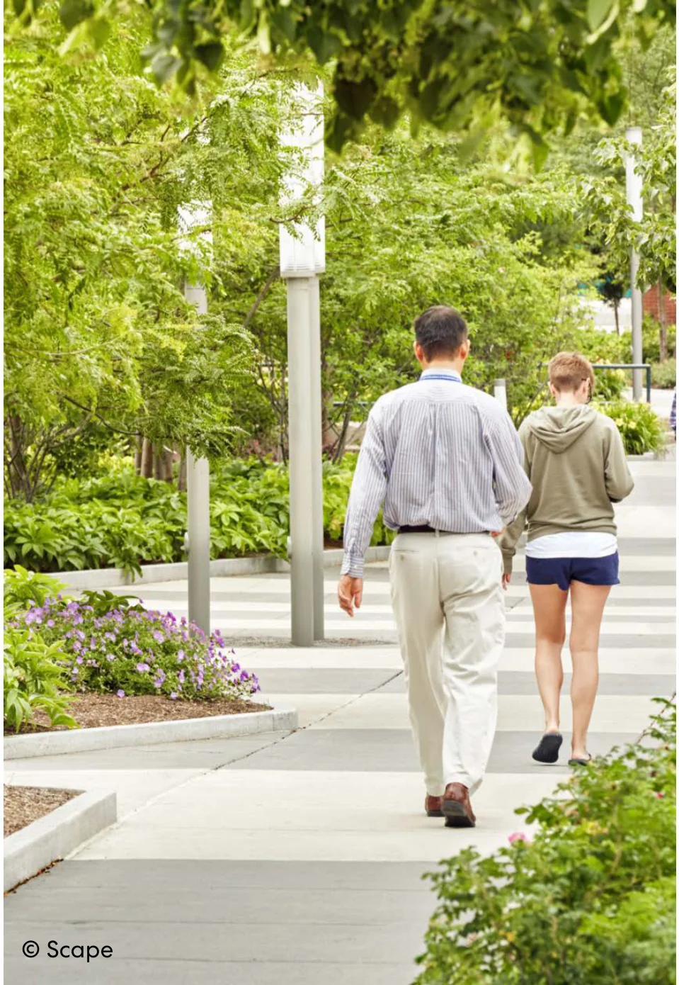
Two pedestrians walking along a paved, tree-lined walkway with lush flowering garden beds and light posts.
© Scape

A lush, tree-lined walkway demonstrates how native plantings and layered vegetation can enhance biodiversity, offer shade, and create a welcoming pedestrian experience at the Park Promenade. This turns the streetscape into both green infrastructure and a lively community space.

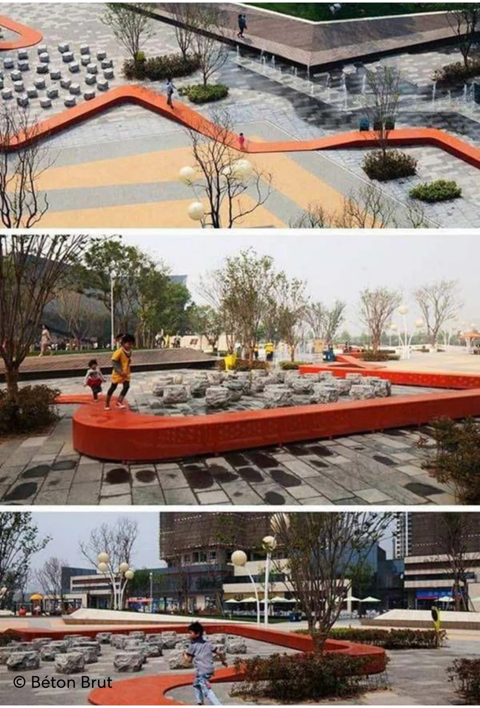
A trio of urban plaza views highlighting a continuous red sculptural ribbon bench, stone climbing blocks, and playful steps for children.
© Béton Brut

This playful urban landscape shows how topography, texture, and informal play elements can create moments of exploration and delight in everyday spaces. At Ballpark NEXT, similar design strategies—like elevated pathways, boulders, and integrated seating—can transform circulation routes and plazas into opportunities for movement and engagement.

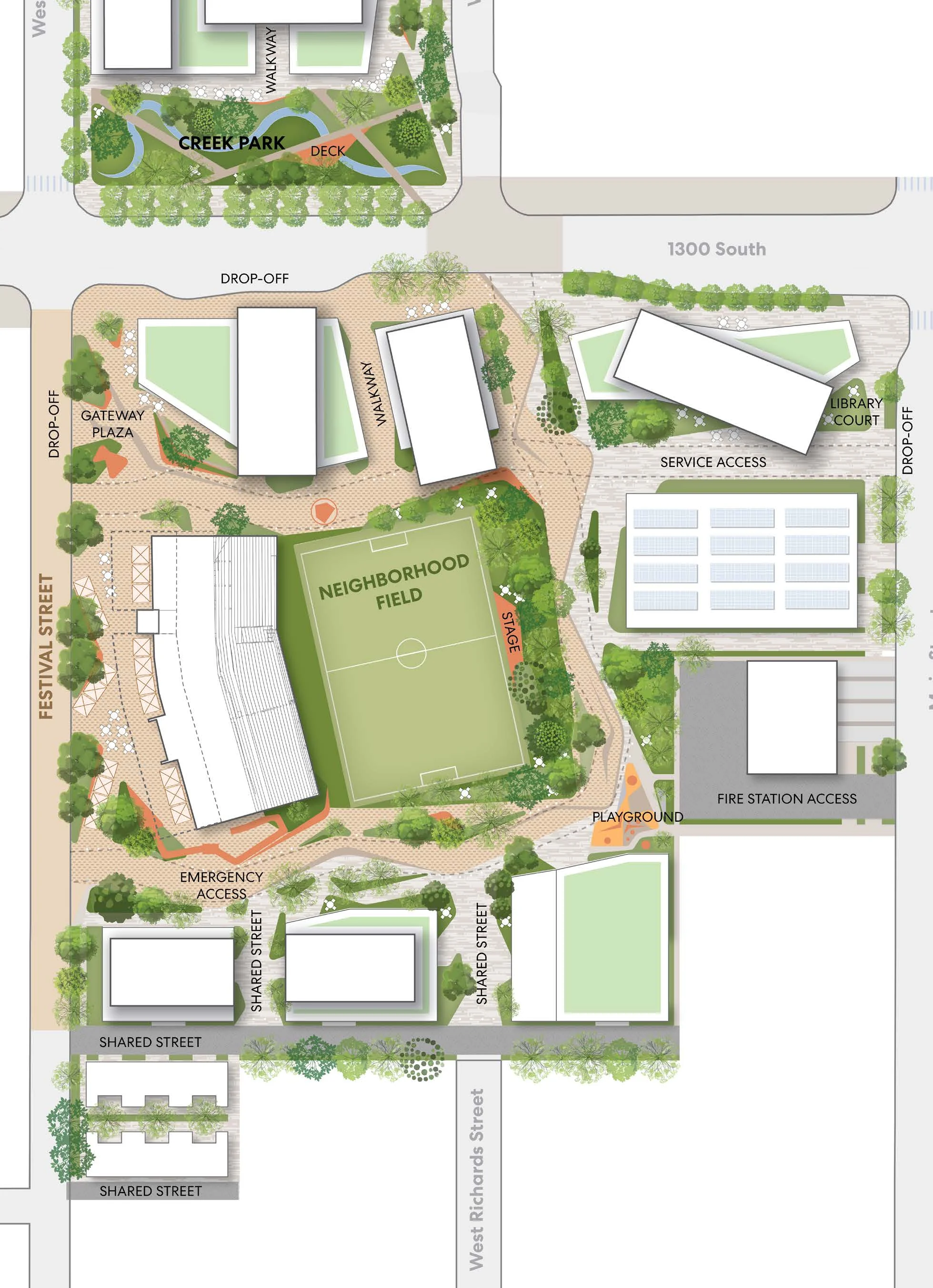
Illustrative site plan of the South Block landscape framework showing the central Neighborhood Field, surrounding Creek Park, walkways, festival street, shared streets, plazas, and building footprints.
Accessible view: South Block Plan Key Elements

The South Block landscape site plan includes the following key zones, circulation paths, and building interfaces:

  • North / Creek Zone: Creek Park, viewing deck, and walkway connection north of 1300 South.
  • North Edge (1300 South): Designated Drop-Off area, Gateway Plaza, and northern Walkway between parcels.
  • Central Park & Recreation: The central open lawn Neighborhood Field flanked by an outdoor Stage, shaded tree promenades, and an adjacent Playground.
  • Civic & Community Anchors: Library Court, Service Access, Fire Station Access, and active building frontages.
  • West & South Streets: Festival Street along the west, Emergency Access, multiple Shared Streets, and West Richards Street connection to the south.
The Framework

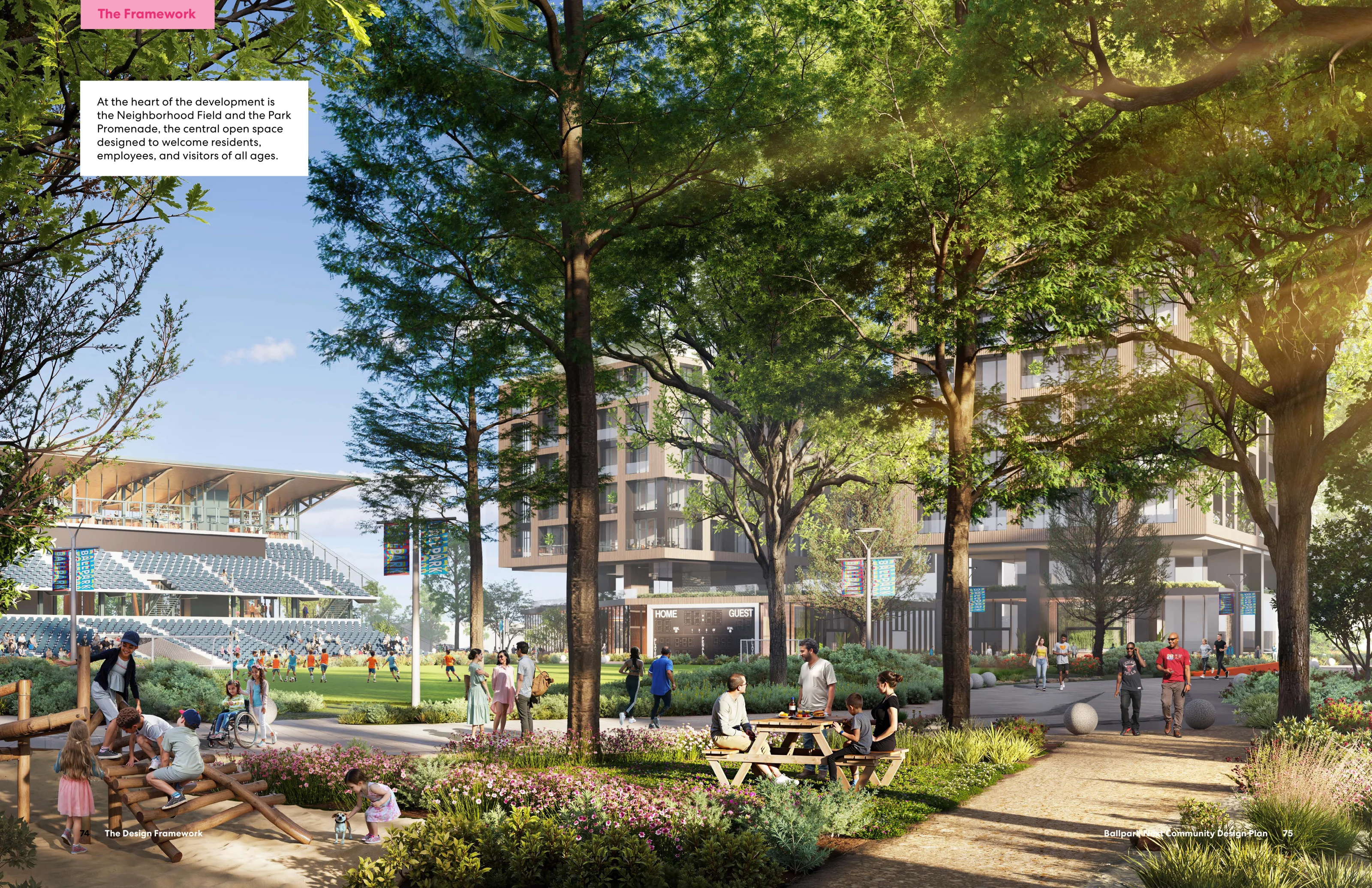
At the heart of the development is the Neighborhood Field and the Park Promenade, the central open space designed to welcome residents, employees, and visitors of all ages.

Vibrant architectural rendering of the Neighborhood Field and Park Promenade showing a lively public park with children playing on timber climbing structures, families picnicking at wooden tables, flower gardens, tree-lined walking paths, modern mid-rise residential buildings, and a baseball stadium in the background.
The Framework

Social
Infrastructure

Social infrastructure encompasses the spaces and services that nurture the Social Determinants of Health, promoting physical well-being, social bonds, learning opportunities, and access to care. These elements lay the groundwork for a resilient and thriving community. The following uses establish a foundation for meaningful, community-centered investment at the heart of the neighborhood.

Attainable Homeownership Opportunities icon

Attainable Homeownership Opportunities

These opportunities are distributed across several residential blocks, supporting long-term stability for local families. While the CRA will prioritize creating ownership opportunities as part of this development, affordable rental options may also be considered in alignment with the CRA’s mission, the Board’s housing priorities, and prevailing market conditions.

Public Library icon

Public Library

A public library is proposed at the corner of 1300 South and Main Street, establishing a civic anchor for the neighborhood. This location supports walkable access to learning, resources, and gathering space—fostering community connection and lifelong education.

Local Small Businesses icon

Local Small Businesses

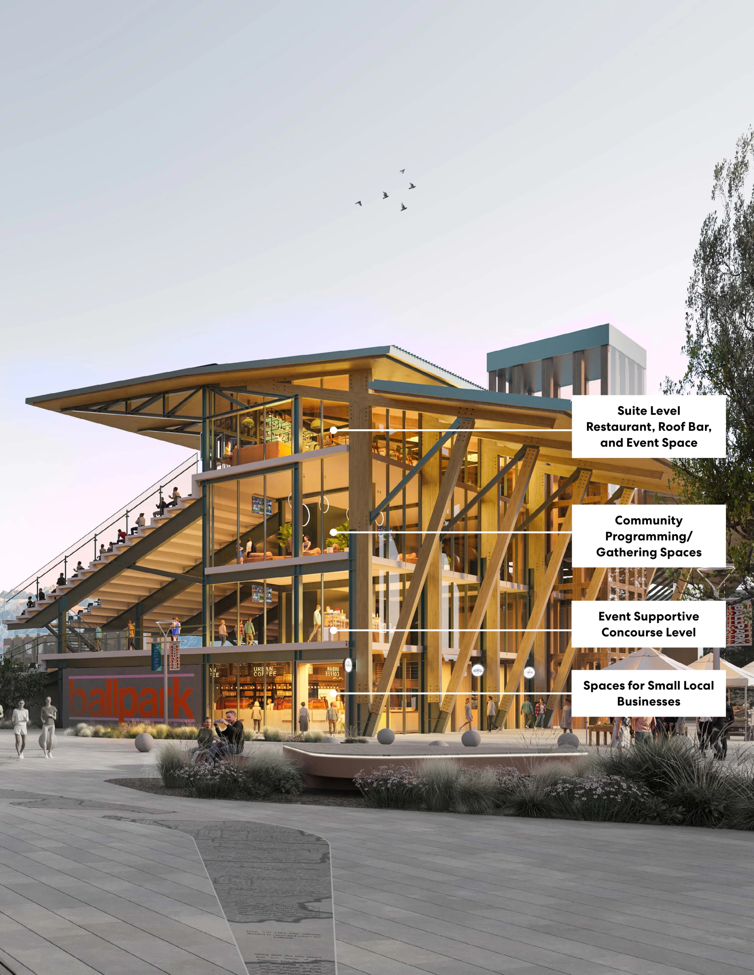
The re-adapted ballpark structure is envisioned as a hub for local small businesses, offering affordable commercial leases that help sustain neighborhood entrepreneurship and cultural identity.

Places for Play icon

Places for Play

Ballpark NEXT reimagines play as an everyday experience for all ages. The former ballfield becomes a flexible open space for informal sports and community events, while a dedicated children’s play area offers safe, shaded play close to residential blocks. Together, these spaces support physical activity, social connection, and intergenerational recreation—core elements of a healthy, vibrant neighborhood.

Local Fresh Food icon

Local Fresh Food

To support health and food access in the Ballpark NEXT neighborhood, a location has been identified for a fresh food market. Positioned near key pedestrian routes and transit, the market provides walkable access to affordable, nutritious options—addressing a long-standing gap in healthy food availability and supporting local food systems.

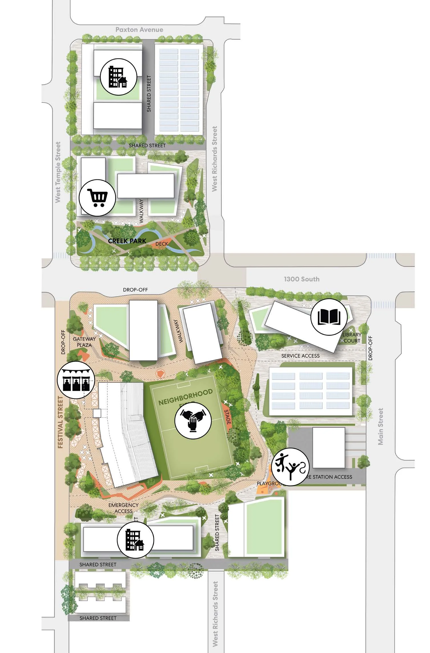
Ballpark Next neighborhood site plan with five marked social-infrastructure uses.
North arrow
Ballpark Next neighborhood site plan Open site plan at larger size
Accessible view

The plan marks five social-infrastructure uses:

  • Attainable Homeownership Opportunities: distributed across several residential blocks.
  • Public Library: at the corner of 1300 South and Main Street.
  • Local Small Businesses: in the re-adapted ballpark structure.
  • Places for Play: in the former ballfield, with a dedicated children’s play area close to residential blocks.
  • Local Fresh Food: near key pedestrian routes and transit.
Illustration of people walking toward a stadium destination with mountain backdrop and lush trees

CHAPTER 04

The Destination

The Destination

Multipurpose
Event Venue

Once a single-use stadium, Smith’s Ballpark is reimagined as a vibrant destination for both the neighborhood and the city—blending open space, active ground floors, and varied programming into a civic hub.

Sports

The adaptable layout of neighborhood fields supports both informal community sports and formal events. For example:

  • Informal pick-up games, such as casual youth soccer matches or friendly basketball sessions.
  • Formal events, including youth soccer tournaments, X Games competitions, and sporting events leading up to the Olympics.

Measuring 240 feet in length (80 yards) by 165 feet in width (55 yards), the multi-use field is spacious enough to host a regulation youth soccer match.

Designed for versatility, the field easily transitions between informal, unstructured play and organized sporting events.

Cultural

The new venue offers a combined capacity of approximately 9,000 spectators—filling a gap in Salt Lake City’s current venue landscape. This versatile space is ideal for hosting both large music events and smaller community functions, such as:

  • Concerts
  • DIY festivals
  • Utah beer festivals
  • Urban flea markets

*Calculated with 7 square feet per capita space requirement.

Architectural rendering of the reimagined ballpark venue featuring annotations for Suite Level Restaurant, Roof Bar, and Event Space; Community Programming/Gathering Spaces; Event Supportive Concourse Level; and Spaces for Small Local Businesses.
The Destination

Adaptive Reuse of
Smith’s Ballpark

The decision to preserve a segment of Smith’s Ballpark was determined through a structural assessment and the collective desire to celebrate an important part of Salt Lake City’s history.

1

Structural Framing System

Smith’s Ballpark has a main structural framing system of cast-in-place (CIP) concrete bearing walls and steel framing and columns with precast risers in the elevated seating area, composite steel deck on the second and third floors, and metal deck on steel trusses for the high roof. The lateral force resisting system of the structure is special concrete shear walls at the ground level, and special steel moment frames at elevated levels.

2

Non-Load Bearing Elements

The ground floor consists of Infill, non-load bearing concrete masonry unit (CMU) walls. The CMU can be removed to provide greater ground floor transparency.

3

Cast-In-Place Concrete

Underneath the first level of precast seating risers there are cast-in-place concrete tunnels comprised of retaining walls that lead to the field and dugouts.

4

Expansion Joints

Smith’s Ballpark is divided into three areas, named the south wing, center structure, and east wing. It has three levels, the ground level, second floor (concourse area), and the third floor (suite level). The south and east wings are open-air areas where most of the seating is located. The center structure contains enclosed, suite-style seating. These three areas are structurally isolated with expansion joints which enables partial demolition.

5

Architectural Elements Preservation

The adaptive reuse of the building will aim to preserve key architectural elements while exploring opportunities for repurposing them either on-site or at other locations throughout the city. A notable example is the commissioned etched glass installation in the stadium’s towers entitled, ‘Lanterns of Salt Lake City Baseball’, designed by Paul Heath and William Littig.

The Destination

Reimagining a
Historic Landmark

Following partial demolition, the southern wing of the remaining Ballpark will be enhanced with contemporary architectural elements that support new event and community programming, while reinforcing the structure’s role as a lasting, iconic symbol for the neighborhood.

New Roof Extension

The proposal includes a new standing seam roof extension that provides shade and a sense of enclosure along Festival Street creating an outdoor room that encourages moments of pause and recreation.

CLT and Steel Structural Addition

Inspired by the tectonics of the existing steel structure, the design introduces a new cross-laminated timber (CLT) and steel truss system to support the roof extension. This contemporary intervention injects new architectural life into the structure, elevating the overall design with warmth, contrast, and a refined material palette.

Existing Structure

The existing steel structure, which is generally in good condition, will undergo preventative maintenance to extend its serviceable life.

Circulation Cores

All vertical circulation will be retrofitted to meet accessibility requirements related to occupancy. The preserved tower in the selected section is reimagined with a structural refresh, transforming it into an iconic beacon. Additionally, a sculptural ADA-compliant ramp is proposed, rising from the Festival Street and landing directly on the concourse level.

Entrance Portals

Both existing and new entrances will be enhanced with prominent, vibrantly colored portals to create a more welcoming atmosphere, improve visibility, and support intuitive wayfinding.

New Facade Treatment

The existing concrete masonry unit (CMU) infill walls along the exterior façade will be replaced with glass curtain walls to improve visual porosity and activate the street edge. A string of small businesses will line the base, spilling out onto Festival Street to create a lively pedestrian environment.

Exploded axonometric architectural diagram detailing the Ballpark structure layers: 1 New Roof Extension, 2 CLT and Steel Structural Addition, 3 Existing Structure with Restaurant, Community Programs, Concourse, and Small Business Shops, 4 Circulation Cores and ADA Ramp, 5 Entrance Portals, and 6 New Facade TreatmentOpen full-size landmark diagram

Architectural rendering showing a bustling public plaza in the Ballpark neighborhood with a multi-story mass-timber community pavilion, pedestrian promenade, outdoor dining, landscaping, and Wasatch mountain views in the background.
Illustration of a soccer match in a park with spectators watching and a large green tree framing the scene

CHAPTER 04

The Experience

The Experience

User
Experience

The Ballpark NEXT User Experience is illustrated through five everyday moments.

Vignette 1: The Field

Guiding Principle: Community Centered: A Space for Every Face

Social Determinant of Health: Social and Community Context

Vignette 2: The Field

Guiding Principle: Acknowledge the Past: Honor the Neighborhood’s History

Social Determinant of Health: Economic Stability

Vignette 3: The Shops

Guiding Principle: Wellness: Culture of Health

Social Determinant of Health: Health Care and Quality

Vignette 4: The Creek Park

Guiding Principle: Wellness: Natural Geography: Be Green

Social Determinant of Health: Neighborhood and Built Environment

Vignette 5: The Library

Guiding Principle: Neighborhood Safety and Activation: Safety in Every Stride

Social Determinant of Health: Education Access and Quality

Isometric aerial site plan with five labeled Ballpark Next user-experience callouts.Open full-size user experience site plan
Site plan rendering. Select the image to open a full-resolution view.
Accessible view

The isometric site plan has five eye-shaped callouts connected by leader lines to their locations:

  1. Vignette 1: The Field — the callout points to the large field in the lower-center of the plan.
  2. Vignette 2: The Festival Street — the callout points to the Festival Street area along the left side of the plan.
  3. Vignette 3: The Shops — the callout points to the shops area near the center-left of the plan.
  4. Vignette 4: The Creek Park — the callout points to the Creek Park area toward the upper-right of the plan.
  5. Vignette 5: The Library — the callout points to the library building on the right side of the plan.

The adjacent page text labels Vignette 2 as “The Field,” while this diagram labels it “The Festival Street.”

The Experience

The Neighborhood Field

For over 75 years, the Ballpark has stood as a beloved social anchor—embodying connection, pride, and collective memory within the neighborhood. Now, through adaptive reuse, it is reimagined as a dynamic community hub designed for all ages and abilities. The transformed space invites both daily rituals and chance encounters, from morning runs and youth athletic training for the Olympics to elder wellness routines and inclusive, intergenerational play.

Site map locator showing the position and viewpoint of The Neighborhood Field within the neighborhood layout
Fall Season: Community members playing soccer tournament on the field with cheering spectators in front of the stadium structure.
Fall: Soccer Tournament

Quote: "I just scored the winning goal at the Fall Soccer Tournament!!"

Winter Season: Festive outdoor winter ice skating rink with skaters of all ages and holiday market stalls.
Winter: Annual Winter Ritual & Ice Skating

Quote: "This local annual winter ritual is so fun!"

Spring Season: Sunny afternoon on the lawn with residents picnicking and watching an outdoor movie screening in the field.
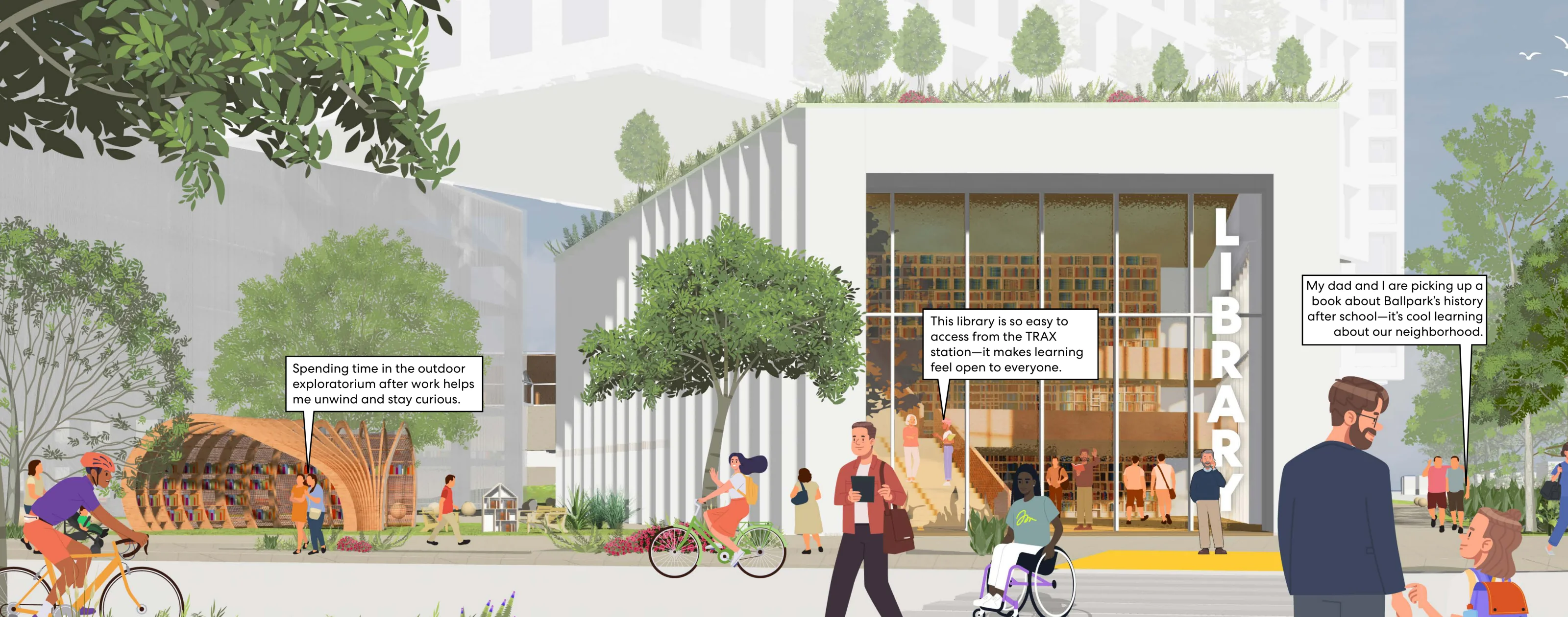
Spring: Movies in the Field

Quote: "I’m enjoying the spring weather with a “Movies in the Field” series!"

Summer Season: Nighttime outdoor summer festival concert with live musical performance, cheering crowd, and fireworks.
Summer: Ballpark Summer Festival & Concert

Quote: "Getting to perform at the Ballpark Summer Festival is rad!"

The Experience

The Festival Street

The Ballpark has long brought people together on game days, energizing the neighborhood and supporting local businesses. Building on that legacy, the adapted Ballpark promotes economic stability through subsidized ground-floor spaces for small, local businesses. West Temple transforms into a Festival Street, hosting farmers markets, pop-ups, and cultural events. These interventons create pathways to local wealth-building and advancing health equity.

Site context map highlighting the Ballpark Festival Street location
Architectural illustration of the vibrant Festival Street outside the Ballpark, featuring local market stalls, community members shopping for fresh produce, a pop-up book market, family gathering areas, and an active pedestrian plaza.

Community Perspectives

“This pop-up gave me the perfect chance to launch my new digital app right in my own neighborhood.”
“Buying local produce every Sunday keeps me healthy, and supports my neighbors.”
“Living here means being part of something thriving and a great place to raise my kids.”
The Experience

The Shops

The Ballpark NEXT vision is rooted in wellness, welcoming young residents while helping older adults age in place with dignity. Health-supportive design is woven into daily life, making care accessible, familiar, and community-based.
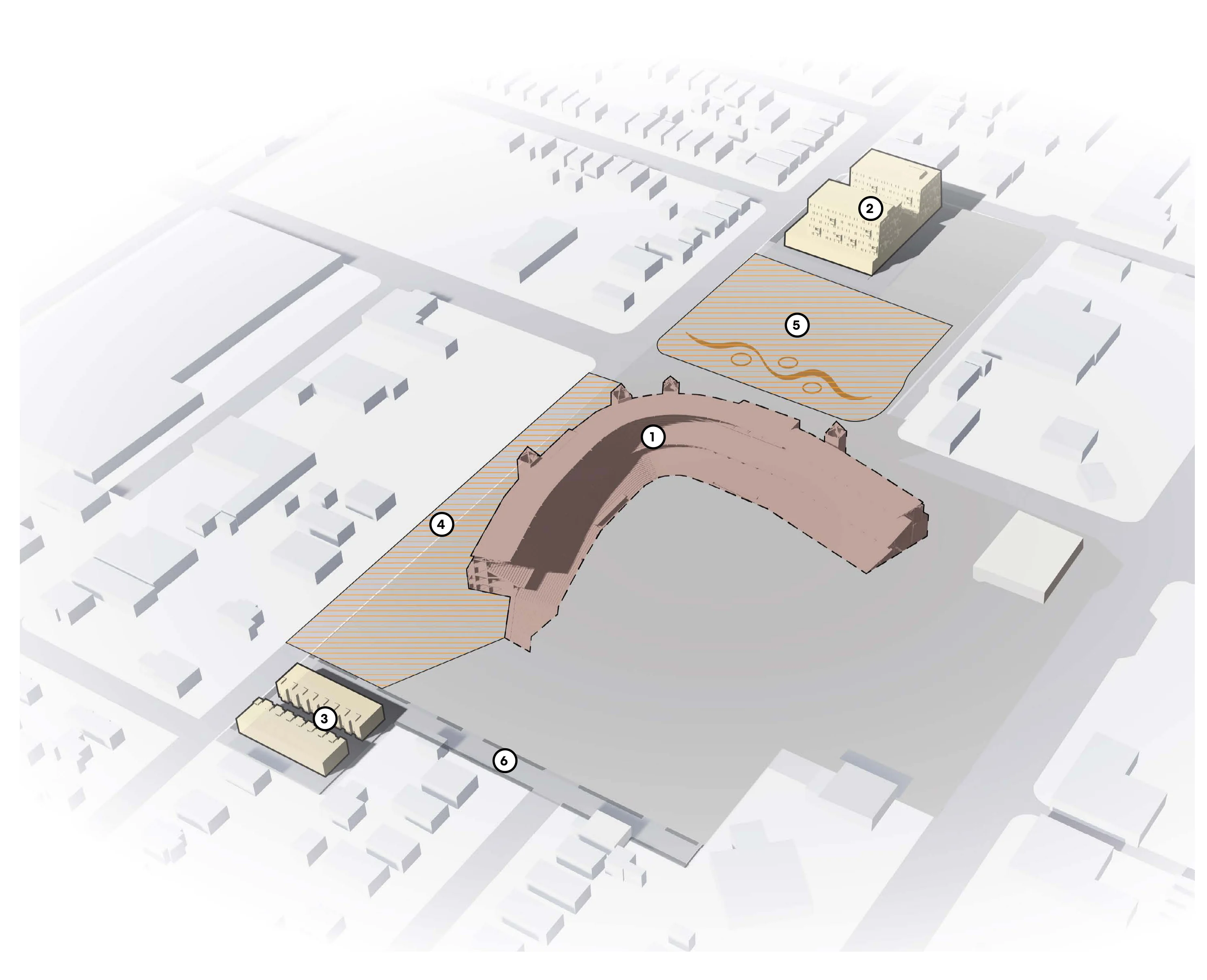
A network of ground-floor services—clinics, pharmacies, fresh food markets, and mental health providers—prioritizes proximity and affordability, supporting chronic care, timely treatment, and reduced reliance on emergency services.
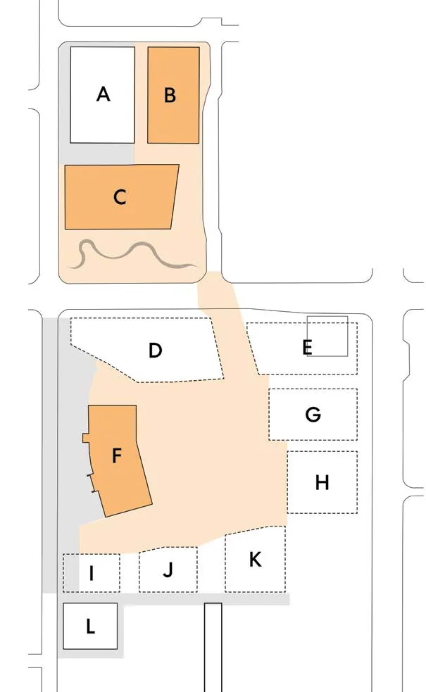
Site map locator showing the ground-floor shops and clinic location
Illustration of active ground-floor shops, fresh produce market, pharmacy, clinic, wellness center, and pedestrian boardwalk in the Ballpark NEXT neighborhood.
“Got a prescription from the clinic, and I can fill it right next door—so convenient.”
“It’s a game changer having fresh produce right in the neighborhood.”
“This clinic helps me stay on top of my health—I’ve never felt more supported.”
The Experience

The Creek Park

Creek Park reveals and celebrates the site’s hidden creeks to restore a sense of place and a daily connection to nature. This green vision brings shade, fresh air, and calm to a neighborhood long underserved by open space. It creates a cooling microclimate, boosts biodiversity, and improves air quality, especially vital in historically redlined communities facing higher environmental burdens. These investments promote health, resilience, and everyday joy in the Ballpark neighborhood.

Location diagram showing view orientation within the Ballpark neighborhood master plan
Panorama of Creek Park featuring wide tree-lined streets, bike path with cyclist, pedestrian boardwalk alongside daylighted creek with native landscaping, and community members enjoying the outdoors.

“This tree-lined street makes my morning runs feel like a breath of fresh air—literally.”

“Spotted a Western Tanager while biking—nature feels closer than ever out here.”

“Our grandkids always want to visit now—this creek park is their favorite part of the neighborhood.”

The Experience

The Library

The new Public Library anchors a vibrant Civic Edge for lifelong learning and community connection. It offers indoor and outdoor spaces for both formal and informal learning where children read with grandparents, students study, and neighbors gather around shared stories. By making high-quality educational resources walkable and transit-accessible, the Library helps close opportunity gaps, boost digital literacy, and open pathways to upward socio-economic mobility.

Site locator map highlighting the Library location within the master plan
Architectural illustration of the new Public Library with an outdoor exploratorium, active public plaza with pedestrians and cyclists, large floor-to-ceiling glass windows displaying library bookshelves, and integrated community spaces

Community Experience

“Spending time in the outdoor exploratorium after work helps me unwind and stay curious.”

“This library is so easy to access from the TRAX station—it makes learning feel open to everyone.”

“My dad and I are picking up a book about Ballpark’s history after school—it’s cool learning about our neighborhood.”

Illustration of people walking, cycling, and talking along a tree-lined avenue
CHAPTER 05

The Road Map

The Roadmap

Phase 1

Phase 1 development and infrastructure is focused on the partial demolition of the ballpark, interim activation of streets and parking lots, and building housing.

New vertical development includes the following:
  • The partial demolition of Smith’s Ballpark, preserving the western segment for future adaptive re-use.
  • Construction of multi-family housing on the northern surface parking block at the corner of West Temple Street and Paxton Avenue.
  • Construction of lower density housing along West Temple Street.
New infrastructure investment includes the following:
  • Interim activation of West Temple as a ‘festival street’, providing opportunity for street closures for seasonal community events.
  • Interim activation of a portion of the surface parking lot closest to 1300 South.
  • Construction of a east-west street segment to serve lower density housing.
Key plan diagram illustrating parcels A through L with active Phase 1 areas highlighted
Isometric aerial 3D rendering of Phase 1 site plan highlighting ballpark partial demolition, multi-family housing block, festival street zone, and parking lot activation numbered 1 through 6.Open full-size Phase 1 diagram
The Roadmap

Phase 2

Phase 2 development and infrastructure is focused on the adaptive re-use of the ballpark, construction of new streets and parks, and adding housing and a parking garage.

New vertical development includes the following:

  • 1 Adaptive re-use of the western segment of the Ballpark into an entertainment venue. This includes ground floor spaces for local businesses.
  • 2 Construction of multi-family housing on the northern surface parking block which could include a grocery store and community serving retail on the ground floor.
  • 3 Construction of a municipal parking garage which would be shared across multiple buildings.

New infrastructure investment includes the following:

  • 4 In coordination with the adaptive re-use of the Ballpark, the festival street and plaza areas along West Temple will be constructed.
  • 5 The interior infrastructure of the southern block will be constructed including the neighborhood field and pedestrian promenade.
  • 6 Construction of the mid-block service street on the northern block.
Phase 2 site plan key map showing parcels A through L with active phase 2 parcels highlighted in orange.
The Roadmap

Phase 3

Phase 3 development and infrastructure is focused on building the new Fire Station 8 on Main Street and adding housing on the southern portion of the site.

New vertical development includes the following:

  • Demolition of existing Fire Station 8 at the intersection of 1300 South and Main Street.
  • Construction of new Fire Station 8, located at Main Street and Harrison Avenue South.
  • Construction of the 2nd municipal parking garage on Main Street which will be shared by multiple users.
  • Construction of new multi-family housing on the south portion of the site.

New infrastructure investment includes the following:

  • In coordination with the new multi-family housing, construction of new shared streets including the extension of Richards Street into the site.
Phase 3 site plan key map showing parcel lots A through L with lots E, G, H, I, J, K highlighted in orange
The Roadmap

Phase 4

Phase 4 development and infrastructure is focused on higher density mixed-use development along 1300 South, including a new ground floor public library branch and the construction of the Creek Park.

New vertical development includes the following:

  • 1 Construction of a hotel with ground floor food and beverage and retail establishments.
  • 2 Construction of higher density multi-family residential development with ground floor retail.
  • 3 Construction of higher density housing with a potential site for a new public library branch on the ground floor at 1300 South and Main Street.

New infrastructure investment includes the following:

  • 4 In coordination with Salt Lake City and County stakeholders, construct the Creek Park with partial daylighting of Parsley, Red Butte, and Emigration Creeks.
Diagram map highlighting parcels D and E for Phase 4 development

Acknowledgments

Salt Lake City
Community Reinvestment Agency
Board of Directors
  • Victoria Petro, District 1
  • Alejandro Puy, District 2
  • Chris Wharton, District 3
  • Eva Lopez-Chavez, District 4
  • Darin Mano, District 5
  • Dan Dugan, District 6
  • Sarah Young, District 7
Salt Lake City
Community Reinvestment Agency
  • Mayor Erin Mendenhall, Executive Director
  • Danny Walz, Director
  • Lauren Parisi, Senior Project Manager
  • Makena Hawley, Project Manager
  • Kathryn Hackman, Communications Specialist
Salt Lake City
  • Fire
  • Planning
  • Transportation
  • Library
  • Public Works
  • Engineering
  • Public Utilities
  • Sustainability
State and County
  • Utah Transit Authority (UTA)
  • Salt Lake City School District
Ballpark Neighborhood
  • Ballpark Community Council
  • Ballpark Action Team (BAT)
  • Urban Indian Center
Consultant Team
Perkins&Will
Urban Design, Landscape Architecture, Architecture
Kimley-Horn & Associates
Civil, Transportation, Structural Engineering
David Evans & Associates
Public Involvement
Victus Advisors
Public Assembly Market Advisors
Illustration of a green tree with a family playing joyfully, including children doing cartwheels and running, and an older couple walking together.
Perkins&Will