The Oakwood Bikeway is a 5.4 mile route that includes a wonderful mix of flatland and hills. It provides an excellent opportunity to exercise and enjoy the outdoors and give cyclists a beautiful tour of Oakwood.
In particular, the route
showcases the many varieties of Oakwood homes from modest bungalows to some of Oakwood’s finest estates as well as some historical points of interest. It also passes features such as Houk Stream, Hills & Dales Park, the city building, Oakwood Junior/Senior High School, Smith Gardens, Hawthorn Hill, Smith Elementary School and the Oakwood Community Center.
Enjoy!
Accessible view
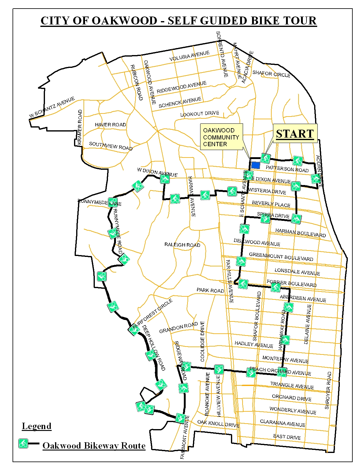
Map and route. This is the 5.4-mile Oakwood Bikeway. The marked route starts beside the Oakwood Community Center at the point labelled START.
- From START, the marked line runs west along W Dixon Avenue.
- It turns south through the western neighbourhoods around Runnymede Lane and Runnymede Road, then continues by Iroquois Circle and Deep Hollow Road.
- The route continues through the southwest portion of the map near Park Road, Grandon Road, Coolidge Drive, Roanoke Avenue, and Hillview Avenue, before returning north toward the central streets.
- On the return through the eastern street grid, the map labels W Dixon Avenue, Patterson Road, Wisteria Drive, Beverly Place, Spirea Drive, and Harman Boulevard before the route returns to the START area.
Named features associated with the tour: Houk Stream, Hills & Dales Park, the city building, Oakwood Junior/Senior High School, Smith Gardens, Hawthorn Hill, Smith Elementary School, and the Oakwood Community Center.
Legend: the black line with green bicycle symbols is the Oakwood Bikeway Route.