CITY OF OAKWOOD PRECINCT MAP
Map information and visual description
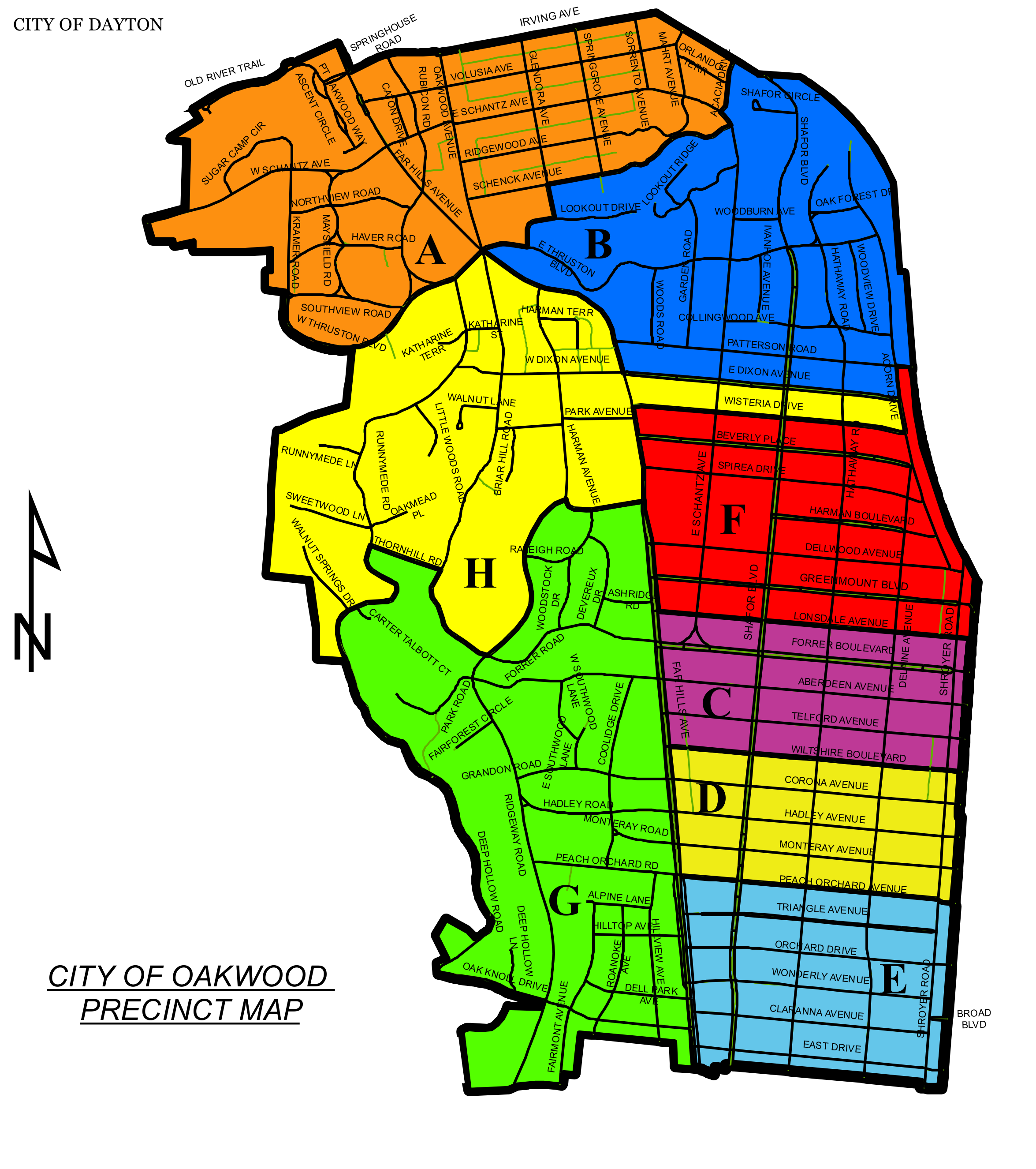
This color-coded map marks the City of Oakwood precincts with large letter labels from A through H. Black boundary lines divide the precincts, and street names are printed throughout the map. A north arrow is shown at the left.
- Precinct A is orange near the upper left-center; precinct B is blue across the upper right.
- Precinct H is yellow in the central-left area; precinct F is red on the right-center.
- Precinct C is purple below F, precinct D is yellow below C, and precinct E is light blue at the lower right.
- Precinct G is green across the lower-left and lower-center area. “CITY OF DAYTON” is labeled above the map, and “CITY OF OAKWOOD PRECINCT MAP” appears at lower left.
Use “Open enlarged map” to inspect the street and boundary labels with scrolling and zoom controls.