Zoning & Parcel Plat Map
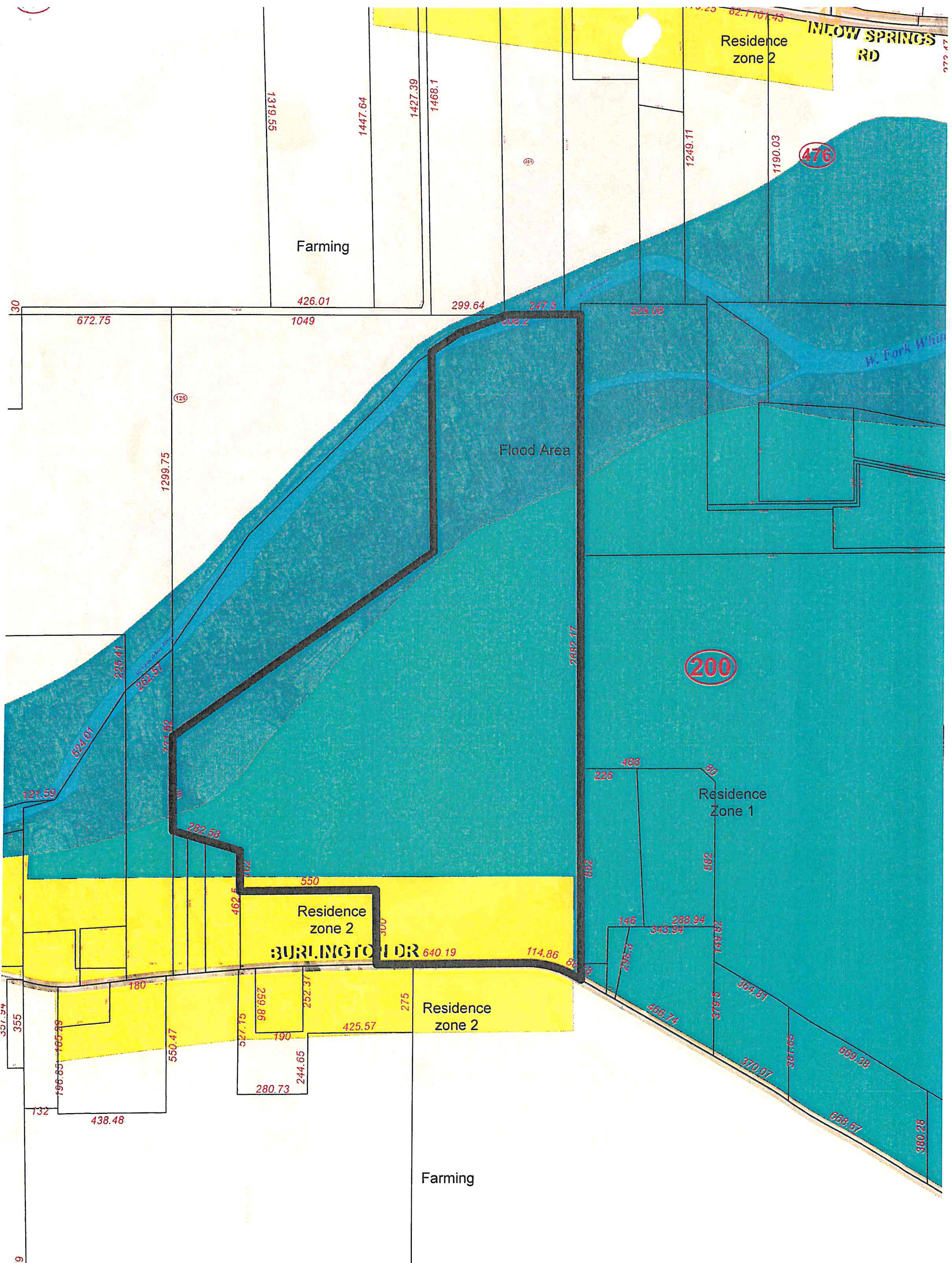
Area overview of Burlington Drive, Inlow Springs Road, and West Fork White River
Accessible view
Image description and verified map information
This supplied crop is a survey plat showing parcel boundaries, zoning fills, roads, and the West Fork White River. The labels and measurements below are transcribed only where they are legible in the image; this is not a complete parcel schedule.
Labels, relationships, and legible measurements
On narrow screens, scroll horizontally to view all table columns.
| Map label or feature | Visible designation | Verified relationship or location | Legible identifiers or measurements |
|---|---|---|---|
| Residence zone 2 | Yellow fill | Shown in a band along the upper edge by Inlow Springs Rd and in yellow parcels along Burlington Dr. | Lower frontage labels include 640.19, 114.86, 180, 425.57, and 280.73. |
| Residence Zone 1 | Teal fill | Occupies the large central/eastern teal area; the circled parcel label 200 is within it. | Circled parcel label: 200. |
| Flood Area | Darker teal corridor | Runs diagonally through the plat alongside the meandering West Fork White River, from the southwest toward the northeast. | No complete boundary schedule is asserted from the image. |
| W. Fork White River | Blue waterway line | Meanders across the northern/eastern portion of the plat within or beside the flood-area corridor. | Printed map label: W. Fork White River. |
| Farming | White / unshaded | Shown in the north-central unshaded parcels and below the Burlington Dr corridor. | Legible northern parcel measurements include 1393.55, 1447.64, 1427.39, 1468.1, 1249.11, and 1190.03. |
| Burlington Dr | Road label along the lower corridor | Runs east-west across the lower portion and fronts the yellow Residence zone 2 parcels. | Legible frontage labels include 640.19, 114.86, 180, 425.57, and 280.73. |
| INLOW SPRINGS RD | Road label at the upper/northeast edge | Forms the upper edge beside the yellow Residence zone 2 area. | Circled parcel label 476 appears near this upper-right edge. |
| Parcel labels | Red circled numerals | One circled 200 label is visible in the Residence Zone 1 area; circled 476 is visible near the northeast edge. | Verified labels: 200 and 476. |