Delaware-Muncie Metropolitan
Plan Commission
Excerpt
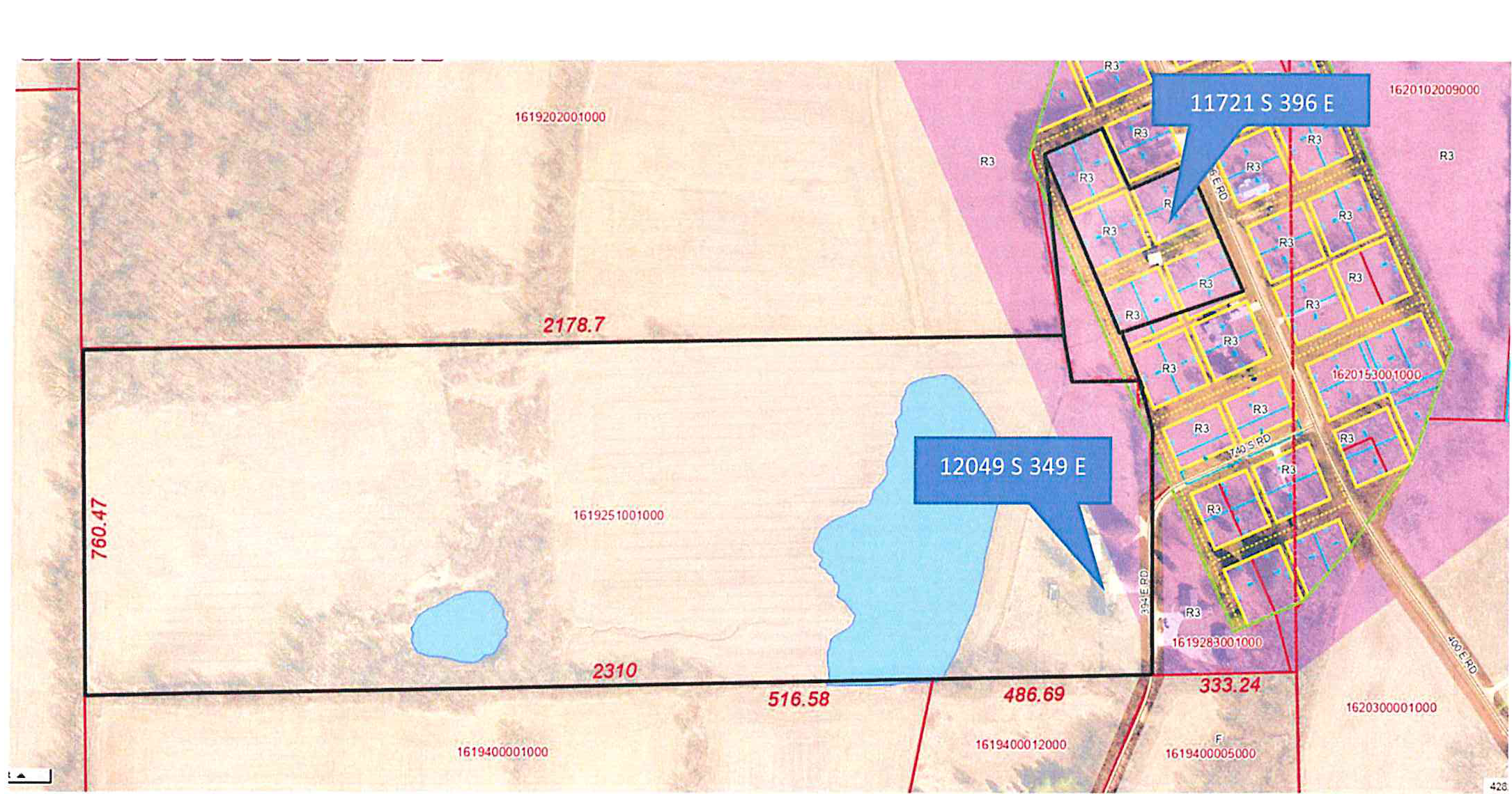
Description & Location: 12049 S CR 349 E, and 11721 S CR 396 E, both in Muncie IN, & adjacent parcels all listed below.
Parcels: 16-19-251-001-000, 16-19-276-001-000, 16-19-280-005-000, & 16-19-277-008-000
Streets: Both S CR 396 E and S CR 349 E are classified as a Local Roads with a 50 ft ROW according to the Official Thoroughfare Plan Map.
Land Use: These parcels are being used both residentially and as farm land.
Zoning: The larger parcel on S CR 349 E is split zoned R-3 Residence Zone and F Farming Zone. The parcels on S CR 396 E are zoned R-3 Residence Zone. The surrounding areas are also R-3 Residence Zones and F Farming Zones.
Request: The request is for a change of zoning from the R-3 Residence Zone to the F Farming Zone for the parcels on S CR 396 E, and from the split zoning of R-3 Residence Zone and F Farming Zone to the F Farming Zone for the parcel on S CR 349 E.
Additional Information: This rezoning will correct the split zoning of the larger parcel on S CR 349 E, and create more accurate zoning for the other properties, as they are used as part of the adjoining farm land as well.