Metropolitan Planning Area (MPA)
Accessible view
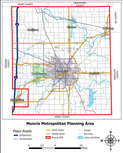
Map Summary: Muncie Metropolitan Planning Area (MPA)
The map displays the boundary of the Muncie MPA outlined in red, encompassing Delaware County and surrounding connections:
- Adjacent Counties: Grant and Blackford Counties to the north, Jay and Randolph Counties to the east, Henry County to the south, and Madison County to the west.
- Municipalities: Muncie (central), Yorktown (west), Daleville (southwest corner), Gaston (northwest), Eaton (north), Albany (northeast), and Selma (east).
- Major Road Network: Interstate 69 running north-south along the western boundary; US Highway 35; State Roads 3, 28, 32, 67, 167, and 332; and local major streets.
- Other Features: Railway corridors, rivers, lakes, and the Prairie Creek Reservoir located in the southeast quadrant.