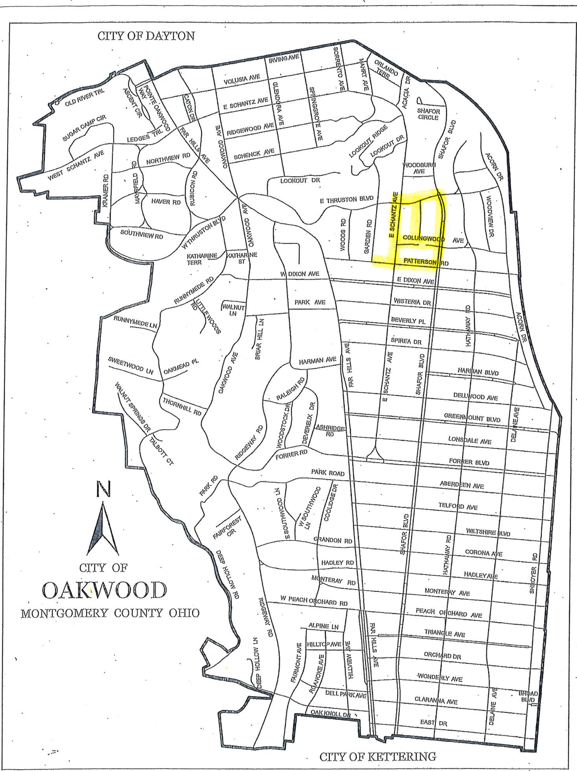
Map of the City of Oakwood
Montgomery County, Ohio
Oakwood street map
This map shows the City of Oakwood street layout. The map boundary is labeled City of Dayton to the north and City of Kettering to the south.
The highlighted area is labeled with E Schantz Ave, Collingwood Ave, and Patterson Rd.
Map labels and visual description
Boundary labels: City of Dayton; City of Kettering.
Place label: City of Oakwood, Montgomery County Ohio.
Highlighted street labels: E Schantz Ave; Collingwood Ave; Patterson Rd.
The map is oriented with north toward the top and includes a north arrow. Streets and the city boundary are drawn in black; the highlighted area is yellow.
Opens an enlarged, pannable view of the map.