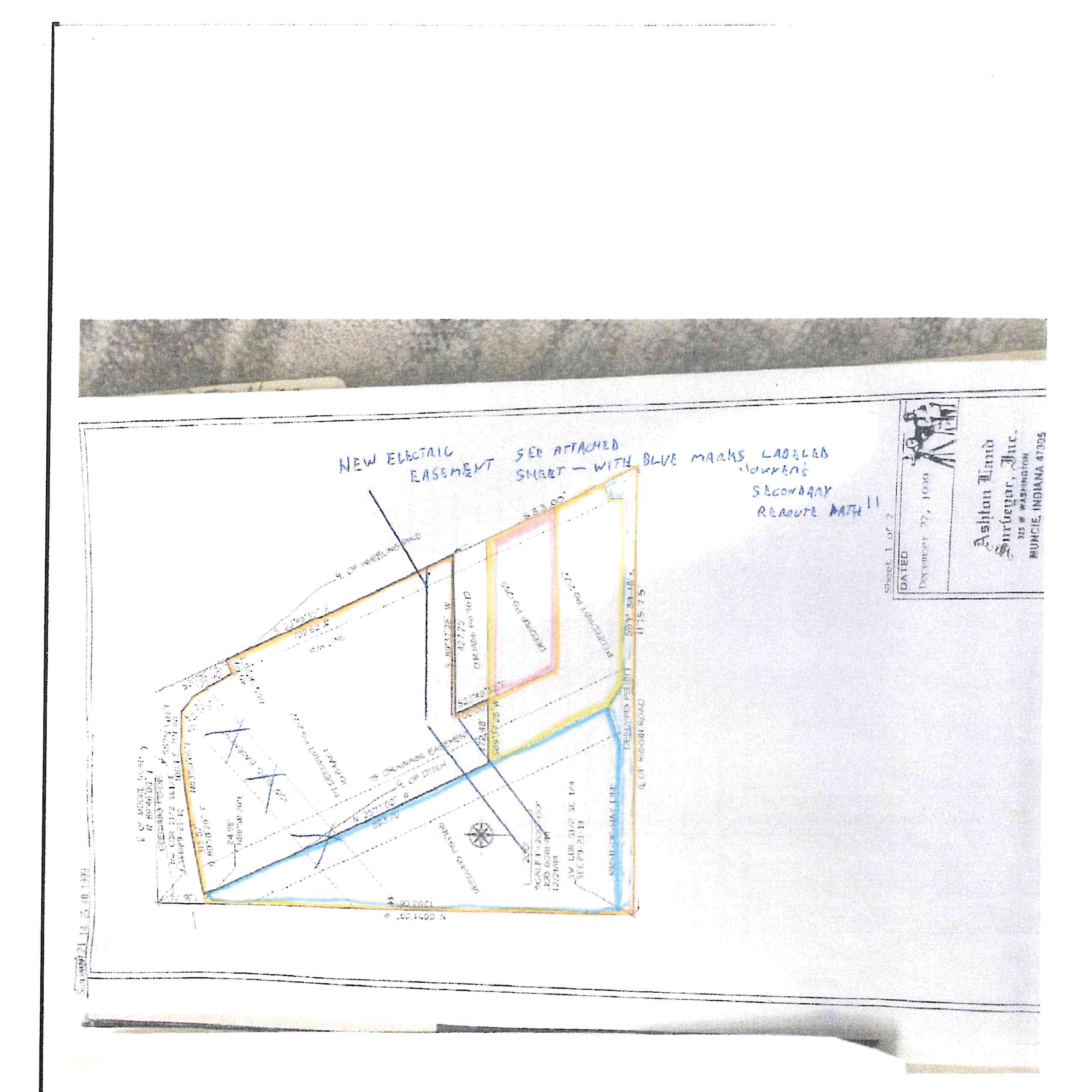
Survey Plat Summary & Key Features
This boundary and easement plat documents a parcel situated in the South Half of the Southeast Quarter of Section 29, Township 21 North, Range 10 East, Delaware County, Indiana. The survey depicts tract boundaries, road centerlines, easements, and marked electric reroute paths.
Key Boundary Dimensions and Calls
Download boundary data (CSV)
Easements & Utilities Noted
- 15′ Drainage Easement: Extends across the tract, aligned along the centerline of the ditch.
- Right-of-Way Lines: Identified along Riggin Road and Wheeling Pike.
- New Electric Easement: Indicated by handwritten blue arrows running across the central portion of the tract.
- Secondary Reroute: Blue markings highlight “Journey’s Secondary Reroute Path” across the designated easements.