Milo's Market
Enlarged Architectural Site Plan • Jackson & Nebo, Muncie, IN
CE1
Use the image viewer to inspect the complete sheet and technical drawing details
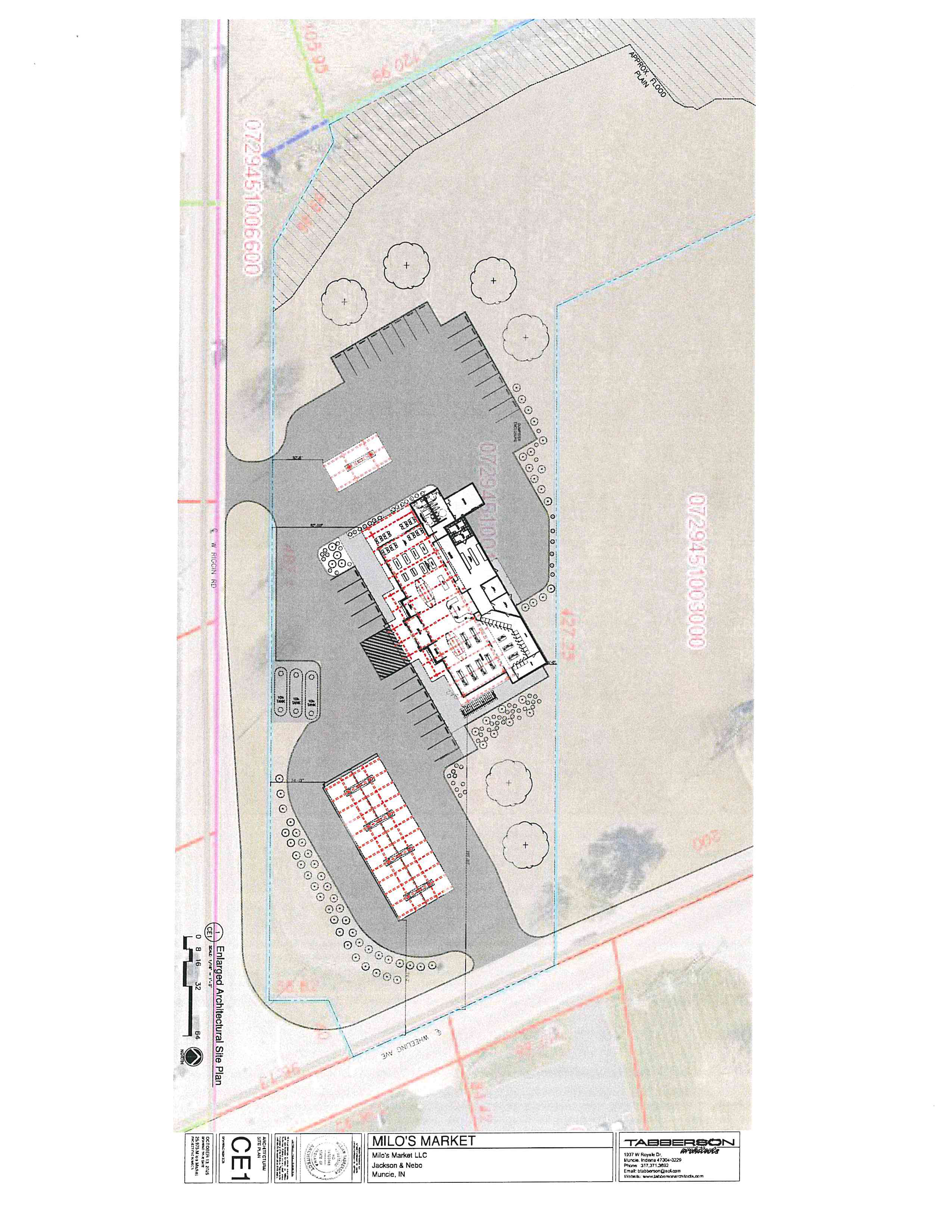
Enlarged Architectural Site Plan • Jackson & Nebo, Muncie, IN
Sheet CE1 is an enlarged architectural site plan for Milo's Market in Muncie, Indiana. The supplied drawing shows the site boundary, the market building, paved parking and drive areas, two fueling-canopy areas, underground storage-tank symbols, landscaping, adjoining parcel labels, and the title block. This companion records only features and labels that are visibly represented in the supplied sheet; it does not infer dimensions, capacities, or code conditions.
| Feature Category | Element Description | Location / Orientation | Identified Notes / Specifications |
|---|---|---|---|
| Main structure | Milo's Market building | Developed site area | Building footprint and interior plan are drawn |
| Fuel facility | Fueling canopy | Paved site area | Canopy structure is drawn |
| Fuel facility | Fueling canopy | Paved site area | Second canopy structure is drawn |
| Fuel storage | Underground storage tanks | West/southwest side of developed area | Tank symbols and the label "TANK" are shown |
| Roadway frontage | W. Riggin Road | West side of sheet | Road label and site drive connection are shown |
| Roadway frontage | Wheeling Avenue | South side of sheet | Road label and site frontage are shown |
| Adjoining parcel | Parcel 0729451006600 | West side of site | Parcel ID is visibly marked |
| Adjoining parcel | Parcel 0729451003000 | East side of site | Parcel ID is visibly marked |
| Environmental | Approximate flood plain | Northern/northeastern site area | Approximate boundary is drawn |
| Site features | Parking and landscaping | Around the building and canopies | Parking stalls, drives, planted areas, and trees are drawn |