MOT-CR-609 SHROYER ROAD IMPROVEMENTS
Text alternative and drawing navigation
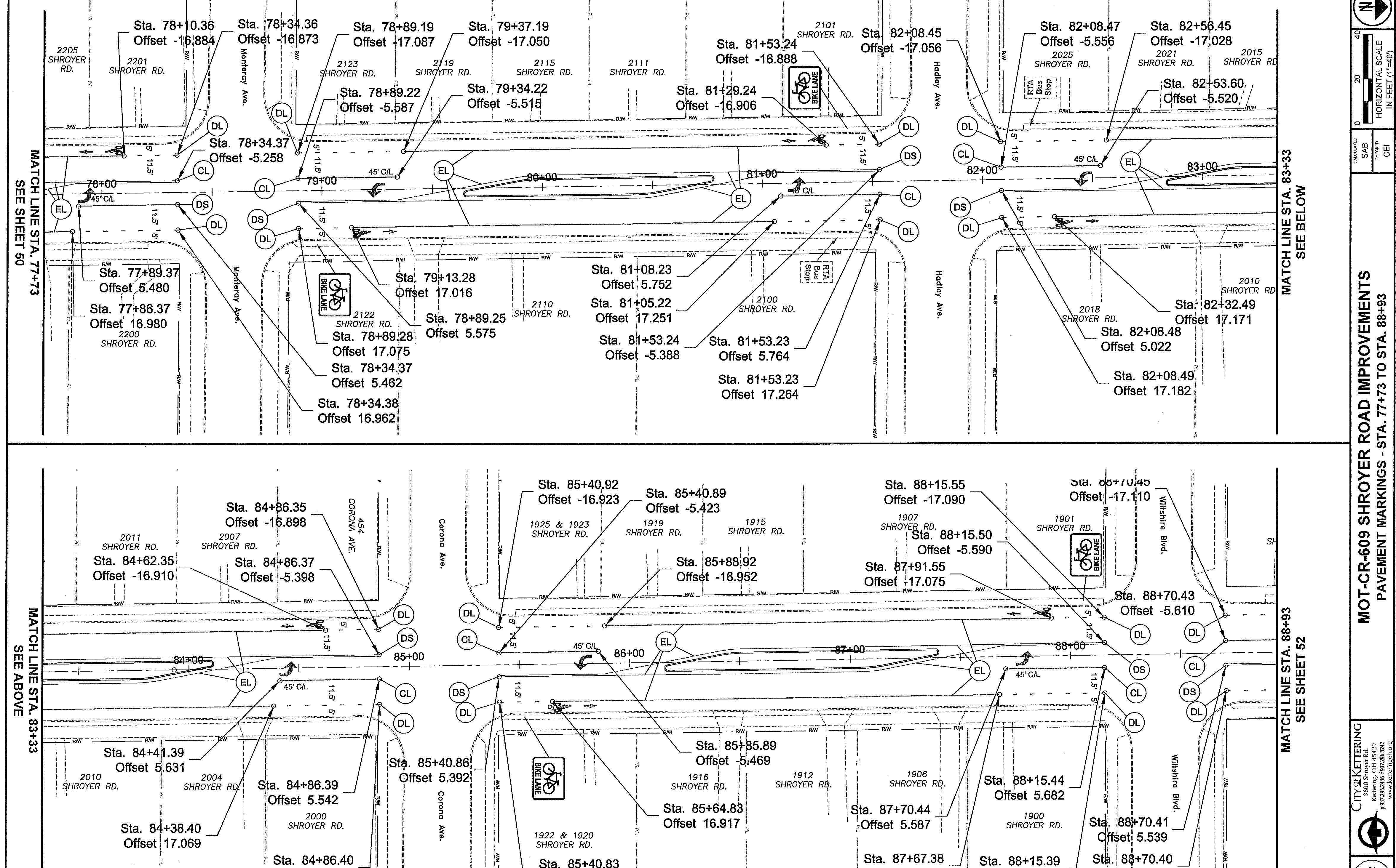
This is sheet 51 of 54 for MOT-CR-609 Shroyer Road Improvements. It covers pavement markings from Sta. 77+73 to Sta. 88+93 on Shroyer Road.
The technical drawing is arranged as two horizontal plan bands. The upper band continues from the left match line at Sta. 77+73 to the right match line at Sta. 83+33. The lower band continues from the left match line at Sta. 83+33 to the right match line at Sta. 88+93. It shows roadway geometry, street intersections, pavement-marking symbols, bike-lane designations, station callouts, and offset values.
Labels in the drawing use station and offset notation, including roadway stations from the 78+00s through the 88+00s and named streets such as Shroyer Rd., Dorothy Lane, Wilmington Pike, Crozet Ave., and Whipp Rd. The complete set of small callouts and dimensions remains available in the image.
For a readable view on a small screen, , then use Zoom in, Zoom out, Reset, and the viewer scrollbars to pan. Open the drawing image in a new tab.