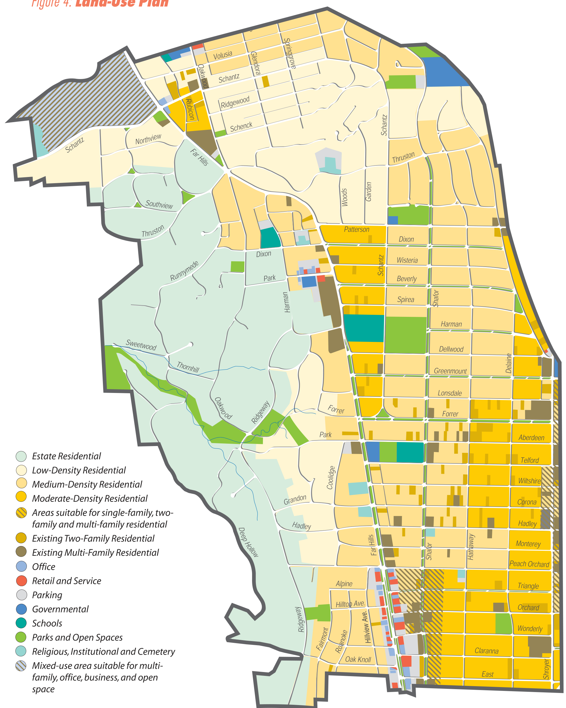
Select the map to open a larger, scrollable view.
Map legend (text)
- Estate Residential
- Low-Density Residential
- Medium-Density Residential
- Moderate-Density Residential
- Areas suitable for single-family, two-family and multi-family residential
- Existing Two-Family Residential
- Existing Multi-Family Residential
- Office
- Retail and Service
- Parking
- Governmental
- Schools
- Parks and Open Spaces
- Religious, Institutional and Cemetery
- Mixed-use area suitable for multi-family, office, business, and open space
![]()