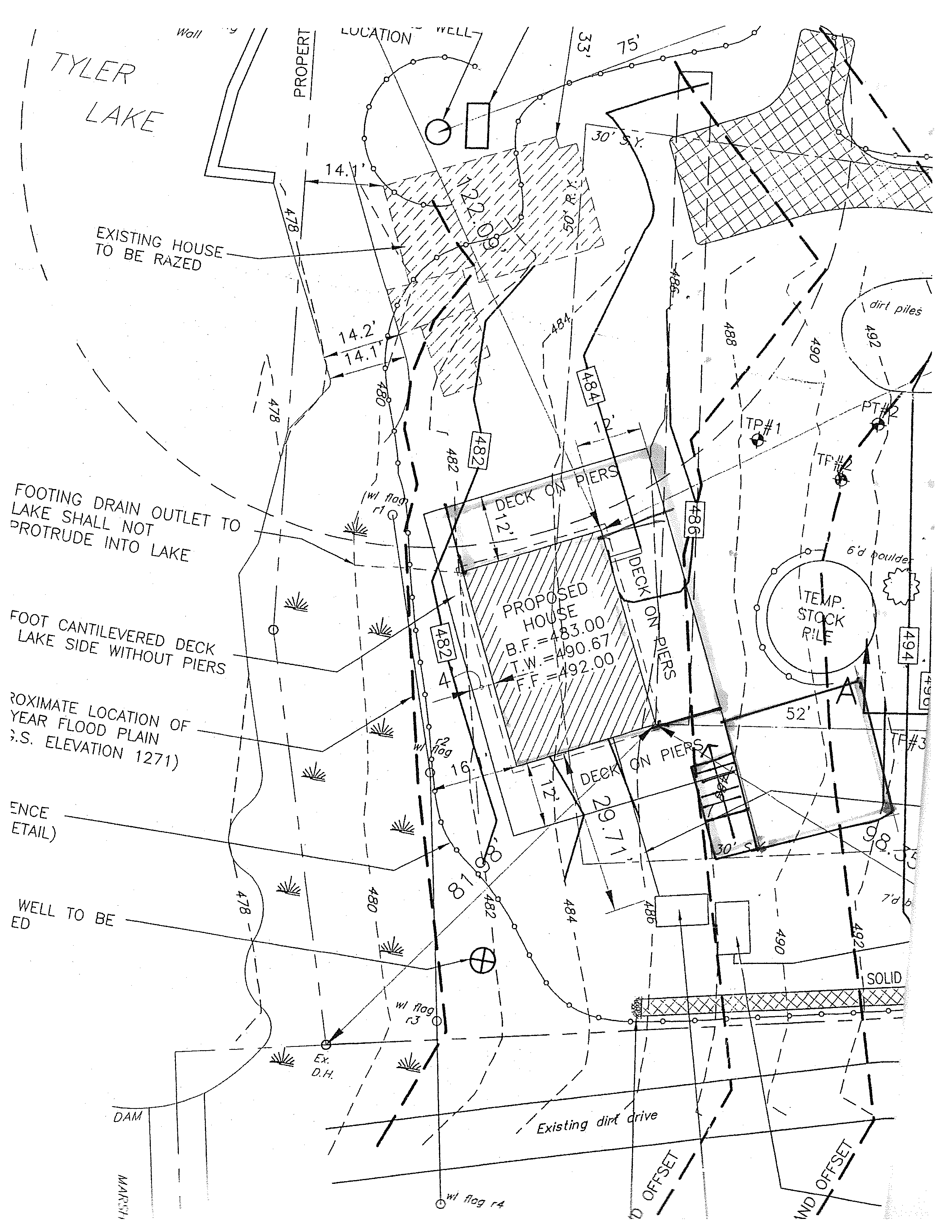
Site Development & Grading Plan — Tyler Lake
Plot layout showing existing house to be razed, proposed residence, deck on piers, property boundaries, and environmental contours.
Plot layout showing existing house to be razed, proposed residence, deck on piers, property boundaries, and environmental contours.
The drawing is a site and grading plan for a parcel beside TYLER LAKE. In the plan view, the lake is at the left/lakeside edge; the existing house marked EXISTING HOUSE TO BE RAZED
is at the upper left, and the hatched PROPOSED HOUSE
is near the center. The deck, property lines, contours, notes, and dimension strings are shown in their drawn positions.
Scroll horizontally to view all elevation columns.
| Plan callout | Value | Meaning shown in plan |
|---|---|---|
| F.F. | 492.00 | First floor elevation |
| T.W. | 490.67 | Top of wall elevation |
| B.F. | 483.00 | Basement floor elevation |
| 100-year flood plain | Approximate elevation 1271 (G.S.) | Approximate location called out on plan |
FENCE (DETAIL).
EXISTING HOUSE TO BE RAZED.
WELL LOCATIONis marked near the upper part of the parcel. A separate lower-left note begins
WELL TO BE; the remainder of that small raster label is not reliably legible here.
FOOTING DRAIN OUTLET TO LAKE SHALL NOT PROTRUDE INTO LAKE.
FOOT CANTILEVERED DECK LAKE SIDE WITHOUT PIERS.
APPROXIMATE LOCATION OF 100 YEAR FLOOD PLAIN (ELEVATION 1271).
1 dirt piles, a
TEMP. STOCK PILE, and a
6' bouldercallout are shown to the right of the proposed house.
Existing dirt driveruns along the lower portion of the drawing. Contour labels visible on the plan include 478, 480, 482, 484, 486, 488, 490, 492, and 494.
wl flag r1, wl flag r2, wl flag r3, and wl flag r4.