Skip to content
Traffic-Signal-Master-Plan-Part-II
Go to document position
/ 321
Set zoom percentage
%
Fit to width
Fit to page
Actual size (100%)
AI
Page 252
Page 253
Page 254
Page 255
Page 256
Page 257
Page 258
Page 259
Page 260
Page 261
Page 262
Page 263
Page 264
Page 265
Page 266
Page 267
Page 268
Page 269
Page 270
Page 271
Page 272
Page 273
Page 274
Page 275
Page 276
Page 277
Page 278
Page 279
Page 280
Page 281
Page 282
Page 283
Page 284
Page 285
Page 286
Page 287
Page 288
Page 289
Page 290
Page 291
Page 292
Page 293
Page 294
Page 295
Page 296
Page 297
Page 298
Page 299
Page 300
Page 301
Page 302
Page 303
Page 304
Page 305
Page 306
Page 307
Page 308
Page 309
Page 310
Page 311
Page 312
Page 313
Page 314
Page 315
Page 316
Page 317
Page 318
Page 319
Page 320
Page 321
CTY-RTE-SECTION
MODEL: 460700_CP106 | PAPERSIZE: 17x11 (in.) | DATE: 1/13/2023 TIME: 2:13:55 PM | USER: rmulvaney
FILE: I:\Oakwood\IN 12004607.00_TrafficSignalMP\2022\460700\460700_Engineering\Signals\Sheets\460700_CP106.dgn
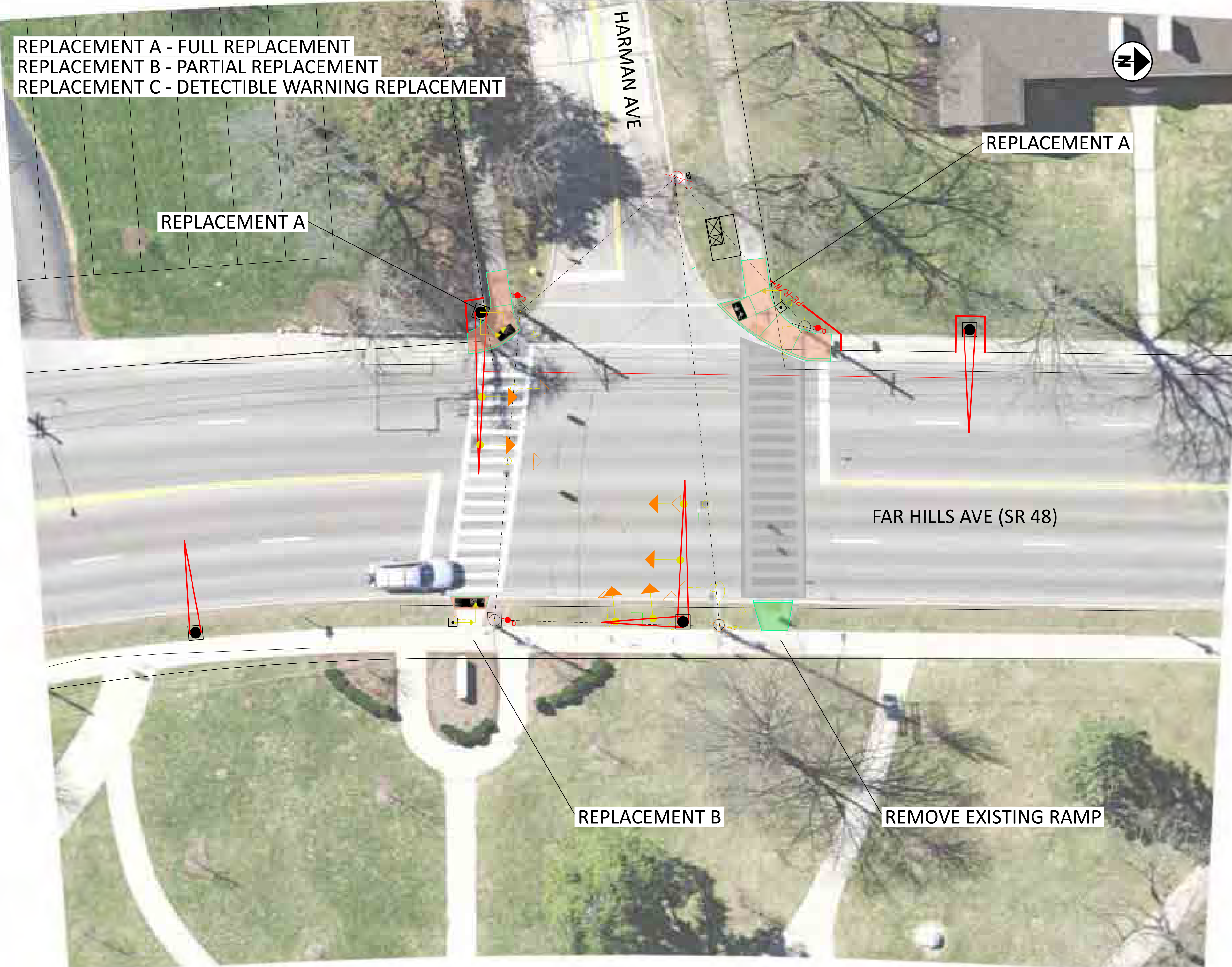
FAR HILLS AVE & HARMAN AVE
SIGNAL CONCEPT PLAN
DESIGN AGENCY
DESIGNER
RTM
REVIEWER
SAK
DATE
01-06-23
PROJECT ID
460700
SHEET
P.0
TOTAL
0
×