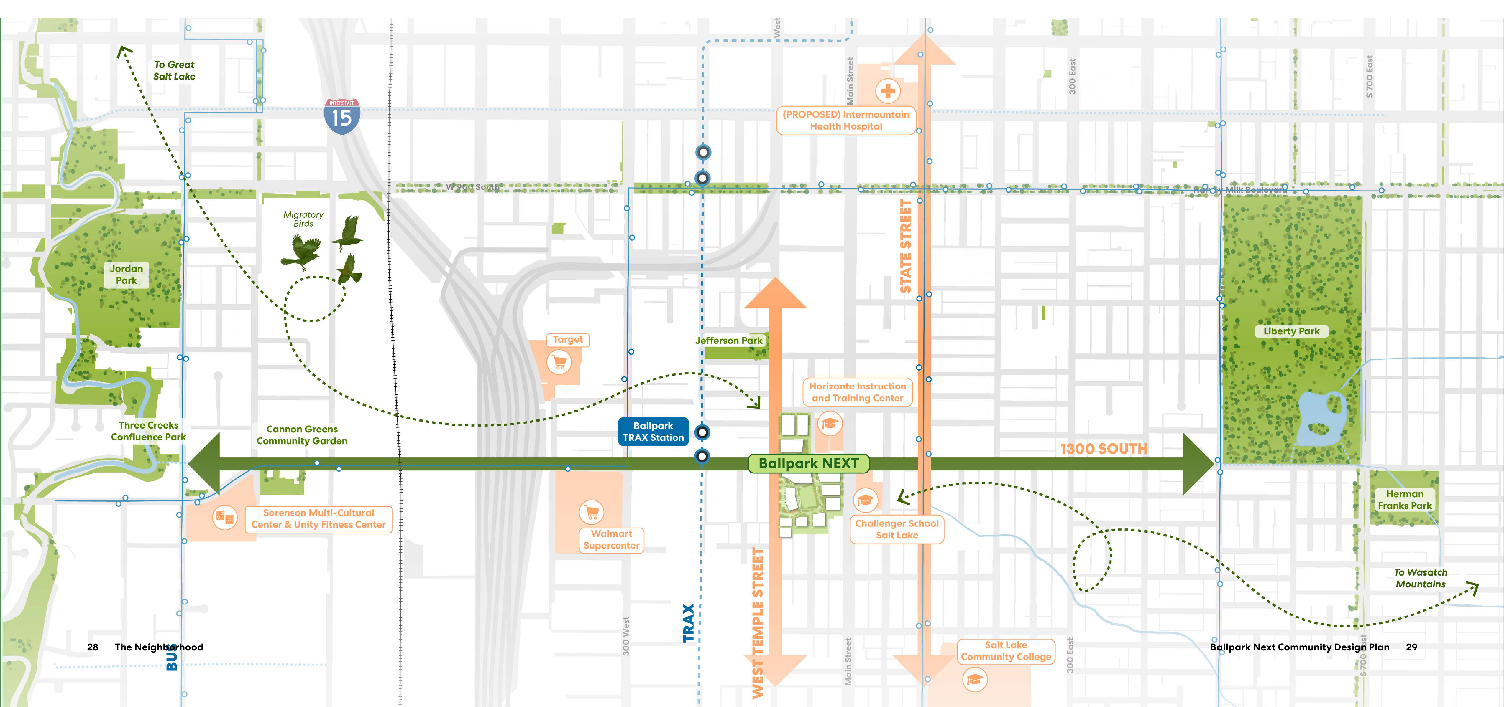
Ballpark NEXT is centered on the broad green 1300 SOUTH corridor, which runs east–west. Its green link runs west to Jordan Park, Three Creeks Confluence Park, and Cannon Greens Community Garden, and east to Liberty Park. Jefferson Park is north of the link near its western end; Herman Franks Park lies farther east, south of Liberty Park. The TRAX light-rail route runs north–south west of West Temple Street, with Ballpark TRAX Station west of Ballpark NEXT. Orange arrows mark the State Street and West Temple Street corridors.
Dotted green migration routes leave the project area northwest, loop west, and continue to “To Great Salt Lake”; another route loops southeast and continues to “To Wasatch Mountains.” Migratory Birds are shown near the northwestern route. The map also labels I-15, 300 West, Main Street, 300 East, and 700 East.
Community, education, health, and shop markers identify Sorenson Multi-Cultural Center & Unity Fitness Center in the far west; Target northwest of Ballpark NEXT; Walmart Supercenter west-southwest of the project; Horizonte Instruction and Training Center north-northeast of the project near the 1300 SOUTH corridor; Challenger School Salt Lake southeast of the project; Salt Lake Community College farther south; and the (PROPOSED) Intermountain Health Hospital northeast of Ballpark NEXT.
 Ecology
 Transportation
 Social