The Ballpark
NEXT Site
The site consists of two city-owned blocks, separated by 1300 South, totaling 14.8 acres.
The south block is currently home to Smith’s Ballpark with several ancillary ballpark structures including canteen and restrooms, and a sheltered pavilion. Salt Lake City’s Fire Station 8 is currently located on the corner of 1300 South and Main Street.
The north block is currently a surface parking lot serving Ballpark events. A large portion of the site are zoned as Public Land with the southern parcels zoned as Moderate Density Multi-Family Residential. Parcel F is located in an area with a 0.2% annual chance of flooding.
| PARCEL ID | ACREAGE | ZONING |
|---|---|---|
| A | 6.47 | Public Land (PL) |
| B | 0.35 | |
| C | 0.45 | |
| D | 0.39 | |
| E | 2.54 | Public Land (PL) Moderate Density Multifamily Residential (RMF-35) |
| F | 4.30 | Public Land (PL) |
| G | 0.16 | Moderate Density Multifamily Residential (RMF-35) |
| H | 0.16 |
Swipe or scroll horizontally to explore the full map.
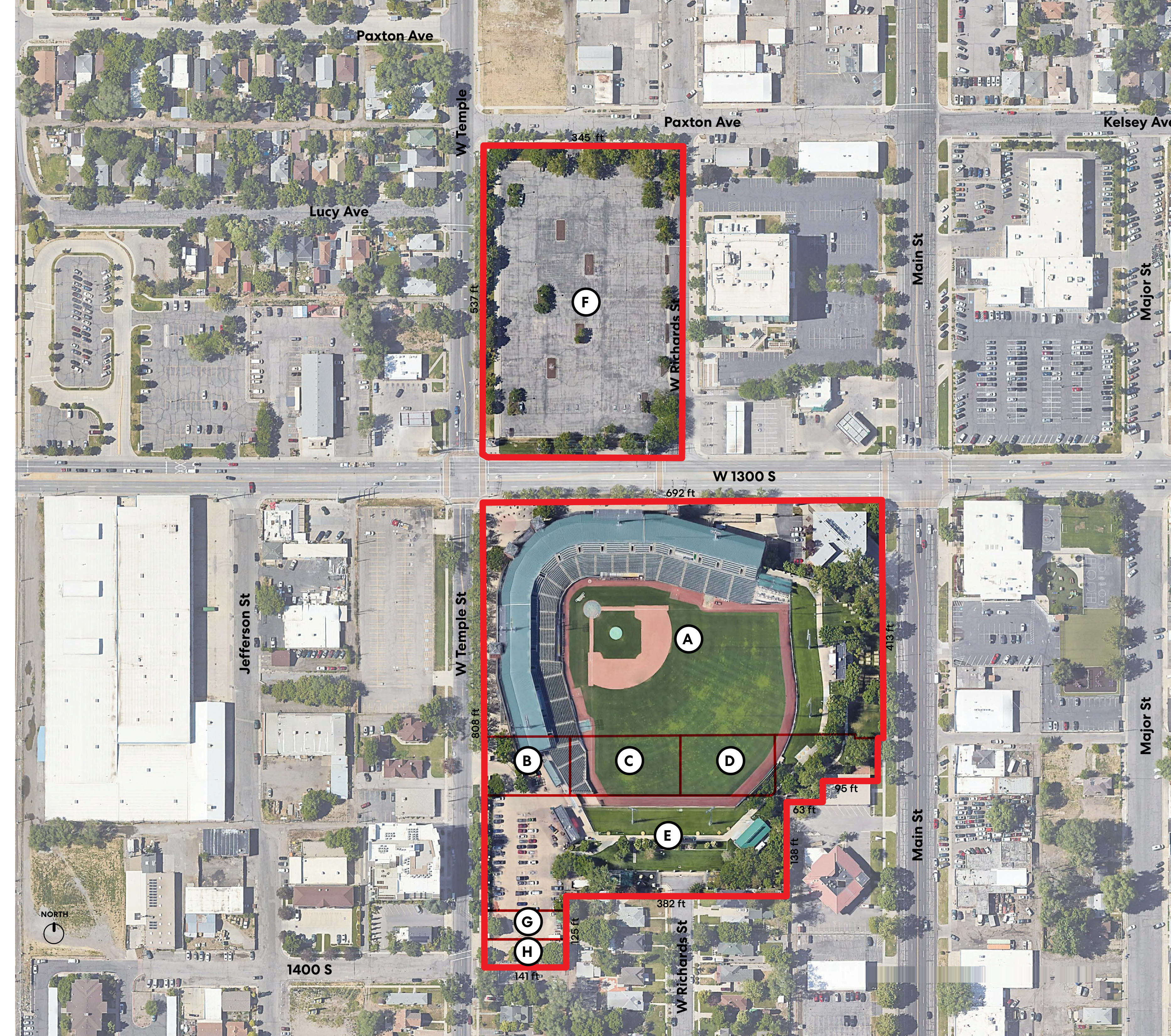
Site map description
The map labels Paxton Ave, Kelsey Ave, Lucy Ave, W Temple St, Jefferson St, W Richards St, Main St, Major St, W 1300 S, and 1400 S. It identifies parcels A through H. Parcel F, north of W 1300 S, measures 345 ft along its north edge and 537 ft along its west edge. The south block measures 692 ft along its north edge, 808 ft along its west edge, and 413 ft along its upper east edge; its eastern boundary steps by 95 ft and 63 ft before extending 138 ft along the lower east edge, and the south edge is 382 ft. Parcels G and H have a 141 ft bottom boundary and a 125 ft east boundary. North is shown near the lower-left corner of the map.
Parcel F is the northern lot north of W 1300 S. Parcel A is the ballpark; parcels B, C, and D are south of it, with E farther south and G and H at the southern edge.