 Attainable Homeownership Opportunities
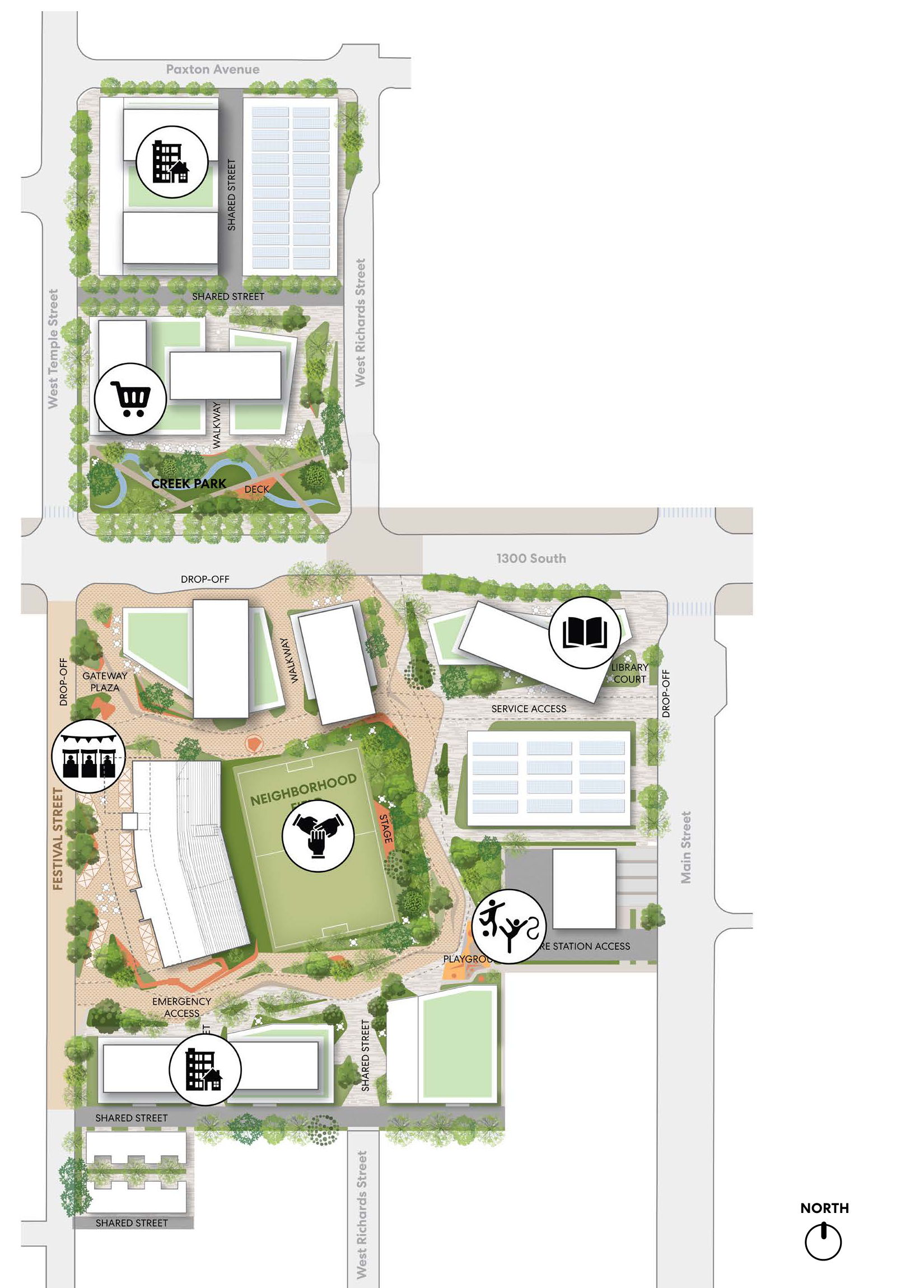
These opportunities are distributed across several residential blocks, supporting long-term stability for local families. While the CRA will prioritize creating ownership opportunities as part of this development, affordable rental options may also be considered in alignment with the CRA’s mission, the Board’s housing priorities, and prevailing market conditions.
 Local Small Businesses
The re-adapted ballpark structure is envisioned as a hub for local small businesses, offering affordable commercial leases that help sustain neighborhood entrepreneurship and cultural identity.
 Local Fresh Food
To support health and food access in the Ballpark NEXT neighborhood, a location has been identified for a fresh food market. Positioned near key pedestrian routes and transit, the market provides walkable access to affordable, nutritious options—addressing a long-standing gap in healthy food availability and supporting local food systems.
 Public Library
A public library is proposed at the corner of 1300 South and Main Street, establishing a civic anchor for the neighborhood. This location supports walkable access to learning, resources, and gathering space—fostering community connection and lifelong education.

 Places for Play
Ballpark NEXT reimagines play as an everyday experience for all ages. The former ballfield becomes a flexible open space for informal sports and community events, while a dedicated children’s play area offers safe, shaded play close to residential blocks. Together, these spaces support physical activity, social connection, and intergenerational recreation—core elements of a healthy, vibrant neighborhood.