The Framework
Landscape Framework: North Block
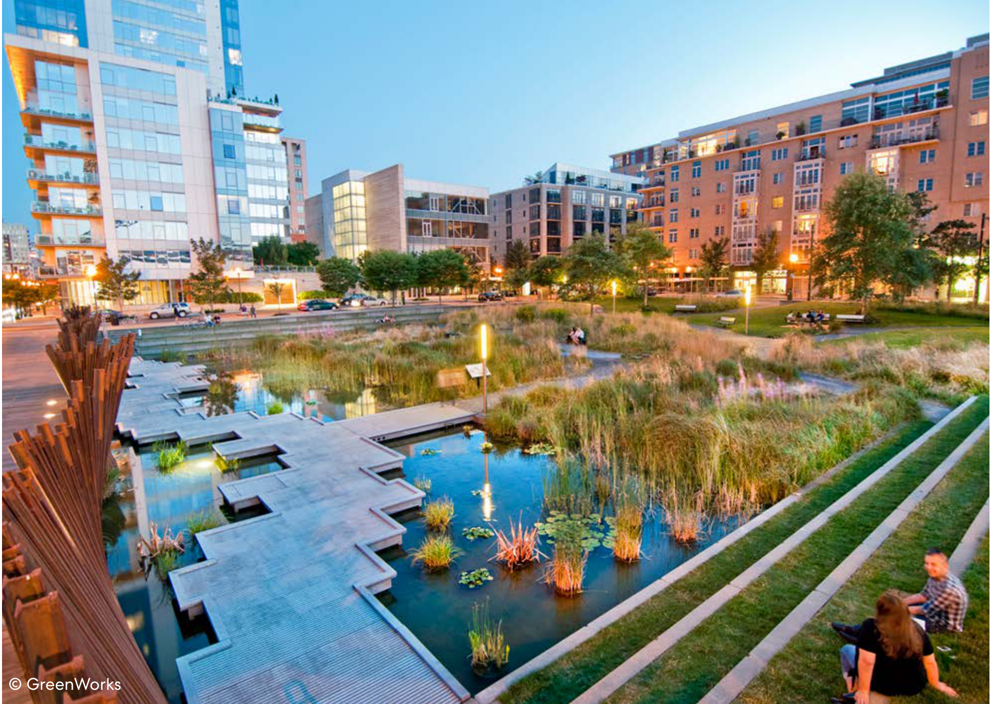
Neighborhood life in the North Block centers around the Creek Park, which celebrates the site’s restored creeks and urban biodiversity. Adjacent hardscaped plazas create opportunities for restaurants, cafés, and local shops to spill out into gathering spaces along the park’s edge.
Scroll horizontally to inspect the map.
Plan description
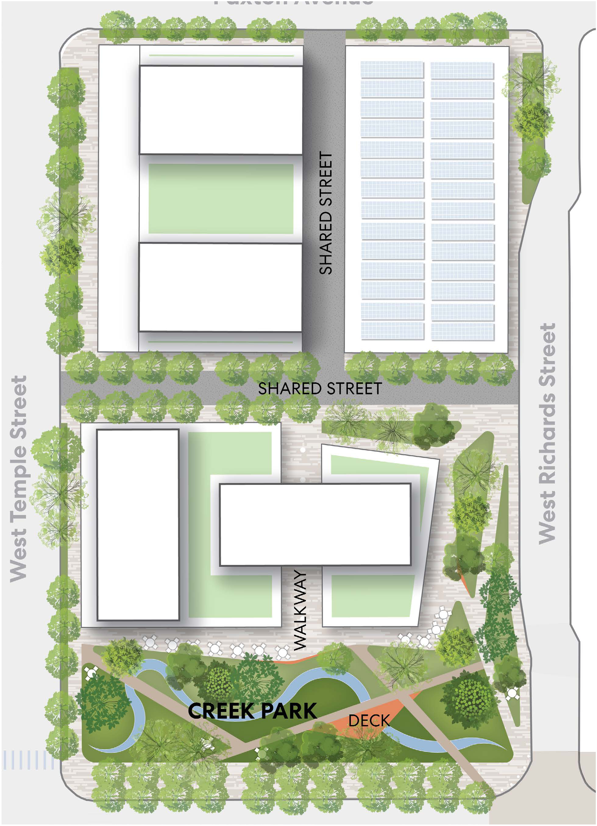
Creek Park fills the lower part of the North Block, between West Temple Street at left and West Richards Street at right. The upper half of the plan contains development parcels divided by a vertical Shared Street. A horizontal Shared Street crosses the middle. Below it, buildings and planted areas are linked by a pedestrian path that leads into Creek Park in the lower half, where winding blue water channels pass through planted areas and meet at a deck crossing.