Development Blocks
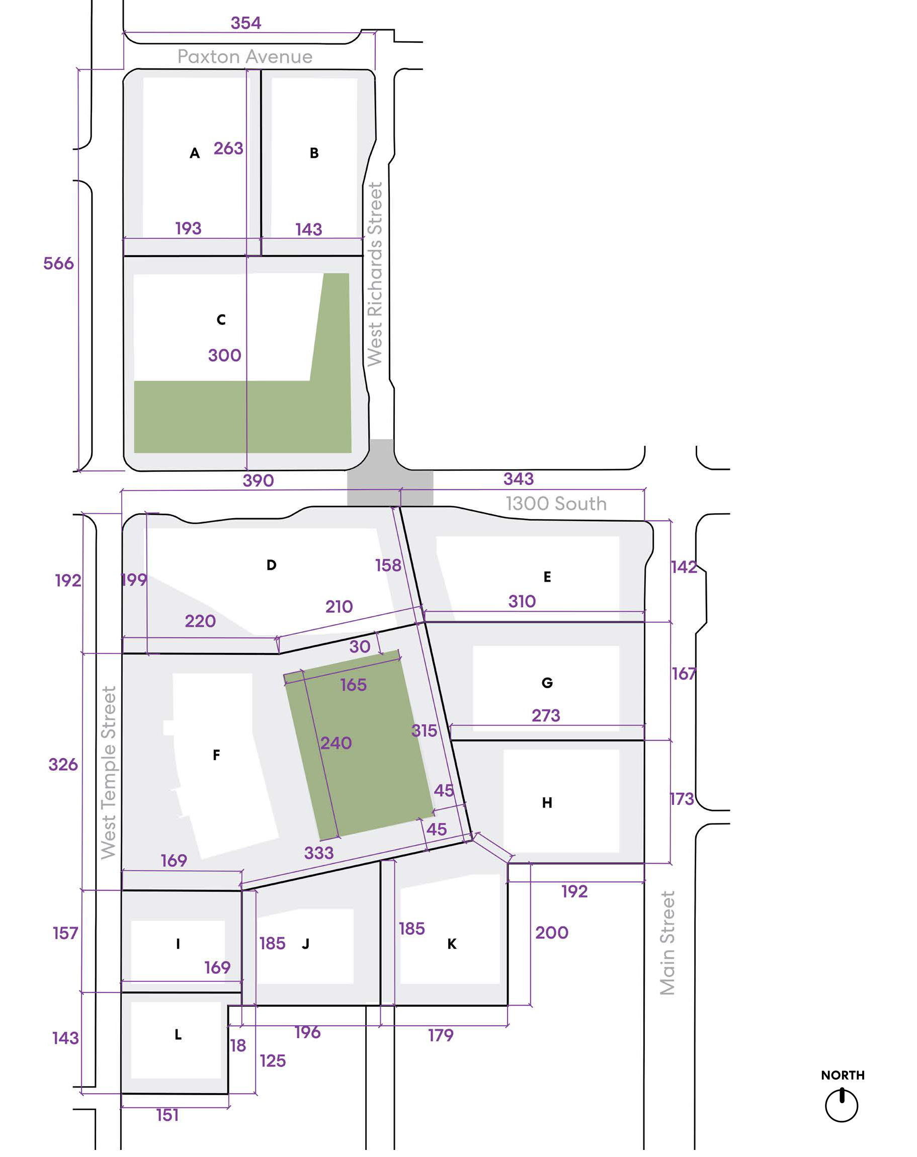
Informed by the mobility framework and with an emphasis on a fine grain, human scaled urban fabric, the site is organized into 11 blocks for vertical development.
Land Parcelization
Development blocks are the foundation for walkable urban fabric and well-proportioned, visually engaging, and high-performing architecture. The approximate acreage for each block is listed in the table below and approximate dimensions are featured on the figure on the corresponding page.
| PARCELS | ACREAGE |
|---|---|
| A | 1.0 |
| B | 0.9 |
| C | 2.3 |
| D | 1.6 |
| E | 1.0 |
| F | 3.4 |
| G | 1.0 |
| H | 0.9 |
| I | 0.5 |
| J | 0.8 |
| K | 0.9 |
| L | 0.5 |
Public Realm Allocation
All development blocks provide space for roadways, parks, and plazas. The acreage for Blocks C and F are larger due to the proposed location of parkspace.
Scroll horizontally to inspect the map.
Diagram description
The plan labels parcels A through L around the proposed network of streets. Paxton Avenue lies along the north edge; West Richards Street and Main Street run north–south; 1300 South crosses the site; West Temple Street borders the west edge. Green areas identify proposed park or public-space portions. A north arrow indicates orientation.
The purple dimension labels have no unit printed. The labels below are grouped by the portion of the plan where they appear; repeated values remain separate because they mark separate dimension lines.
- North blocks A–C: 354, 263, 193, 143, 566, 300, 390, 343.
- Middle blocks D–H: 192, 199, 158, 220, 210, 30, 310, 142, 167, 326, 165, 240, 315, 45, 45, 333, 169, 273, 173, 192, 200.
- Lower blocks I–L and adjacent edges: 157, 185, 169, 185, 143, 18, 196, 125, 179, 151.