The Framework

Landscape Framework: Water

The water framework focuses on two key ideas: first, the daylighting of three creeks; and second, the integration of water elements throughout the site to support cooling, biodiversity, and overall environmental health.

1Daylighting Creeks

The Creek Park brings water back to the surface, partially daylighting three creeks buried beneath 1300 South. One potential strategy to achieve this is by installing diversion structures to remove water from the existing 1300 South system and a control structure to re-enter the 1300 South system.

This act of restoration turns forgotten flows into a living feature—cooling the site, supporting ecosystems, and inviting people to gather around water as a source of life, beauty, and connection in the city.
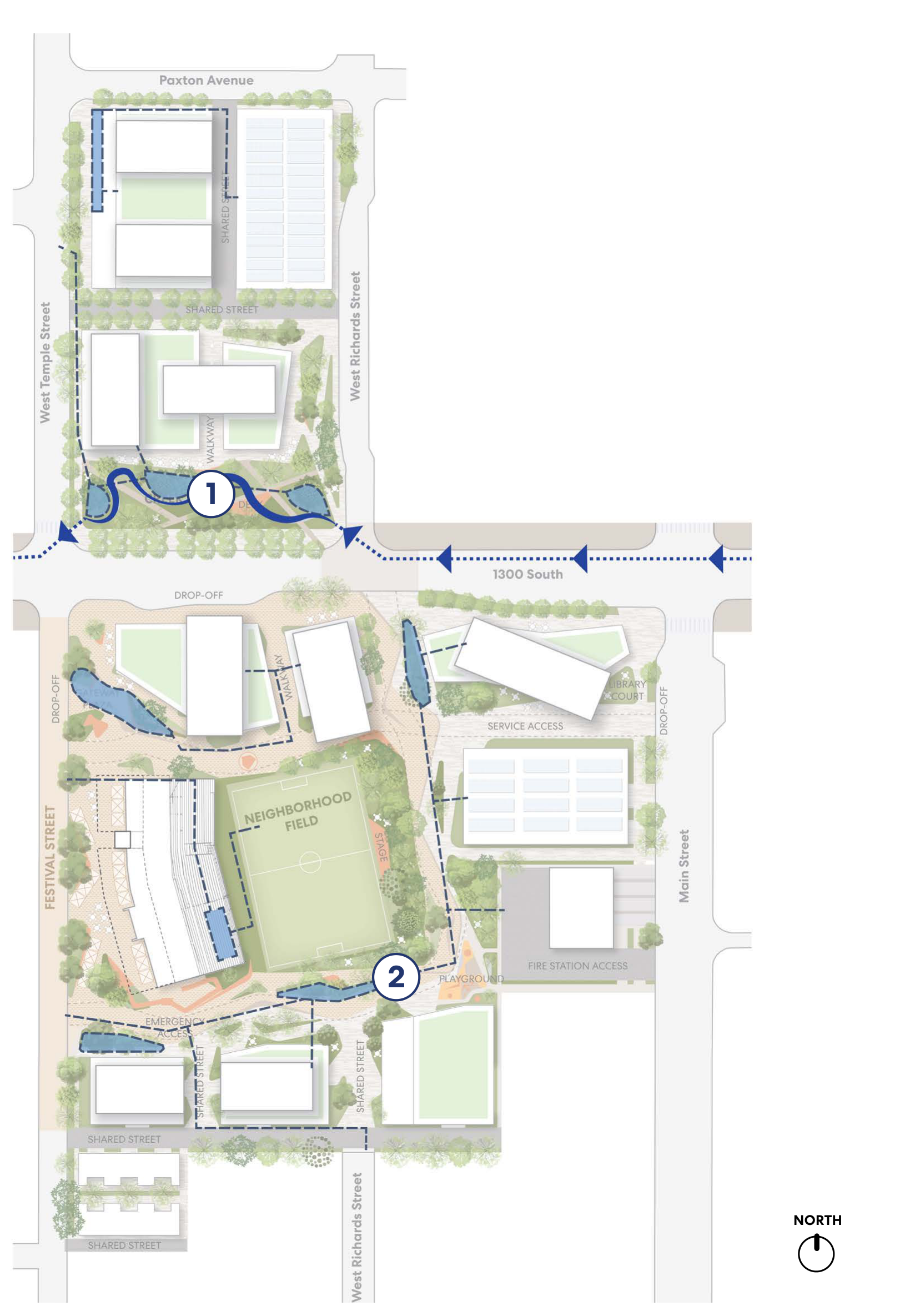
2Stormwater Swales

Several open water elements, designed as stormwater swales, are integrated around the Neighborhood Field. While they may not hold water year-round, depending on rainfall and seasonal conditions, they play a vital role in managing stormwater on site.

These swales help filter pollutants, support native planting, and create small pockets of cleaner, cooler air, offering both ecological and public health benefits for the community.

North-oriented site plan highlighting creek water flow, open water elements, stormwater bioswales, and stormwater swales, with numbered callouts 1 and 2.

Scroll horizontally to inspect the map.

WATER ELEMENTS

  • Creek Water Flow
  • Open Water Elements
  • Stormwater Bioswales
Plan description

North is at the top. The site plan labels Paxton Avenue, West Temple Street, West Richards Street, 1300 South, Main Street, the Neighborhood Field, Gateway Plaza, Library, Creek Park, and Park Promenade. The legend labels a dark-blue dotted arrow symbol “Creek Water Flow.” On the plan, a dark-blue dotted line with left-pointing arrowheads runs along 1300 South from the western edge, across West Temple Street and West Richards Street, past Main Street, and beyond the eastern edge. A separate dark-blue winding creek lies inside the north block; callout 1 is placed on the creek. Thin blue stormwater lines appear at the north lot’s northwest edge by Paxton Avenue, at Gateway Plaza, beside the Library, along the west side and southeast of the Neighborhood Field, and south of the field along the Shared Street. Callout 2 is near the southeast side of the Neighborhood Field. The key marks open water elements with solid dark-blue squares and stormwater bioswales with light-blue squares.